Three Goblins: Goblin Valley Utah State Park

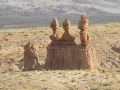
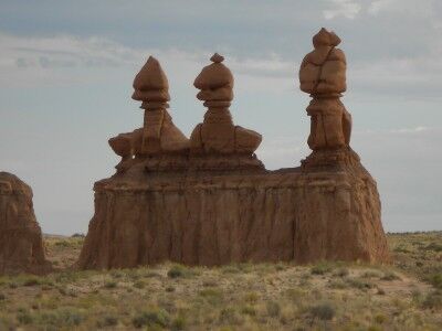
One of the first formations you come upon once you enter Goblin Valley State Park in Utah are the three goblin guards. The three goblin guards stand by themselves off to the left of the road as you drive toward Observation Point. The three stand out because they are the only goblins in the general area and seem to be welcoming you to their little world (or there to warn all the other goblins of your presence).

The three goblins at the entrance of Goblin Valley Utah State Park

The 3 goblins at the entrance of Goblin Valley state park in Utah

The three goblin guards are also deceiving in foretelling what you are about to see once you reach Goblin Valley. They make it appear that you will be entering a world where there will be many distinct formations in their own area, when in reality you’ll soon be seeing hundreds of goblins scattered all over the valley floor.

California State Park Closures Talk

What do America’s parks, whether they be national or state, mean to you? Have you ever really thought deeply about it? Christopher Grant Ward, who operates a non-profit advocacy focused on supporting parks and preserved spaces across California and around the world called Folk4Parks.org, recently sat down to give at talk about what parks mean in light that 70 California State Parks will be closed by Labor Day 2012 due to state budget issues. It’s well worth the time to listen to his talk and hopefully get you thinking a bit more about what parks in the US mean to you as an individual and for all of us:

I think this is the part of the talk that spoke to me the most:

…what is it exactly that parks give us? I’ve heard the value of parks described as an escape, a release, a reconnection with nature. John Muir described this as, “Saving the American soul from total surrender to materialism.” You know, I’ve thought about this a lot, living a modern life full of web design, travel, office politics and something called social media strategy. I live most of my life outside of the present moment. I focus on plans and goals. We all worry to some degree about what people will think when we do one thing or another. If you’re like me, then your daily actions are not always the things you most desire to do, but we do them because they work to move us toward those goals. And that’s OK, that’s not a bad thing. But when we work with purpose, what’s important in our lives is rarely situated in the present moment.

When I stand in the face of a natural scene in Del Norte Redwoods, Mt. Diablo or Yosemite, I am utterly enthralled, captivated. But I am captivated without intent or purpose. I have no goals but to experience the now. The natural world has no judgment of my actions. This break from purpose is what gives us rest. True rest. This break from purpose gives us reprieve from past mistakes and a pause from worry about what is to come. And we can do this with others. Standing amidst nature with your loved ones, with perfect strangers, we also can share and celebrate with each other the absence of purpose.

Christopher also sets up a challenge that anyone that enjoys our parks needs to consider accepting:

How will California espouse preservation to the next generation, as they watch us underfund the oldest, most extensive and diverse visions of state preservation in the world? How do we learn the importance of conservation when we can no longer visit places that help us understand what must be conserved?

California needs everyone to get involved. There is no time where times were so tough that people could not act to make a difference for parks, or where they should be considered ancillary to more fundamental things. 175 years ago, parks were established as preserved places with public access. Today, parks also need public support. These are your parks. If these ideas matter to you, if this resonates with you, show your support and get involved.

While the focus is on California state parks, I would suggest that it can be expanded to all parks, from local to national, in the US. If you enjoy our parks and they resonate with you, figure out a way to show your support and get involved. Today, they need our support and involvement more than ever.

Limekiln Beach Limekiln State Park California

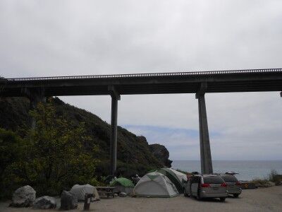
After hiking to Limekiln Falls and to the historic lime kilns, it’s also worthwhile visiting Limekiln State Beach at Limekiln State Park (CA). The beach is at the other end of the parking lot as the hiking trails (easily seen from the parking lot). You cross a small bridge over Limekiln Creek and enter the Limekiln beach campground. The Limekiln beach is at the far end of the campground just beyond a huge bridge that carries cars across the Limekiln Canyon on highway 1:

Limekiln beach campground at Limekiln State Beach California

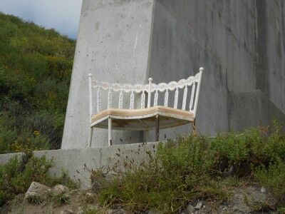
Although it would seem that the beach would be quite noisy with the highway bridge right above, that is not really the case. The bridge is high enough that there is very little car noise on the beach. When I visited, someone has set up a small love seat directly next to one of the bridge support columns:

Loveseat at Limekiln State Beach

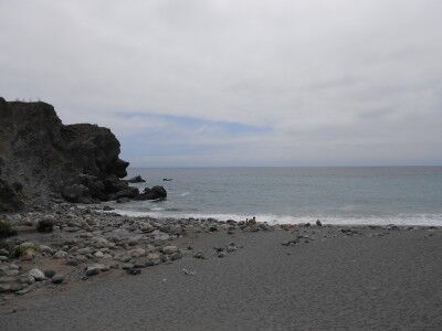
That provided a wonderful view of Limekiln Beach when sitting on it:

the view of Limekiln Beach from loveseat

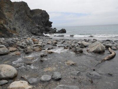
Limekiln Beach itself is pretty interesting. On the left side, Limekiln Creek empties into the ocean bringing down a rocky bed of stones and boulders to the sea:

Limekiln Creek emptying into the ocean at Limekiln beach

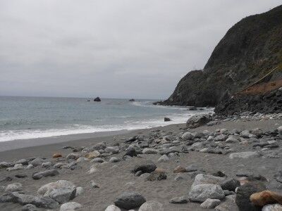
To the right is a the beach, although it is littered with large stones that have been swept down the creek in the past:

With the campgrounds nearby, there were plenty of kids and families enjoying the beach and the creek. I would imagine that it would be a wonderful place for families to camp giving everyone plenty of choices of how to spend the day depending on what they enjoyed doing most. If interested, here are some more photos of Limekiln State Park. Unfortunately, Limekiln State Park is on the list of California State parks to close.

Manzanita Tree Mount Diablo State Park California

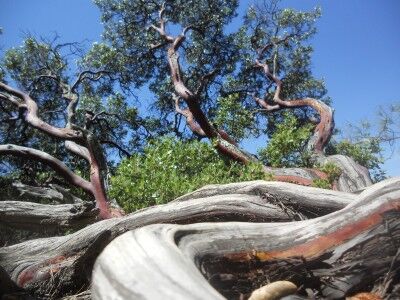
I am far from an expert photographer, but I do enjoy taking photos when I am wandering national and state parks. Every once in awhile I take a photo that I do like that seems to stand out from the rest. This is a photo I took at Mount Diablo State Park (CA) of a Manzanita tree.

Manzanita tree at Mount Diablo state park in California

There are plenty of Manzanita trees at Mount Diablo and the way that their trunks curve and twist allow you to get some fun and interesting photos of them. I think I could have probably spent an entire afternoon simply searching for cool looking Manzanita trees to photograph.

Lime Kilns Limekiln State Park California

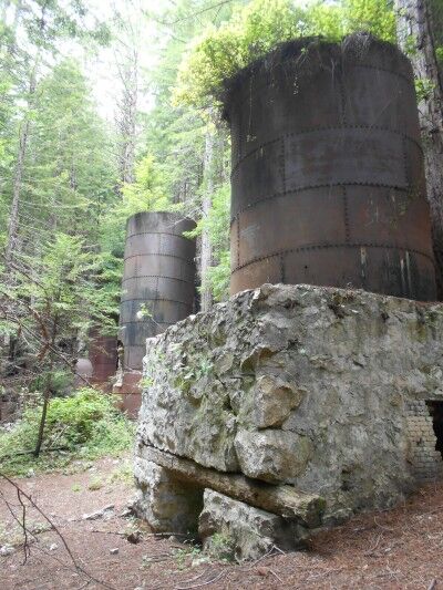
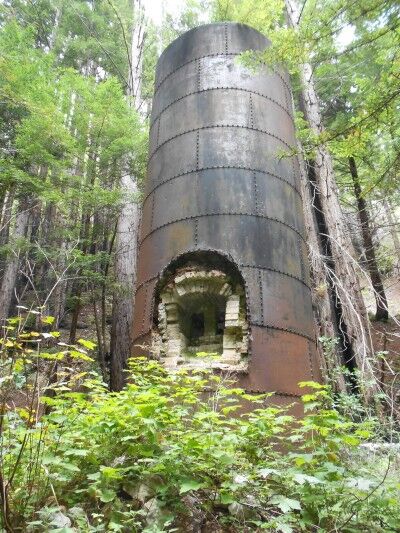
In addition to seeing Limekiln Falls at Limekiln State Park (CA), hiking to the historic lime kilns is also a must. It’s pretty strange seeing these huge iron and stone furnaces in the middle of a redwood forest where they look so completely out of place:

lime kilns at Limekiln State Park California

According to the Limekiln State Park brochure:

Beginning in 1887, the Rockland Lime and Lumber Company extracted, processed and exported thousands of barrels of lime from Limekiln Canyon. Four stone and iron furnaces were built at the base of a large talus slope eroding from the limestone deposit. Limestone rocks were loaded into the kilns, where very hot wood fires burned for long periods to purify lime.

The lime was packed into barrels, hauled by wagon to Rockland Landing on the coast and loaded onto ships that carried it to northern ports for use in concrete.

After only 3 years, the limestone deposit was depleted, as was the redwood forest that had been nearly clear-cut to use for lumber and fuel.

Today the four kilns, some stone walls and bridge abutments are the only remains of the thriving lime industry that existed here.

lime kilns in redwood forest

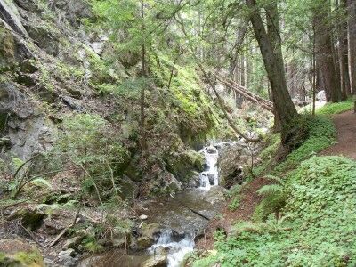
To get to the historic lime kilns, you follow the same directions as to Limekiln Falls, but take the fork to the left and remain on Limekiln Trail instead of right onto Falls Trail. The trail is quite easy without the obstacles that Falls Trail has, and the scenery is quite beautiful as you hike along West Fork Creek:

West Fork Creek Limekiln State Park California

If interested, here are some more photos of Limekiln State Park. Unfortunately, Limekiln State park is on the list of California State parks to close.

Limekiln Falls Limekiln State Park

I always love when I come across the unexpected. As I was traveling highway 1 down the coast of California, I heard that it would be worthwhile stopping at Limekiln State Park (CA) to see the waterfall that they had there. I enjoy waterfalls and think that they have a mysterious beauty in themselves so it was a no brainer that I would make the stop, but I was pleasantly surprised at how beautiful Limekiln Falls actually is.

There isn’t much parking at Limekiln State Park (maybe 20 spaces total outside of the camping area) as it is mainly a place set aside for those camping. To get to the Limekiln Trail (which will lead to Falls Trail), you park your car and head toward the bathrooms at the end of the parking lot. As you pass the bathrooms, you’ll get a see of all the dangers that you could face on the trail.
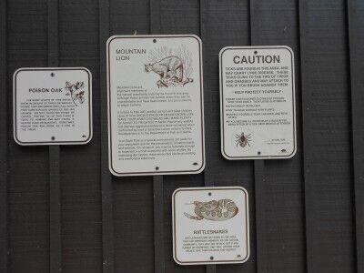
hiking warning signs displayed at Limekiln State Park

Once past the bathrooms, you need to walk through the camp ground to the far end where the Limekiln Trail Head is located. Once on the trail, it will fork about 200 yards in with Hare Creek Trail to the right and Limekiln Trail to the left following Limekiln Creek:
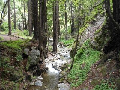
Limekiln Creek at Limekiln State Park California

The trail is shaded and cool with huge clovers covering the ground in many areas:
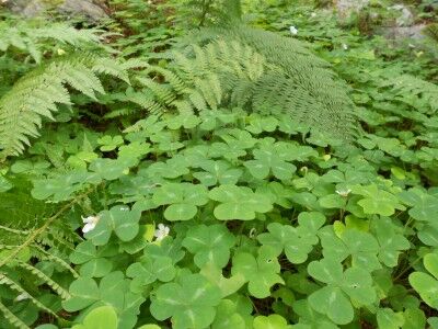
giant clovers at Limekiln State Park California

Stay to the left at the fork on Limekiln Trail and about 1/4 of a mile further on the trail will fork again with Limekiln Trail to the left and Falls Trail to the right. Stay right. Once you reach this fork, it’s about another half mile to the falls (about 1 mile in total).

The Falls Trail has some obstacles, but most people should be able to manage it. There are several places where you must cross Limekiln Creek. Fallen branches and logs have been placed down at these crossings, but it does require a bit of balance if you don’t want to fall into the water:
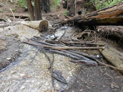
Creek crossing Limekiln Creek California

There are also several places where fallen trees have blocked the trail and you must scramble under or over them to remain on the trail:
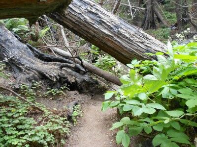
fallen tree across Falls Trail at Limekiln State Park

Once you reach Limekiln Falls, I immediately realised why people recommended to place it on the lists of places to see. The waterfall fans out and much of it cascades down mossy vegetation in the center of the falls. It reminded me a bit of the waterfalls in Fern Canyon at Redwood National Park, but on a much larger scale (it’s about 100 feet in height) and with the sun making everything sparkle:
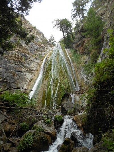
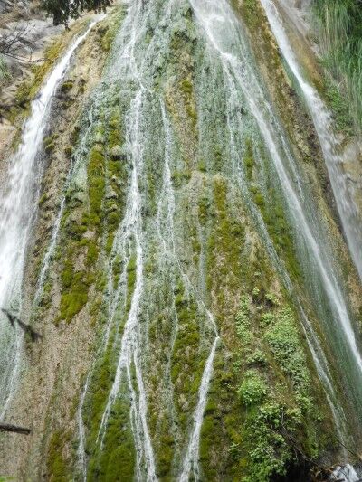
Limekiln Falls at Limekiln State Park California

close-up of Limekiln Falls at Limekiln State Park

If you happen to being driving the coast of California, it’s definitely worthwhile making a stop to see this waterfall. If interested, here are some more photos of Limekiln State Park. Unfortunately, Limekiln State park is on the list of California State parks to close.
Sea Glass Beach Fort Bragg California

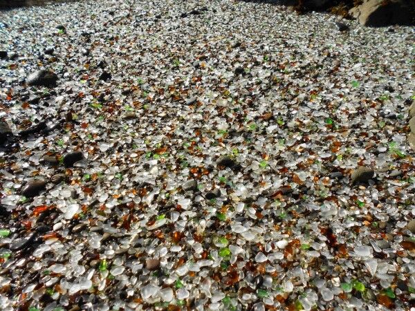
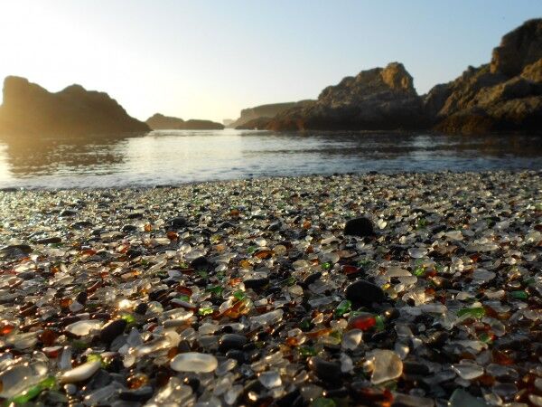
While not technically a National Park (there are a lot of rock outcroppings along the shoreline which are all part of the California Coastal National Monument), Glass Beach in Fort Bragg, CA is definitely worth a visit. It’s not often that you see a beach that is almost entirely made of sea glass (also called beach glass, mermaids tears, lucky glass, ocean glass and sea gems) that is several inches thick in some places:

a beach made up almost entirely of sea glass in Fort Bragg, CA

Most people assume that sea glass comes from glass garbage dumped out at sea that eventually makes its way to the shore. In many cases, this is how sea glass arrives on the beach, but not in the case of Glass Beach in Fort Bragg. Instead, the glass has been there for up to 100 years getting churned by ocean waves and sand.

Towns along the sea coast used to dump all their garbage into the oceans. In most areas, the tide would come in and sweep all the garbage out to sea, but the rock formations at Fort Bragg create a unique wave pattern that kept everything on the beach. Basically, all the glass garbage that was dumped in the Fort Bragg dumps from 1906 – 1967 remains where it was dumped and over the years the sand and tides have smoothed the sharp glass into smooth, rounded sea glass pebbles of many different colors making the entire beach a “glass beach.” It also has resulted in Fort Bragg having the highest concentration of sea glass in the world.

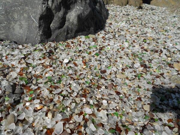
beach glass from Glass Beach in Fort Bragg California

It’s a pretty incredible sight with the sea glass several inches thick in some areas. It also makes for excellent foreground photographs of the California Coastal National Monument outcroppings just off the coast:

seaglass beach

Here is a short video I took at Glass Beach:

There are actually 3 Glass Beaches in Fort Bragg. The one that is most famous is part of MacKerricher State Park (CA) and was the Fort Bragg dump from 1949 – 1967. I took these photos and video at the 1943 – 1949 dump site which is just south of MacKerricher State Park. There is another dump site that ran from 1906 – 1943, but it’s only accessible by sea kayak.

For those interested in directions how to get to 1943 – 1949 dump site, there is a Glass Beach Museum on highway 1 toward the south end of Fort Bragg where you can get a map of all the glass beaches in Fort Bragg (and see an amazing display of sea glass).

Natural Bridge at Natural Bridges State Beach California

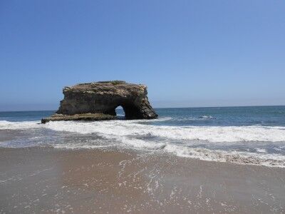
If you are looking for a beach that has more than just sand, Natural Bridges State Beach (CA) is an excellent choice. In addition to Sandy Beach and the Natural Bridge, the beach also has wonderful tide-pools to explore during low tide and is home to one of the largest monarch butterfly over-wintering sites in the Western United States. The beach was named after three natural bridges that extended out into the ocean — now only one remains:

natural bridge at Natural Bridges State Park in California

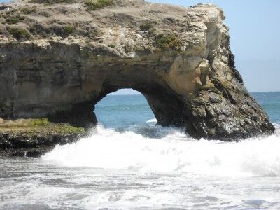
Waves crashing through Natural Bridge at Natural Bridges State Beach in California

In the early 1900s, three arches carved by nature out of a mudstone cliff inspired the naming of Natural Bridges.

The arches were formed millions of years ago when water, silt and clay sediment combined with one-cell marine plants called diatoms. Heat and pressure solidified the mixture into a soft stone that formed the three arches.

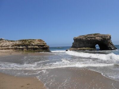
Wave action against the soft rock formed the bridges and also undercut them, eventually wearing them away and leaving only islands. The outermost arch fell in the early part of the 20th century and the inner arch broke during a storm in 1980. Only the middle arch remains, but it is being slowly eroded by the waves.

With the last remaining bridge now fully cut off from the coast, it’s part of the California Coastal National Monument.

Natural Bridges formation at Natural Bridges State Beach in California

I arrived at high tide, so I was not able to explore the tide-pools. I have on other occasions in the past and they are quite interesting and an excellent place to take kids with quite a bit of tide-pool life to see.

The park rangers offer year round guided nature walks on such topics as wildflowers, birds and wetland explorations.

The monarch butterfly natural preserve walkway is currently being worked on, but should be ready when the monarch butterflies return in winter. Monarch butterfly tours are offered at 11:00 am and 2:00 pm on weekends in the fall and winter. The park also offers two special events related to the monarch butterflies: Welcome Back Monarch Day is on the second Sunday in October from 10:00 am to 4:00 pm and The Monarch Migration Festival is the second Saturday in February from 10:00 am to 4:00 pm.

Stout Grove Redwood National Park

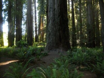
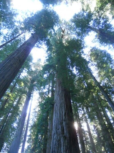
For anyone that is in the Crescent City, CA area, a visit to Stout Grove is well worth the time and effort. This 1/3 mile loop in Jedediah Smith Redwoods State Park (CA — part of Redwood National Park) is a wonderful walk under 300 foot redwoods with lush ferns covering the ground which will take your breath away as you look toward the sky to see if you can see the tops.

Stout Grove redwood trees at Redwood National Park

a look up at 300 foot redwood trees at Redwood National Park

More Photos from Stout Grove hike

A placard at the beginning of the trail gives a brief explanation on how this redwood grove came to be:

Stout Memorial Grove

Stout Grove, a majestic example of an ancient coast redwood forest, is often considered to be the heart of Jedediah Smith Redwoods State Park. In 1929, Mrs. Clara Stout donated this 44-acre grove to the Save-the-Redwoods League to save it from being logged and to memorialize her husband, lumber baron Frank D. Stout. Today, land continues to be added to these northernmost parks through the efforts of the League.

A walk along this loop trail reveals colossal redwoods thriving in rich soil deposited during periodic flooding of the Smith River. Here, waist-high sword ferns carpet the forest floor and normally flared tree bases are covered in river soils. Flood waters inhibit the growth of understory trees and plants seen in other groves, leaving the 300-foot redwoods as the main attraction

Here is a short video clip as I walked a portion of the Stout Grove loop:

Directions: Drive east on Highway 199 and turn right on South Fork Road (about 2 miles past the National Parks Visitors center). Continue .5 miles across 2 bridges — at the “Y” in the road, turn right onto Douglas Park Road. Continue until the pavement ends at which point the road changes to Howland Hill. Continue approximately 1 mile on the gravel road to a paved road on the right — park in the lot and walk down the ramp to the 1/3 mile loop hike.

Dry Lagoon Humboldt Lagoons State Park California

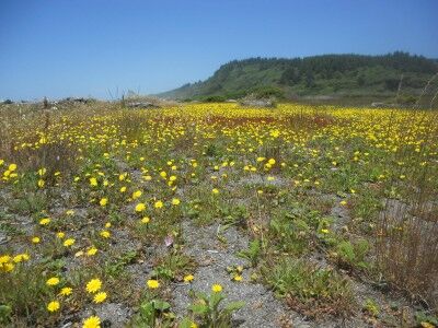
If you are into large driftwood scenery or photography, Dry Lagoon beach in Humboldt State Park (CA) is a place you want to check out. Located off of highway 101 between Trindad and Orick, there is a one lane road that leads down to a beach parking lot. While most people probably head straight for the waves, it’s the area deeper in that caught my eye. Between a lagoon filled with reeds and the sandy-pebble beach is a a wide stretch of plant life including a large number of wildflowers:

flowers  bloom at Dry Lagoon in Humboldt Lagoons State Park California

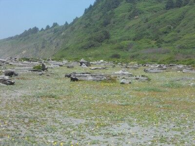
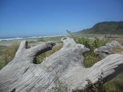
Even better than the wildflowers, are the large redwood tree driftwood logs that have settled into the sand which gives the area an other-worldliness look:

Large logs scattered about at Dry Lagoon in Humboldt Lagoons State Park California

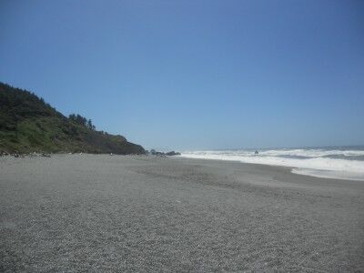
The beach itself is a combination of sand and pebbles / small rocks. Like at Agate Beach, there were a number of people combing through the sea rocks and collecting their favorites.

Dry Lagoon Beach at Humboldt Lagoons State Park California

This beach is a nice photography beach, especially those that love driftwood:

Large driftwood log at Humboldt Lagoons State Park in California