Purple Sand Beach

I really enjoy finding unique beaches. A prime example is sea glass beach in Fort Bragg. I managed to stumble across another one this weekend when I traveled to Pfeiffer Beach in Big Sur California.

I actually have been to Pfeiffer Beach before (with direction on how to get there), but didn’t realize that it had a little secret — it’s one of the few purple sand beaches in the world. I missed this because the main part of beach doesn’t have much purple sand (if you look closely, you can see little bits here and there, but if you weren’t specifically looking for it, you wouldn’t notice it — at least I didn’t on my first visit).

To really see the purple sand, you need to walk beyond the main beach area toward the north. The father up the beach you head in this direction, the more purple sand that can be seen. The easiest place to spy the purple sand is at the base of the hills, but there will be certain areas of the beach that also have purple sand patterns woven into the mix. For those who go to the beach expecting that the entire beach will be purple, they will be disappointed. The vast majority of the beach is white sand like any other beach. There are, however, areas where purple sand mixes with the white sand (usually with black sand as well) to make some wonderful patterns:
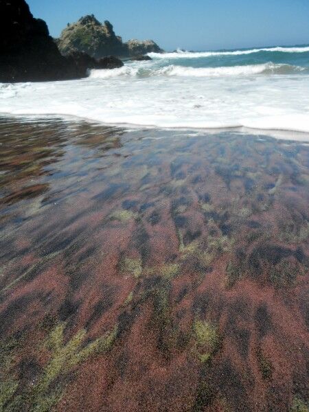
purple sand

What is amazing is that each time a wave comes up the beach and washes over the purple sand, the pattern changes making it like a constantly changing giant sand painting:
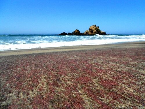
purple sand beach

Due to the numerous rock outcroppings just off shore, you can see California Coastal National Monument from Pfeiffer Beach as well:
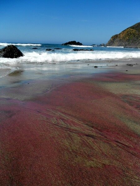
Pfeiffer beach

The purple sand is the result of manganese garnet deposits which are found in the hills surrounding the beach. For anyone that enjoys seeing the unexpected and interesting phenomenon at the beach, scheduling a day to explore the purple sands at Pfeiffer Beach is definitely worth taking the time to do.
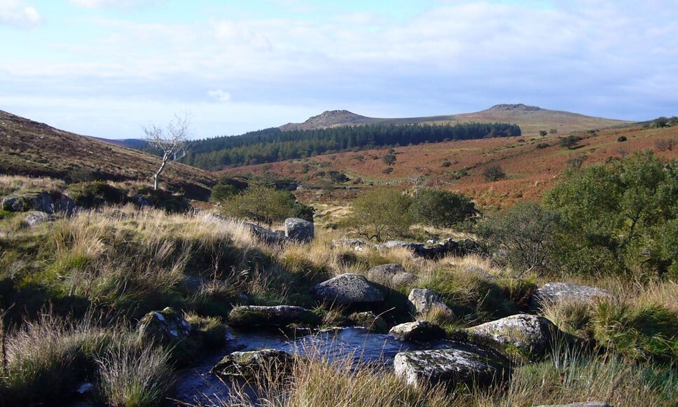
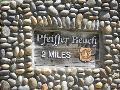
Pfeiffer Beach National Forest

Pfeiffer Beach (run by the National Forest Service) is a hidden gem where you may be able to escape the crowds clogging up all the other beaches and state parks along highway 1 in the Big Sur area of California. There are a couple of reasons for this.

First, the Pfeiffer Beach isn’t marked with a sign along highway 1 so you would drive right on by it unless you knew exactly where to turn. Coming south on highway 1, it is 0.5 miles past the US Forest Service Ranger Station. You make a tight right turn when you see the yellow “Narrow Road” sign (which you need to be looking for because it’s hidden a bit too — there is no sign for “Pfeiffer Beach”). About 100 yards down the road you will get confirmation that you are one the correct road when you see this sign:

The second reason that less people go to this beach is that the next two miles of road down to the beach are mostly one lane so that campers and RVs can’t make it down it. Combine the lack of marking and the no RVs and you have a beach that, although beautiful, gets a lot less traffic than the other beaches in the Big Sur area.

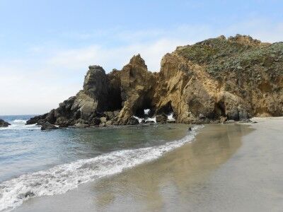
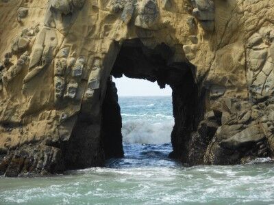
The beach has plenty of sand with a number of rocky outcrops just offshore, many with arches and tunnels within them:

There is a small creek that runs down the beach and empties into the ocean. Sea lions playing in the waves just offshore when I was there and the many rocks outcroppings (which also make Pfeiffer beach part of the California Coastal National Monument) were the home of sea birds and resting sea lions. There is a $5 fee to enter. If interested, here are more photos of Pfeiffer Beach. It’s definitely a beach to visit, especially when the crowds at the other main stops are beginning to get to you.

Trinidad State Beach California

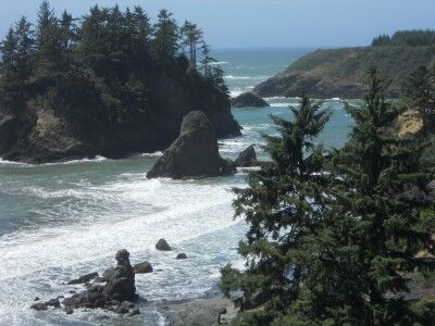
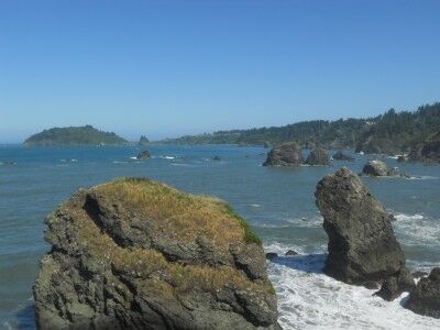
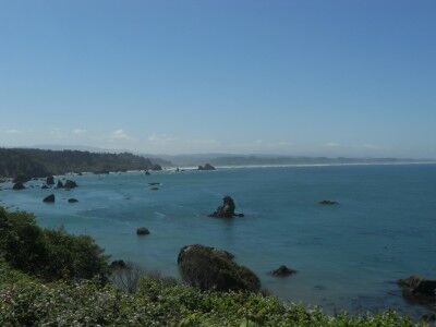
While Trinidad state beach is a bit difficult to find (once you exit and head into the town of Trinidad, the main road will first curve 90 degrees right and then a little later 90 degrees left — toward the coastline. Instead of following the main road and turning left, you want to make another right down a one lane road to find the entrance to Trinidad state beach). Once you reach the parking area, there are a lot of picnic tables and a wonderful view of the beach below. The many rock outcroppings in the ocean making them part of the California Coast National Monument:

The view overlooking the beach at Trinidad State beach in California

It is a about a quarter mile hike down to Trinidad state beach along a narrow dirt path.

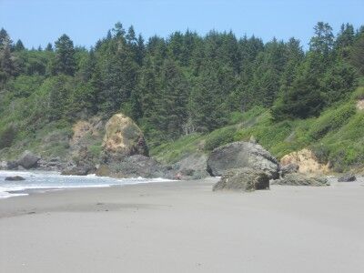
beach level at Trinidad state beach in northern California

It was extremely windy while I was there making the view and picnic are much more comfortable than the beach (there were trees that blocked the wind up there), but I don’t know if that is a regular occurrence or not. It was a fun beach to explore with all the different rock outcroppings.

California Coastal National Monument

I’ve looked at one of our National Monuments hundreds of times and never even realised it. If you have ever been along the California coast, there is a good chance that you have seen this national monument as well. The California Coastal National Monument, as it name implies, spans the entire coast of California and was established on January 11, 2000. It compromises more than 20,000 small islands, rocks, exposed reefs and pinnacles located off the 1,100 miles of the California coastline.

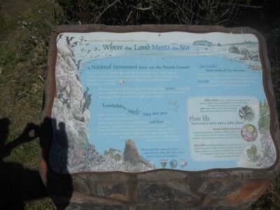
I would not have even realised I was enjoying the scenery that this National Monument provided except for an informational sign I happened across:

A California Coastal National Monument sign found overlooking Trinidad Bay

Where Land Meets The Sea

A National Monument here on the North Coast?

Scan the coastal landscape spreading out before you. This area is rich in geological history and biological resources. The rocks dotting Trinidad Bay are now part of California Coastal National Monument (CCNM).

The Bureau of Land Management manages the CCNM, a network of over 20,000 small islands, exposed reefs, rocks and pinnacles spanning California’s entire 1100 mile coastline.

Landslides melting into the sea

Large masses of land are continually slumping into the ocean. The slow moving landslides, or earth flows, are a mixture of sediments from soft clay to hard rock. Like Rocky Road ice cream left in the hot sun, wave energy melts the softer sediments away, leaving behind large, chunky rocks. Many of the rocks you see close to shore were deposited from earth flows.

Ses Stacks: Hard rocks of the old coast

Some of the rocks that you see were once part of the ancient coastline. These resistant formations, or sea stacks, were isolated by rising seas, you erosive surf and geological uplift. Pilot rock is one example.

Trinidad Bay California seen from Luffenholtz Creek

all rock formations off the coast of California are part of the California Coastal National Monument

So now you know. If you happen to be along the California coastline and see rock formations off the coast, you are looking at one of our newer National Monuments.