Point Reyes’ Little Known Alamere Falls

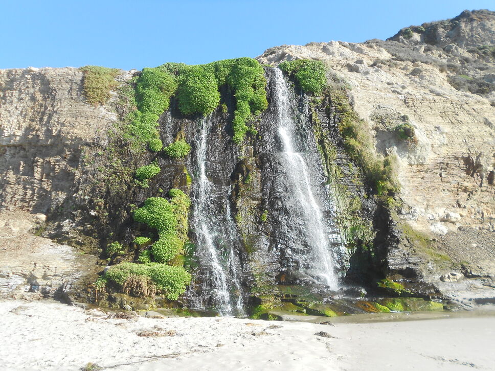
When visiting Point Reyes national seashore, the first thing that comes to mind is usually not waterfalls. For this reason, a lot of people miss the wonderful Alamere Falls which flows year round and falls directly onto the beach. One of the reasons it’s not well-known to most visitors is that it takes quite a hike to get there. You’re either going to have to walk 16 miles round trip from a trailhead near the visitors center, or 8.5 miles round trip if you drive to the Palomarin trailhead. Either way, it means a substantial hike which keeps the vast majority of people who visit the park from ever going there.

These photos were taken in Mid November 2013 during a year with far below normal rainfall, taking the trail that begins at Palomarin (a warning on taking this shorter route — the last 4/10 of a mile to the waterfall is on a “unmaintained trail” — while there is not an issue walking the trail, there is quite a bit of poison oak and you’ll want to have long pants and sleeves when walking this portion to avoid it)

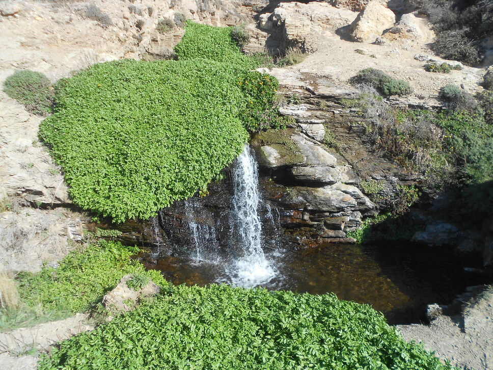
The first part of the falls you’ll see is the upper falls:

Alamere waterfall upper section

Just below you come to a small middle falls:

Alamere waterfall mid section

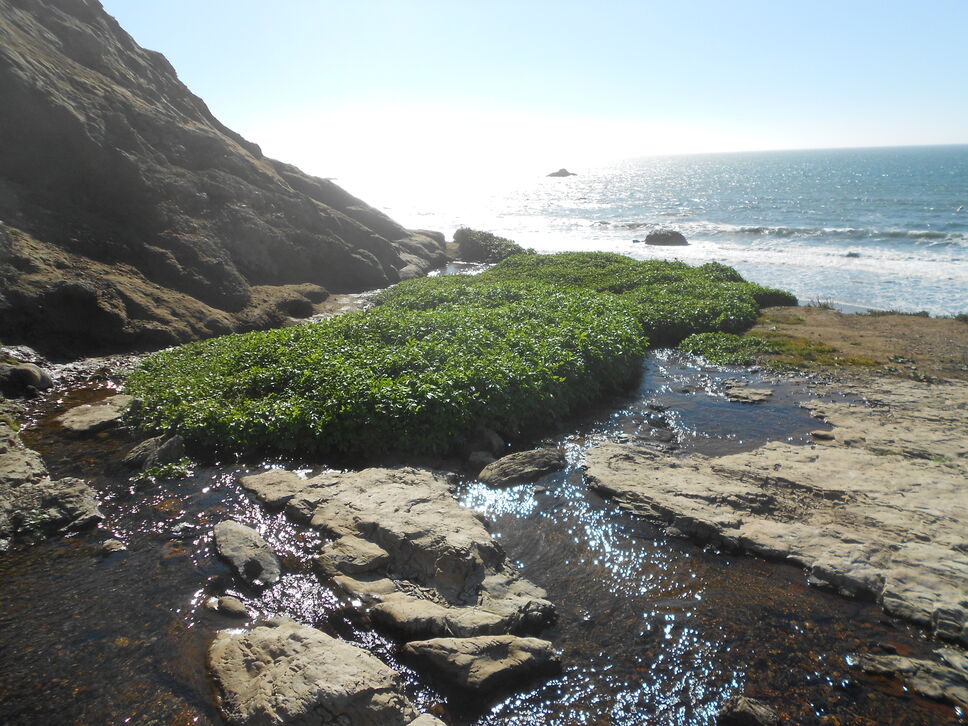
From this vantage point you can see where the river flows over the edge creating the lower (and main) falls with the ocean in the background:

the top of Alamere waterfall

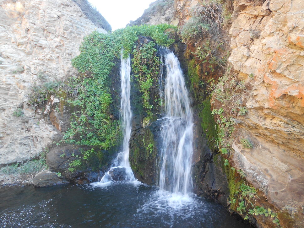
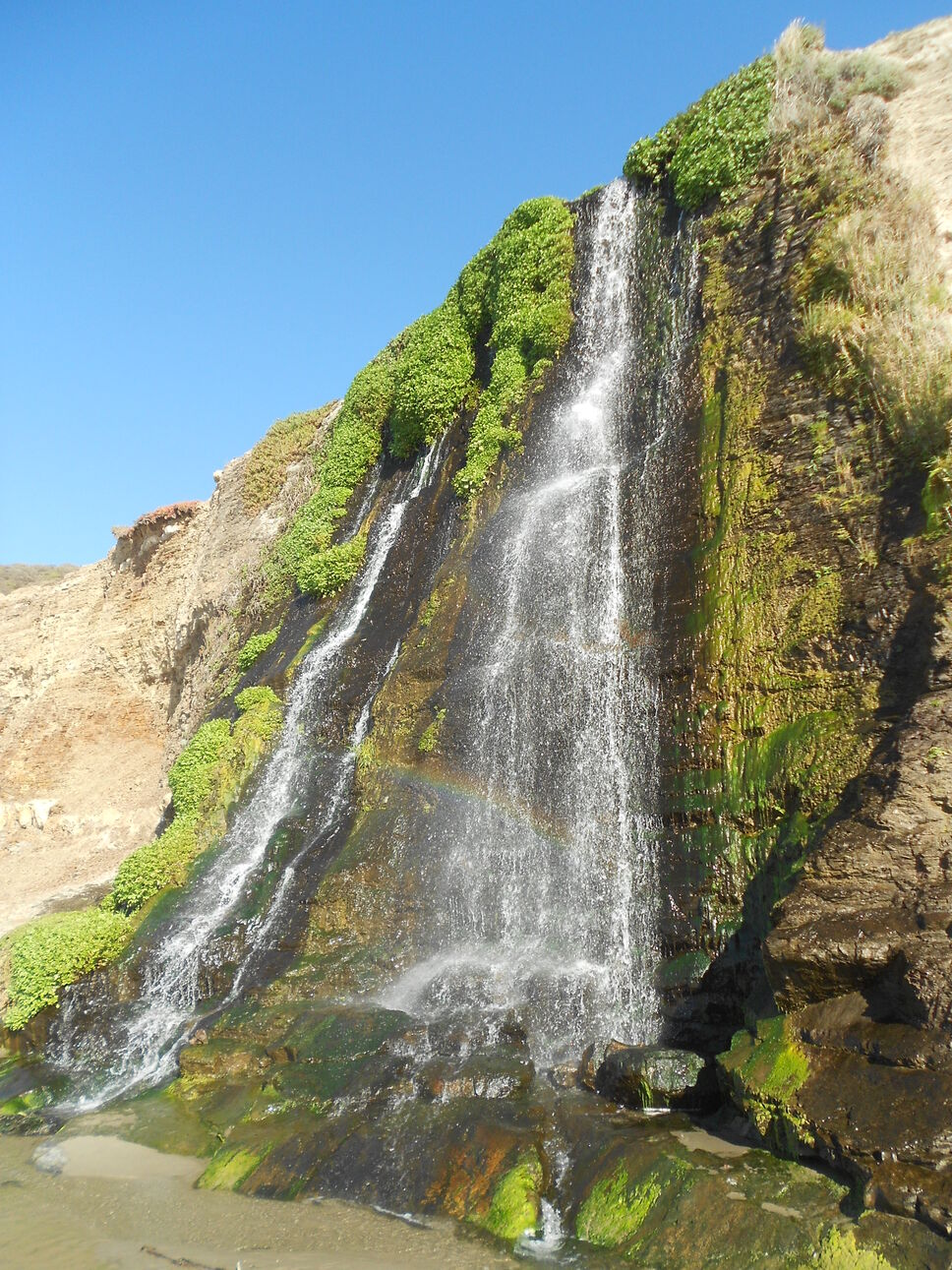
You aren’t able to actually see the lower falls from up here. In order to get there, you have to descend a rather steep unofficial trail with a lot of loose rocks. If you’re a strong hiker and have good balance, you shouldn’t have too much trouble doing it, but it helps to have a partner to help make it up and down some of the steeper areas. If you get nervous or don’t have good balance, it might be difficult to make it down to the beach. It’s not recommended for small children. Once you get down, however, you’re met with this:

Alamere waterfall main falls

Alamere Falls Point Reyes

Alamere waterfall at Point Reyes national seashore

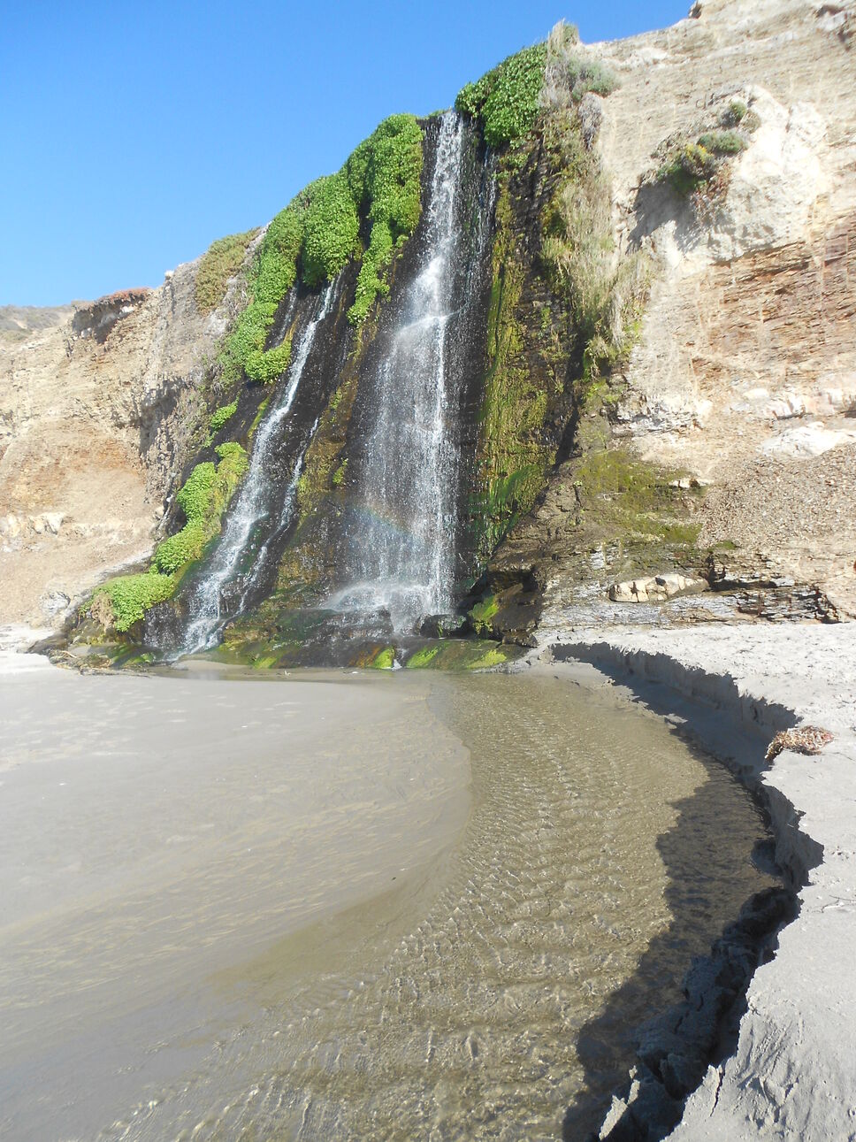
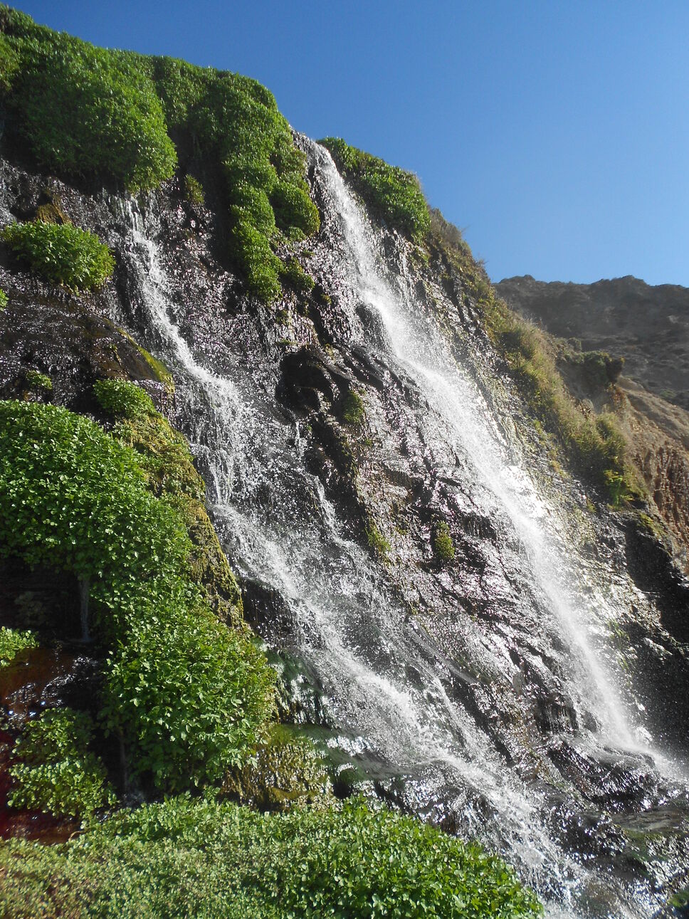
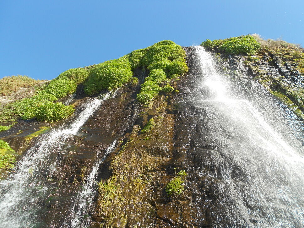
You can even get up right up next to it:

Looking up at Alamere waterfall

And if the sun is out, you’ll see numerous rainbows within the falling water:

Rainbow in Alamere waterfall

Since it’s pretty spectacular when there has been little rain and it has a low flow, I can only imagine what it’s like after a rainfall or a wet year.

Cataract Falls, Colorado

I would not recommend anyone making a special trip only to see Cataract Falls. The lower falls, which is the only area that is really accessible to most people, is nice but nothing spectacular. An exception might be for those with children who want to see a waterfall in the Vail, Colorado area (it’s about an hour drive from Vail in White River national forest in the Eagles Nest wilderness area) or simply don’t want to do a moderate to strenuous hike which is required to see other waterfalls in the area. It’s not the biggest falls around, but it’s easy to get to (only about 1/4 mile off the road). There is a small bridge below the falls where you can get a nice photo (the first photo below was taken from it), and there are areas where you can sit on rocks to enjoy a snack or meal.

cataract falls

I made the trip in late Autumn (mid October), so there was a bit of snow on the ground and the waterfall was beginning to ice up:

Ice forming on Cataract waterfall, Colorado

The is a way to get to the top of the falls, but it’s much steeper than the trail there with a lot of loose gravel on the trail. I wouldn’t recommend it for small children or anyone who isn’t confident with their balance. This is a shot from the top of the waterfall:

The top of Cataract Falls in Colorado

From the top of the fall, the trail disappears, although you can still climb to see an upper falls area. This is quite difficult and I wouldn’t recommend it for anyone but well experienced hikers. I made it about half way up, but stopped due to the snow/ice on the ground. I’m not sure it would have been any easier without the snow on the ground. This photo was partial way up:

Upper Cataract waterfall in Colorado

Directions

Take Interstate 70 West to exit 171. Upon exit, turn right (south) on U.S. 24. You will drive 15.4 miles when you’ll see a national forest gate and dirt road on your left. This is the North Entrance to Camp Hale. Drive until the road ends (not far — you can see the end from U.S. 24) and turn right. Drive about a mile until you reach a fork in the road (there was a “Road Closed Ahead” sign at the fork when I was there). Stay left (the road closed side). Drive until you reach the “Road Closed” barrier (I’m not sure if this is permanent or not, but was there in October 2013):

road closed sign

The trailhead is 100 feet before the barrier (you passed it if you reach the barrier) on the left side marked with two large wooden triangle posts.

Berry Creek Falls Big Basin Redwoods California State Park

For anyone that visits Big Basin Redwoods state park (California) and has the time, the Berry Creek Falls trail is well worth the time and effort (approx. 10 miles round trip — the park signs estimate it at 6 hours and difficult, but I would say it’s more intermediate for anyone that does a decent amount of hiking and it should take less time. I was able to complete the hike in under 5 hours with a stop for lunch and a lot of photo taking along the way). It’s one of my favorite trails when I head back home to visit my parents, and I have the time to make the hour drive to the park. I recently was able to do the hike, and with all the recent rain in this area, Berry Creek Falls is running with more water than usual making it even more spectacular.

Berry Creek Falls

Big Basin waterfall

Berry Creek Falls top