List of National Parks that are Open During the Shutdown

As most people are well aware at this point, the vast majority of the parks within the national park system are closed due to the government shutdown. A few states have worked with the government and they have decided to reopened a few parks with state funds. It’s important to note that just because a state has decided to reopen some parks within their state, that doesn’t mean that all of the national parks sites within their state are open. The number of sites open is still only a small percentage of the 401 sites that make up the national park system. Below is the current list of sites that are currently open, along with the dates that they are scheduled to remain open:

Arizona

grand canyon national park arizona

Grand Canyon National Park (currently scheduled to be open from October 12 to 18)

Colorado

rocky mountain national park

Rocky Mountain National Park (currently scheduled to be open from October 11 to 20)

New York

statue of liberty

Statue of Liberty National Monument (currently scheduled to be open from October 12 to 18)

North Carolina / Tennessee

national park

Great Smoky Mountains National Park (currently scheduled to be open from October 16 to 20)

South Dakota

mount rushmore

Mount Rushmore National Memorial (currently scheduled to be open from October 14 to 23)

Utah

Arches National Park

All Utah parks are currently scheduled to be open from October 11 – 20

Arches National Park
Bryce Canyon National Park
Canyonlands National Park
Capitol Reef National Park
Cedar Breaks National Monument
Glen Canyon National Recreation Area
Natural Bridges National Monument
Zion National Park

20 Room Dwelling Montezuma Castle National Park

If you’re heading either way between Phoenix and Flagstaff Arizona on Highway 17, it’s well worth your time to stop to visit Montezuma Castle National Monument. It’s only a 15 minute drive from the main highway, and it’s one of the smaller national parks which I have visited meaning that it’s possible to see the entire park in about an hour. Even thought it’s not the biggest park in the system, it’s a pretty impressive sight that’s well worth the little time it takes to visit.

The main building is the incorrectly named “Montezuma Castle” which is neither a castle or have any relationship to Montezuma (early settlers incorrectly assumed that the dwelling was Aztec, gave it the name which stuck even after it was established that southern Sinagua farmers began building it over 700 years ago). It’s a five-story, 20 room building which sits about 100 feet above the valley floor and it’s quite impressive when you round the corner to see it for the first time:

montezuma castle national monument

Montezuma castle national park

montezuma castle

The information sign below the dwelling gives the following information:

Montezuma Castle invites us to pause in wonder at the ingenuity of the people who began building it over 700 years ago.

Ancestors to today’s Puebloan peoples built and occupied the Castle. We can only speculate why they chose to build here and how they lived in this magnificent cliff dwelling.

Both “Montezuma” and “Castle” are misnomers. In the 1800s, European Americans were fascinated with Inca, Maya and Aztec civilizations and gave southwestern sites exotic names, in this case for Emperor Motecuhzoma II — who lived long after the Castle was constructed.

The Yavapai call this place “the home of the protectors of the Yavapai.” The Hopi refer to it as both Sakaytaka, “place where the step ladders are going up,” and Wupat’pela, for “long, high walls.”

Due to looting, by the early 1900s much of what the Castle’s residents left behind was gone. Damage to the building increased as visitors climbed ladders to walk through the rooms. Now the dwelling is only accessed for inspection, maintenance, and research.

While I would certainly leave yourself a minimum of a full hour to enjoy this park, don’t skip it if you’re in the area and short on time. While I think it’s better to take the time to read a bit about the history and see the displays at the visitor’s center, if all you have is an extra 10 minutes to see the Castle, definitely do it.

Purple Sand Beach

I really enjoy finding unique beaches. A prime example is sea glass beach in Fort Bragg. I managed to stumble across another one this weekend when I traveled to Pfeiffer Beach in Big Sur California.

I actually have been to Pfeiffer Beach before (with direction on how to get there), but didn’t realize that it had a little secret — it’s one of the few purple sand beaches in the world. I missed this because the main part of beach doesn’t have much purple sand (if you look closely, you can see little bits here and there, but if you weren’t specifically looking for it, you wouldn’t notice it — at least I didn’t on my first visit).

To really see the purple sand, you need to walk beyond the main beach area toward the north. The father up the beach you head in this direction, the more purple sand that can be seen. The easiest place to spy the purple sand is at the base of the hills, but there will be certain areas of the beach that also have purple sand patterns woven into the mix. For those who go to the beach expecting that the entire beach will be purple, they will be disappointed. The vast majority of the beach is white sand like any other beach. There are, however, areas where purple sand mixes with the white sand (usually with black sand as well) to make some wonderful patterns:

purple sand

What is amazing is that each time a wave comes up the beach and washes over the purple sand, the pattern changes making it like a constantly changing giant sand painting:

purple sand beach

Due to the numerous rock outcroppings just off shore, you can see California Coastal National Monument from Pfeiffer Beach as well:

Pfeiffer beach

The purple sand is the result of manganese garnet deposits which are found in the hills surrounding the beach. For anyone that enjoys seeing the unexpected and interesting phenomenon at the beach, scheduling a day to explore the purple sands at Pfeiffer Beach is definitely worth taking the time to do.

Sipapu Bridge Natural Bridges National Monument

When people visit Utah, and the many national parks there, Natural Bridges National Monument often gets overlooked (I have to honestly admit that I have bypassed it a couple of times in the past in order to make my way to more famous national parks in the area). Now that I have gone, I know that I will be back to do what appears to be an absolutely breathtaking canyon hike which I didn’t have time to do this time around.

Natural Bridges National Monument offers a 9 mile loop drive that has overlook pullouts to view the three main bridges in the park. This makes it a destination for those who don’t want to (or can’t) hike, as well as those that love to hike. The first bridge view along the road is of Sipapu Bridge (220 feet high, 268 feet long, 31 feet wide and 53 feet thick) and gives a good indication of the beauty of the entire national monument (wouldn’t you just love to hike the winding canyon along with river under all the natural bridges?)

Sipapu Bridge

Sipapu Natural Bridges national monument

Sipapu natural bridge

Sipapu Bridge Natural Bridges National Monument

The information sign at the bridge view give the following information:

Several names have been given the the bridges over the years. Sipapu has had at least two other names — President and Augusta — but these were later changed. Cliff dwellings and rock art in the area reminded William Douglass, the leader of the 1908 government survey, of the Hopi culture he had studied extensively in Arizona. Charged with finding “appropriate Indian names” for the bridges, he chose Sipapu, meaning “place of emergence.”

Cedar Mesa, a million acre plateau encompassing the monument and surrounding are, is composed of nearly horizontal sedimentary rock layers. During the Permian Period, wind blown sands from the north and west were deposited here as dunes. Later sediments buried these dunes and with time, pressure and moisture, they became”petrified” sand, or sandstone. Today geologists label this layer Cedar Mesa Sandstone.

Buried, then tilted and uplifted, the sandstone was slowly exposed by meandering streams which carried away the overlying sediments. These streams helped carve Sipapu and other bridges.

Wire Pass Trail Photos Vermillion Cliffs National Monument

Most people who make it out to the Wire Pass Trailhead in Vermillion Cliffs National Monument are heading directly for The Wave (advance permit is required, permit not available at trailhead). And while The Wave is definitely a place that everyone should add to their bucket list, that doesn’t mean that those going there should neglect the other wonderful hikes in the area.

One of these is the Wire Pass Trail which lead through a slot canyon and eventually intersects with the Buckskin Gulch slot canyon. The Wire Pass trail requires a permit ($6.00 per person which can be obtained at the trailhead) and is well worth the cost. Here are a few photos that I took on a recent hike on the Wire Pass Trail:

wire pass trail

wire pass foot print

wire pass canyon

wire pass slot canyon

wire pass trail slot canyon

slot canyon vermillion cliffs

vermillion cliffs slot canyon

slot canyon rocks

slot canyon barrier

vermillion cliffs wire pass trail

slot canyon curve

wire pass slot canyone vermillion cliffs

wire pass trail arch

The Wave Permits

One of the favorite places I have found since traveling to national parks is The Wave at Coyote Buttes in Vermillion Cliffs National Monument. This is definitely not your average place, and one that everyone should immediately add to their bucket list. It’s really difficult to describe this place in a way that does its beauty justice. Even the photos of The Wave, as spectacular as they are, still fail to show the incredible beauty of this place. Here a re a couple of photos that give a little taste of what is in store if you make it to The Wave:

The Wave Vermillion Cliffs national monument

The Wave photo

The problem for those wanting to see The Wave in person is that this is not the easiest place to visit. The national park service only gives out permits for 20 people to see The Wave per day. There are two ways to get The Wave permits:

1. There is an online lottery which distributes 10 permits per day which works as follows:

  • Permits can be applied for up to four months in advance.
  • It’s possible to apply for a permit anytime during the entire month (it doesn’t need to be on the first day 4 months in advance).
  • Permits can be requested for three entry dates per application. If more than one of your requested dates is chosen in the lottery, only one trip will be given the permit.
  • To apply for the permit requires a non-refundable $5 administrative fee for each application.
  • All applicants will be notified by email on the first of the month as to whether or not their application for a permit was successful.

You can get more information about the online lottery process here and apply for the permits online here

2. In addition to the online permit lottery, there are 10 permits to The Wave given away the day before by lottery at the the new Grand Staircase-Escalante National Monument Visitor Center in Kanab, Utah. The Lottery starts at 9:00 am sharp Mountain Standard Time (9:00 am Daylight Savings Time in summer — if you are even a minute late, you will be locked out and not able to participate), so you need to arrive before then. If there are only 10 people that want permits, all will get them. If there are more than 10 people that want permits (most days there are), then a lottery is held.

The permits or for the following day and the lottery is held every day (there may be some exceptions for holidays). Here are a few more rules for the walk-in permits to The Wave:

  • Credit cards are not accepted for these permits. Applicants must pay by either cash or checks.
  • If you are lucky and there are 10 or less people seeking permits on the morning you are there, everyone will receive a permit for the next day.
  • In the rare case when all ten permits aren’t issued the previous day (highly unusual), it may be possible to get a same day permit.
  • When more than 10 people want a permit, a lottery drawing for the next day’s 10 permits will be held.
  • A group of up to six people may request permits, but only one person from the group can enter the drawing (if this person is picked, then all six people receive permits).

Although I have tried several times to get permits from the online lottery, I have never been successful. I have been able to get to The Wave through the walk-in lottery a couple of times, but both were during the winter when the competition for the permits is much less compared to summer. Still, if you are going to be in the area, you should try your luck in getting a permit. It’s a destination that you will never regret seeing…

Moonrise at Gila Cliff Dwellings National Monument

As I was driving in to see the Gila Cliff Dwellings National Monument (about 1 mile from where the Gila Cliff Dwellings are located), I noticed that the moon was reflecting brightly in the daytime sky and I managed to get this shot of it.

Moonrise at Gila Cliff Dwellings National Monument

I wish I were a better photographer because even though I like this photo, it doesn’t do justice to actually being there. It’s always exciting when I come across these beautiful scenes that stop me in my tracks.

National Park Free Days 2012

Update: The national park service has announced National Park Free Days 2013

Many people don’t realize that most parks within the National Parks system don’t charge any entrance fee at all. That being said, some of the most popular National Parks do charge entrance fees. While these fees are applicable most times of the year, National Parks, National Monuments, National Recreation Areas, National Preserves, National Seashores and National Lakes designate several times a year when they offer free access days. The National Parks free days for 2012 are as follows:

the wave
The Wave

January 14 – 16 (Martin Luther King Jr. holiday weekend)

April 21 – 29 (National Park Week)

June 9 (Get Outdoors Day)

September 29 (National Public Lands Day)

Nov. 10 – 12 (Veterans Day weekend)

The 2012 National Parks free days are quite similar to the 2011 fee free National Parks days with the one major change being that Get Outdoors Day has replaced the first day of summer as a fee free day in 2012.

The 2012 fee free National Parks days apply to entrance fees, commercial tour fees and transportation entrance fees. While the fee free days don’t apply to other park fees such as reservation fees, camping fees, tour fees, or concession fees, many times the businesses operating within the National Parks (hotels, restaurants and tour operators) will create their own promotions which will coincide with the free entrance fee days. Even with the entrance fees National Parks are considered a great value, but National Parks free days make them even a better value.

Here is the official National Park Fee Free Days 2012 press release.

Tour of the Moon Classic Cycling At Colorado National Monument

By Kristen Lummis (enjoy her blog Brave Ski Mom, like her on facebook or follow her on twitter @BraveSkiMom)

Colorado is full of classic bicycle routes, many of which can leave you breathless at a high altitude.

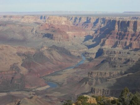
The Colorado National Monument ride is different. Located in western Colorado, just shy of the Utah border, Colorado National Monument offers cyclists never-ending vistas of stunning red rock canyons, pinyon-juniper forests, three seasons of wildflowers and a musical accompaniment of canyon wrens on almost any given day.

winding road through colorado national monument

The ride isn’t easy. No matter which way one rides the Monument (as the locals call it), it involves a significant climb. But with a top altitude of only 6,640 feet, a total vertical gain of 2300 feet, and a round-trip distance of 33 miles, this ride won’t leave you gasping for air.

rim rock road high point colorado national monument

The Tour of the Moon

For eight exciting years, between 1980 and 1988, the Monument was the location of the “Tour of The Moon,” a popular stage of the Coors International Bicycle Classic. During its heyday, the Coors Classic was the largest men’s and women’s pro-am race in the world, attracting the top teams and top cyclists.

In 1981 and 1985, cycling legend Greg LeMond won the Coors Classic. Other famous participants included speed-skating legends Eric and Beth Heiden, with Beth winning the women’s division in 1980. The 1984 film American Flyers, starring Kevin Costner was inspired by the Tour of the Moon and filmed on site in Mesa County.

Since the late 1980s, cycling on the Colorado National Monument has been limited to amateurs, enthusiasts and just plain crazy people. We fit into all three of these categories. We are certainly amateurs. We are most definitely enthusiasts, and my husband is sometimes considered crazy. How to else to explain why he would choose to ride up and down the Monument three times on one firecracker hot 4th of July? He didn’t ride the entire 33 mile circuit each time. But he did ride the difficult climbing section three separate times — in a row.

the steep curves of Colorado National Monument road

The USA Pro Cycling Challenge

In late August 2011, professional cycling returned to Colorado with the USA Pro Cycling Challenge. The Monument wasn’t one of this year’s stages. However, with a landscape like no other in pro cycling, USA Pro Cycling Challenge organizers are hoping to resurrect the Tour of the Moon for the 2012 race. The National Park Service may have other ideas. Citing concerns for protection of the park’s natural resources, an application by the Local Organizing Committee has so far been denied.

Local organizers have a number of alternate routes in mind for 2012. But it won’t be the same. Until the Park Service changes its mind, cycling on the Colorado National Monument will be limited to amateurs. This means that while most of us can’t ride with the pros, we can ride somewhere they can’t. And if you haven’t ridden over the Colorado National Monument, you should. It truly is a classic ride.

Park map of Colorado National Monument

When You Go

Colorado National Monument is located approximately 250 miles west of Denver, between the towns of Grand Junction and Fruita. The East entrance to the park is located approximately 5 miles from downtown Grand Junction on Monument Road.

Just past the East Entrance station is parking at the Devil’s Kitchen trailhead (on the left) or the Devil’s Kitchen picnic area (on the right, complete with bathrooms). Both areas have parking and are good places to begin your ride. Please note that all cyclists must have a steady white light on the front of their bikes and a flashing red light on the back. Cyclists are also required to ride single file (for more information on park requirements, click here).

From Devil’s Kitchen, the road switchbacks up about four miles, through a dark tunnel before plateauing at the Cold Shivers viewpoint. Traffic can be heavy along this portion of the road, but just about 1/2 mile past Cold Shivers is a turn off to Glade Park, a ranching community. After this point, cyclists pretty much have the park to themselves.

From here, it is another 5-6 miles of rolling uphill terrain to the high point of the Colorado National Monument. After the high point, the descent begins, with only one more significant uphill climb, at Black Ridge.

The Visitors Center (at mile 19) is worth a stop to refill water bottles and check out the new interpretive displays. Leaving the Visitors’ Center, the road descends rapidly through two shorter tunnels to the West Entrance of the park.

Leaving the park, cyclists ride east along Broadway, turning right onto South Broadway for about 4 miles. Another right turn onto South Camp takes riders back to Monument Road and back to their cars.

Back at your car, you’ve completed one circuit of the Tour of the Moon. That’s what the pro women rode back in the ’80s. The pro men did two back-to-back circuits.

Enjoy!

Sunset View Overlook Cedar Breaks National Monument

Sunset View overlook gives you a spectacular view directly over the Amphitheater portion of Cedar Breaks National Monument. The overlook is right next to the parking lot so there is no hike involved to get there, so it is definitely worth a stop when you are driving Scenic Drive.

Sunset View Cedar Breaks national monument

view from sunset view overlook at Cedar Breaks national monument

This is the description that the Cedar Breaks pamphlet gives about the Amphitheater:

Nothing is subtle about the great natural rock amphitheater of Cedar Breaks and its gigantic spectacle of extraordinary form wrapped in bold, brilliant colors… The Cedar Breaks Amphitheater is the result of many of the same forces that created other great Southwestern landscapes, including the Grand Canyon, Zion Canyon, and the Bryce Amphitheater. it is, however, unique in its own right as an amazing product of geological forces.

Shaped like a huge coliseum, the amphitheater is over 2,000 feet deep and over three miles in diameter. Millions of years of deposition, uplift, and erosion carved this huge bowl in the steep, west-facing side of the 10,000-foot-high Markagunt Plateau. Stone spires stand like statues in a gallery along side columns, arches and canyons. These intricate formations are the result of persistent erosion by rain, ice and wind…