Point Bonita Lighthouse New Bridge Photos Golden Gate National Recreation Area

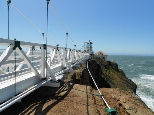
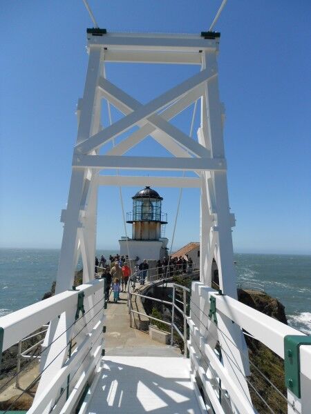
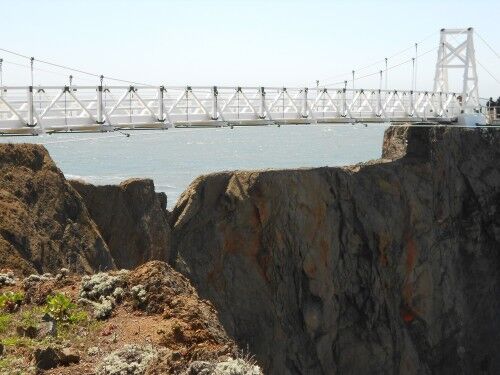
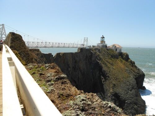
After a two year wait, people can once again visit the Point Bonita lighthouse located in Golden Gate National Recreation Area via a newly built $1 million dollar, 132-foot-long bridge which spans rocky cliffs to the lighthouse. The old bridge became unsafe and the lighthouse was closed to the public until this new span could be built.

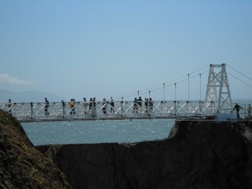
The sparkling white, narrow bridge is a much safer replica of the previous bridge and was built to withstand the high winds that frequent the area. The former bridge had a two-person limit before it became unsafe and was closed while the new bridge tops out at 50 people.

While the new bridge is built to last 50 years, it won’t be for everyone. For those that like their bridges solid and sturdy, this probably isn’t the bridge for you. When I visited the winds were in the mid to high teens and there was a sway and bounce as I crossed. With rocky cliffs below, it might also be a challenge for those with a great fear of heights. The national park volunteer who was monitoring the flow of people across the span said the bridge would remain open to visitors crossing as long as the wind remained under 27 miles per hour.

While the Coast Guard is in charge of operating and maintaining Point Bonita lighthouse, the National Park Service manages the lighthouse for visitors. The lighthouse is currently open to the public three days a week (Saturday, Sunday and Monday) from 12:30 PM to 3:30 PM (there is a tunnel that you must walk through before you reach the bridge and lighthouse — this door is closed promptly at 3:30 so you will miss seeing both completely if you are even a minute late)

Many of those who visit focus on the Golden Gate bridge and miss this incredible gem that is only a few miles away. It is one to definitely add to your list if you happen to be in the area visiting:
point bonita lighthouse bridge new

new point bonita lighthouse bridge

brand new point bonita lightouse bridge

Point Bonita lighthouse new bridge

point bonita lighthouse bridge visitors

Canyon Overlook Trail Zion National Park

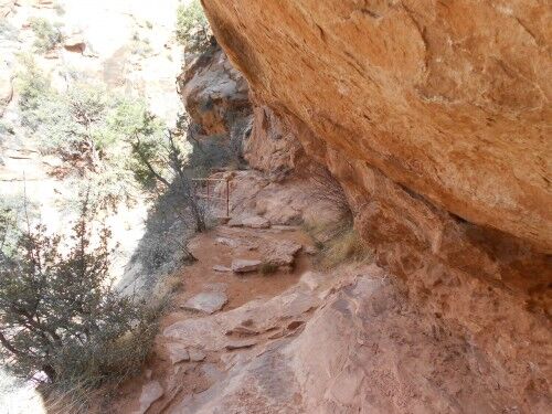
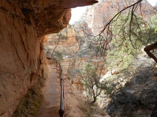
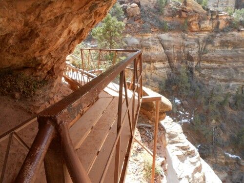
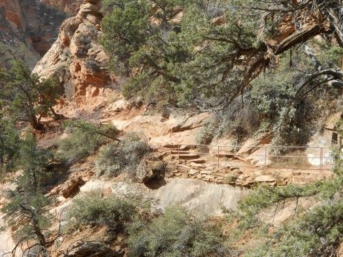
One of my favorite (relatively) easy hikes (there is some steepness at the beginning and those really scared of heights won’t like the bridge — sections of the trail have rails to keep you from accidentally wandering too close to the steep edges) at Zion National Park is one that too many people miss due to its location. The Canyon Overlook trailhead is at the east end of the tunnel after leaving Zion Valley (there is a small parking lot at the end of the tunnel where you can park). Since it isn’t in Zion Valley where most people instinctively head and spend all their time, they miss this little gem which definitely is worth making the time to do.

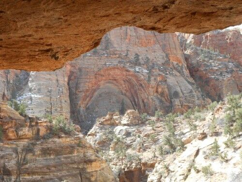
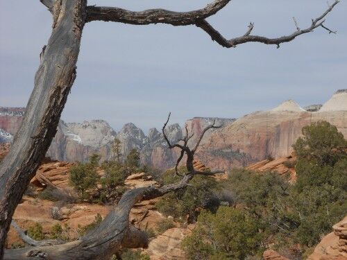
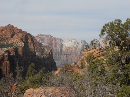
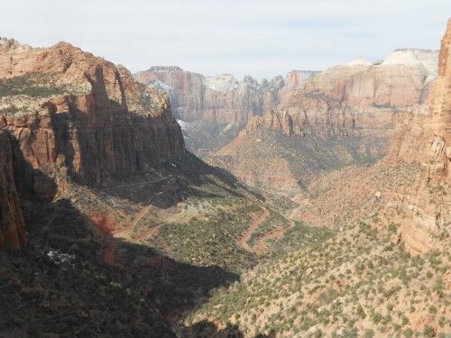
The Canyon Overlook hike is only 1 mile round trip and gives a wonderful view of Zion Valley. For those who want to see a grand view of part of Zion Valley, but don’t want to (or can’t) tackle the more rigorous hikes like Observation Point, this will give a spectacular view. The trail winds along Pine Canyon Creek with the Zion-Mt Carmel Tunnel on the opposite side. The hike ends at a railed observation overlook with lower Zion Canyon below (with the famous Zion road switchbacks) and the Beehives, West Temple, East Temple, Towers of the Virgin and the Streaked Wall across the valley. Here are a few photo so you can judge for yourself:
canyon overlook trail

canyon overlook trail railing

canyon overlook trail bridge

canyon overlook trail cove

canyon overlook trail hike zion

canyon overlook trail hike

canyon overlook trail zion national park

canyon overlook trail zion valley

Landscape Arch Devils Garden Arches National Park

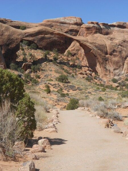
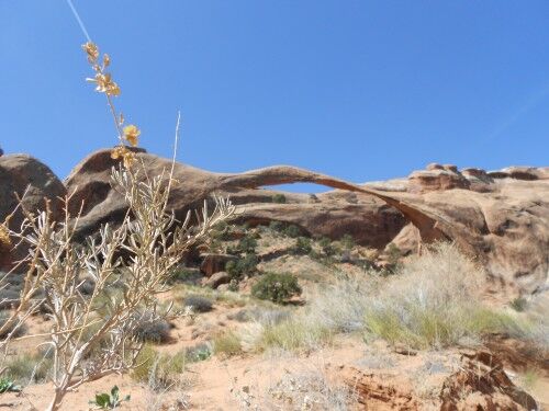
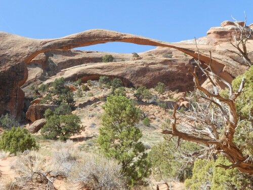
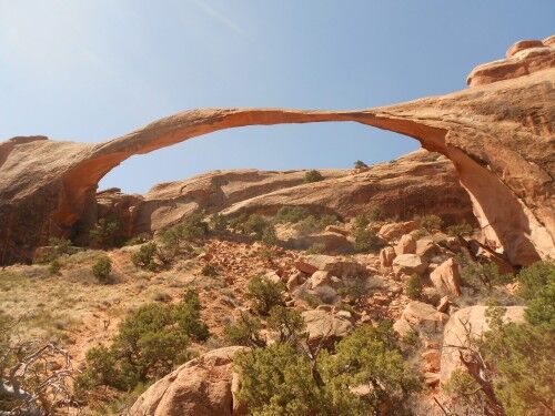
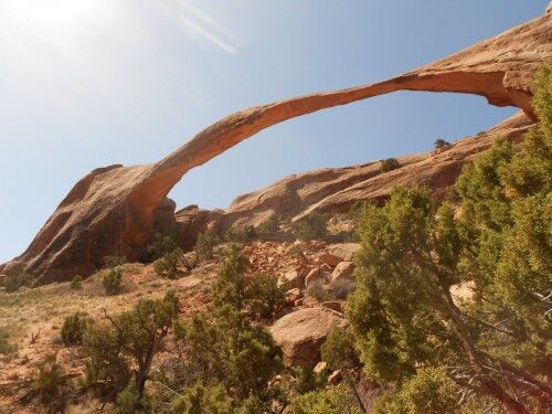
Probably the most famous arch along the Devils Garden trail at Arches National Park is Landscape Arch. Unlike Tunnel Arch and Pine Tree Arch, Landscape Arch is on the main Devils Garden trail and there is no need to take a side trail to see it (although there is a short side trail to get a bit closer to it). It’s the longest natural bridge at Arches national park and also considered to be so in the world.

While it was once possible to hike under Landscape Arch, the park service has closed the trail that once passed under it because there have been three instances since 1991 when large slabs of stone have fallen from the thinnest section of the arch. This section can easily be identified as the color under the arch is much a brighter red than other areas of the arch.

landscape arch

land scape arch

landscape arch devils garden Arches National Park

landscape arch arches national park

Landscape Arch in Arches National Park

This is the goal of most people taking the Devils Garden trail. It’s 1.6 miles round trip from the trailhead to Landscape Arch and the trail is considered easy terrain. There are more (beautiful) arches beyond Landscape Arch that are definitely worth seeing, but the terrain does get significantly more difficult from this point and requires rock scrambling is some sections.

There’s an informational sign on the which says the following about the 1991 Landscape Arch rockfall:

September 1, 1991 — Hikers thought they heard cracks of thunder from distant clouds. Visitors resting under Landscape Arch noticed loud cracking and popping noises overhead. They fled as small rocks tumbled from the slender 306-foot-long span. Moments later, a 60-foot-long slab peeled away from the arch’s right side. When the dust settled, 180 tons of fresh rock debris lay scattered on the ground.

What caused this cataclysmic event? Water had been slowly shaping the arch for countless centuries, dissolving cement between sand grains, seeping into tiny cracks, freezing and expanding. What had finally upset the delicate balance?

Unseasonably heavy rains the preceding ten days may have filled pore spaces within the sandstone. The added weight may have finally overwhelmed the rock slab in its timeless struggle with gravity.

Immediately after the 1991 rockfall even, the National Park Service closed the trail which took visitors up and under the arch. The trail under the arch remains closed today.

It is a dilemma! The longer time passes without a rockfall, the more stable the rock formation may seem. On the other hand the passage of time takes Landscape Arch closer to ultimate collapse. So, in the interest of visitor safety and preservation of the landscape beneath this fabulous arch, the longer trail under the arch remains closed. Please respect this closure by staying on designated trails.

Pine Tree Arch Devils Garden Arches National Park

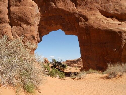
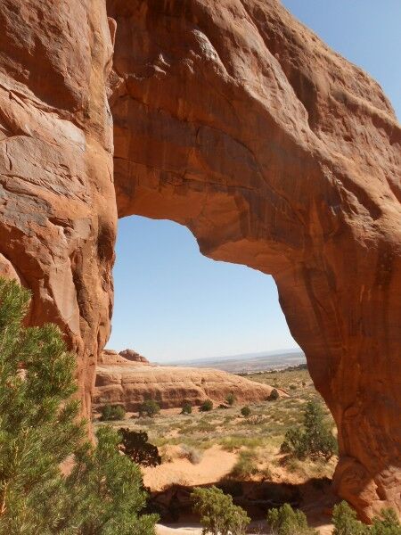
Pine Tree Arch is an arch at the end of a side trail off the Devils Garden trail at Arches National Park. This side trail leads to both Pine Tree Arch and Tunnel Arch. Pine Tree Arch is to the left where the side trail splits, and is around a bend so can’t be readily seen. It’s a relatively short and level walk to the arch from the split (the somewhat steep hill comes before the split) so it’s definitely worth going to if you have already made it to Tunnel Arch.

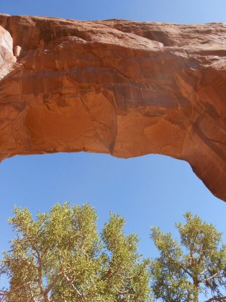
As would be expected, Pine Tree Arch has a pine tree in the middle of the arch as well as in various places around it. It’s a much larger arch than Tunnel Arch and you can walk under and through it unlike at Tunnel Arch:

pine tree arch

pinetree arch Arches National Park

pine tree arch devils garden Arches National Park

pine tree arch back

While it really doesn’t make sense not to visit both arches once you have visited one since they are so close together, I happen to think that Pine Tree Arch is the nicer of the two. Because of its size and location to the trail, it gives an opportunity for a wider variety of photos.

Tunnel Arch Devils Garden Arches National Park

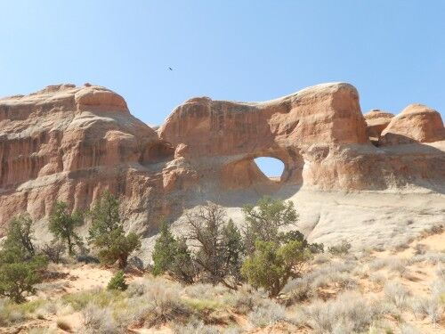
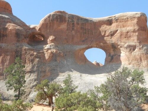
The Devils Garden trail at Arches National Park is a wonderful hike that is well worth taking. It can be made into a number of different hiking levels depending on how far you want to hike, and has a number of opportunities to wander off the main trail to see various named arches. The first of these side trails leads to Tunnel Arch and Pine Tree Arch. When the side trail splits, it’s a right to Tunnel Arch or a left to Pine Tree Arch. Most people choose to go right first since Tunnel Arch can be seen from the trail at the split:

tunnel arch

tunnel arch devils garden

Since it’s a short hike off the main Devils Garden trail, it’s worthwhile to make the trip to both Tunnel Arch and Pine Tree Arch. If, however, you are really pressed for time, these two arches aren’t quite as spectacular as several others on the trail that you certainly won’t want to miss. The viewing spot for Tunnel Arch also usually supports a crowd of people since it is the first arch on the trail and easily accessible for most (there is one slightly steep hill to reach it), so it can get overly full at times.

Rainbow Point Photos Bryce Canyon National Park

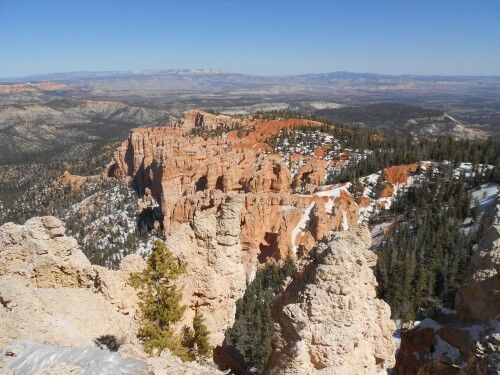
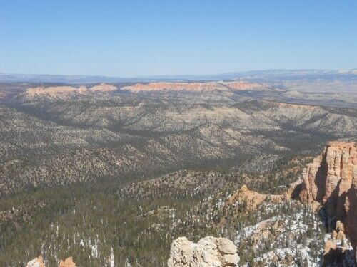
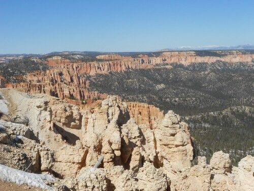
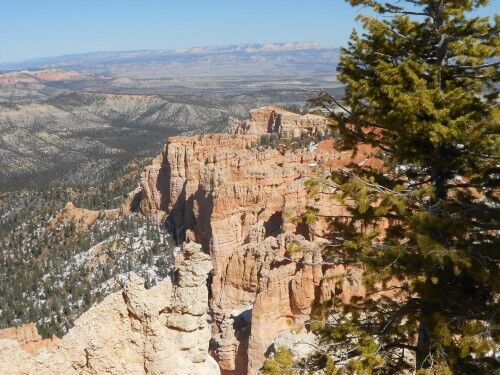
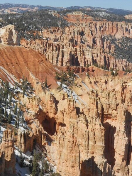
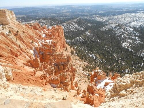
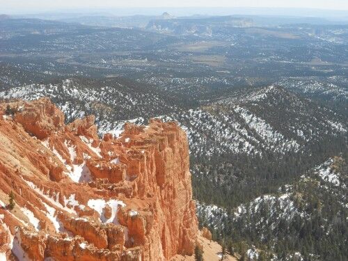
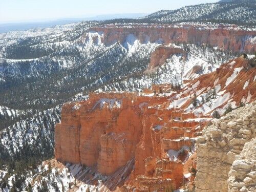
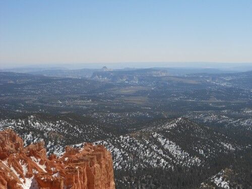
If you decide to drive the full length of the road within Bryce Canyon National Park (which you most definitely should do) you will ultimately end up at 9115 feet above sea level at Rainbow Point. Rainbow Point is the focal area of the parking area, but be sure not to miss Yovimpa Point which is to the right of the parking lot when you first enter.

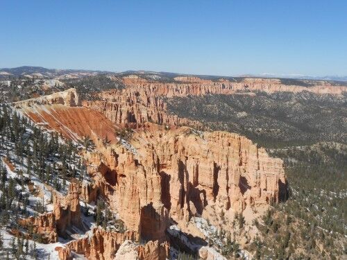
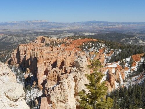
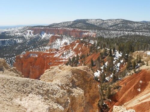
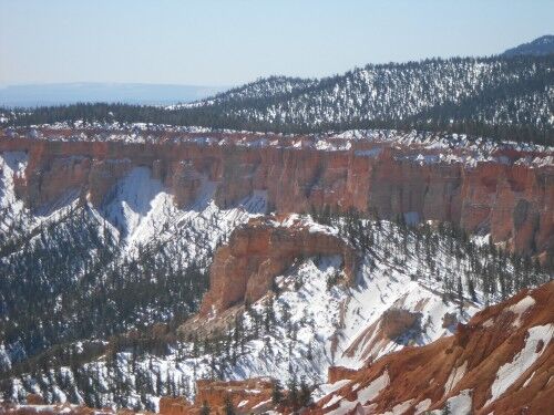
Even on a clear day in winter, Rainbow Point can be quite cold due to the elevation, and especially if the wind happens to be blowing that day, so be sure to dress warm. The overlook gives a wonderful view of Bryce canyon from the far end and makes the drive out there well worthwhile. Here are a few photos I took on a recent trip out there:

Rainbow Point

Rainbow Point view

Rainbow Point Bryce Canyon

Bryce Canyon Rainbow Point

Rainbow Point photo

Rainbow Point Bryce Canyon national park

Bryce Canyon Rainbow Point overlook

Yovimpa Point Photos Bryce Canyon National Park

Yovimpa Point is an overlook at Bryce Canyon National Park that visitors often miss. Most people take the 15 mile road within Bryce Canyon to the end and see the signs for Rainbow Point. They immediately head straight for Rainbow Point as this is the main focal of the parking area.

There is, however, a short path that begins on the right side as you first enter the parking area (the reason that so many people miss it) which leads to Yovimpa Point. The walk is short on a paved path, so it is definitely worth making the effort to see it since you are already in the area. Yovimpa Point gives a view of Bryce Canyon on the opposite side from most of the other canyon overlooks. Here are a few photos from my recent trip there:

Yovimpa Point

Yovimpa Point Bryce Canyon

Bryce Canyon Yovimpa Point

Bryce Yovimpa Point

Yovimpa Point photo

Yovimpa Point view

Goosenecks Capitol Reef National Park

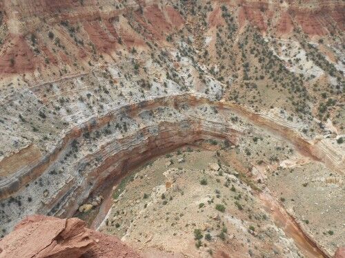
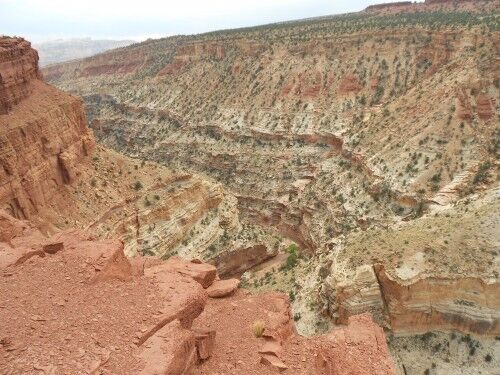
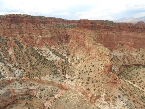
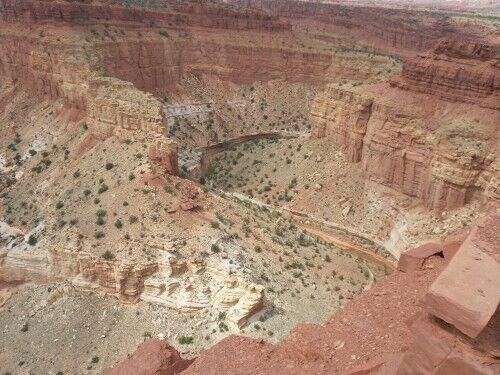
I absolutely love it when I stumble upon the unexpected when viewing a national park. One of the hidden treasures at Capitol Reef National Park is the Goosenecks overlook. It really is a different view than most of Capitol Reef, and it’s a bit off the beaten path so that many people may miss this beautiful natural wonder (it’s at the end of a 1 mile dirt road that begins at Panorama Point). For those that travel through Capitol Reef, don’t let the dirt road discourage you from making the drive. As a reward, you will be greeted with views like this:

goosenecks

capitol reef goosenecks

goosenecks at capitol reef

capitol reef national park goosenecks

The information sign at Goosenecks gives the following description:

When Sulphur Creek was young, this scene was a low plain.

The stream looped leisurely across gently sloping land, overflowing and changing direction with each flood. Imperceptibly, the Waterpocket Fold began its slow, upward warp.

Trapped in its channel, unable to detour, the water ran steeper, and sliced a deepening trench through layers od soft rock. Where loops almost meet, “Goosenecks” form — the stream’s last course, incised in stone. Now the creek flows 800 feet below the rim.

Solar Trash Can Compactors Bryce Canyon National Park

I am a firm believer that technology has an important role to play in our National Parks. While the parks themselves may be wild and rugged, technology can certainly solve some of the issues that occur when people want to visit these off the beaten track destinations.

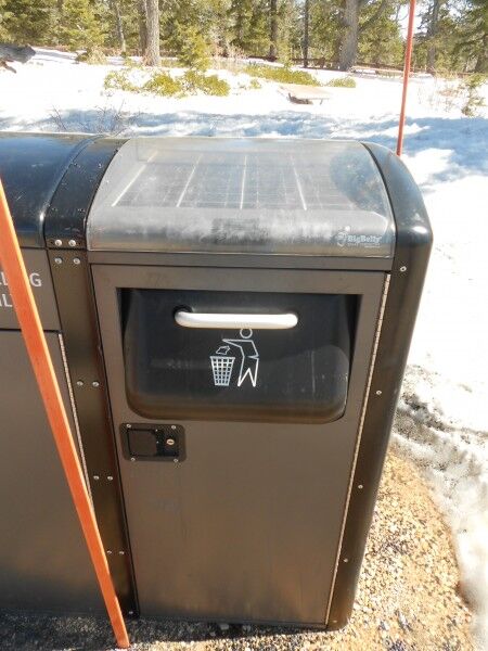
One of the things that I love about traveling to National Parks is when I find a simple technological concept in use that makes perfect sense. On a recent trip to Bryce Canyon National Park, I noticed that all the trash cans weren’t simply regular garbage cans, but solar powered trash compactor cans:

solar trash compactor

solar trash can

solar garbage can

It’s such a simple idea that makes a whole lot of sense. The compactor means that the trash can doesn’t need to be emptied as often (freeing up extra time for park staff to do other things), there is no additional electricity being used (since they are solar) and they keep the park cleaner (since it is an enclosed system, birds and other wildlife can’t get into the trash can). I hope that I end up seeing more of these, and other similar simple concepts that make sense, in other National Parks I visit.

National Park Anti-Graffiti Sign

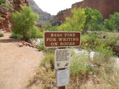
One of the things that distresses me when visiting the National Parks is that is seems that more and more people find it necessary to leave their name inside the National Parks. I’m not sure why people feel the need to deface these natural wonders — what is it that makes people think that it’s a good idea to spray paint or carve their name into the rocks at National Parks? It saddens me to no end that signs like this actually need to be posted these days in National Parks (this one was found at Capitol Reef National Park):

anti-graffiti sign in National Park

I remember hiking in Arches National Park well away from the most visited places and running into a ranger that was cleaning up marks that people had left on some of the remote arches. He said it was a constant battle because if people see that one person has done it, they feel it’s OK for them to do it as well. Sharpie markers, along with gum, were the bane of his existence.

If you ever see park rangers out and about cleaning the natural wonders that we visit, be sure to thank them — and don’t be shy in discouraging anyone from marking natural wonders in the National Parks…