Grand Canyon Thanksgiving

By Kristen Lummis (enjoy her blog Brave Ski Mom, like her on facebook or follow her on twitter @BraveSkiMom)

Like many families, we have a Thanksgiving tradition that we cherish. Every other year, we spend Thanksgiving at Grand Canyon National Park.
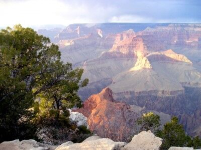
turnout view at Grand Canyon National Park

Here’s how we do it. We take advantage of the four day weekend and make it a five day weekend, taking the boys out of school on Wednesday and driving through some of the most spectacular scenery in the Southwest. We leave early in the morning, so that we have time to stop and take in the beauty of southwest.

Along the way we have made detours to Newspaper Rock where we try to decipher centuries of petroglyphs. We’ve stopped along the San Juan River in the beautiful village of Bluff, Utah for lunch and more Native American art. We’ve driven out of our way to stand high above the Goosenecks of the San Juan near Mexican Hat. We’ve spent a couple of hours at Monument Valley, drinking in its grandeur and learning about the Navajo code talkers in the museum. We’ve pulled off the road between Kayenta and Tuba City, not for something to see, but just because it was a beautiful day and we thought it would be fun to toss a football.

And then once we enter the park at Desert View, we stop at every turnout until we reach Grand Canyon Village on the South Rim. Because no matter how many times you have seen the Grand Canyon, each time is like the first time, even if you just saw it 10 minutes ago. The Canyon is an awe-inspiring sight.
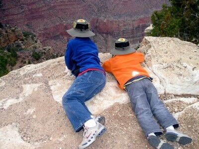
peering over the edge of the Grand Canyon

So once we are there, what do we do? We hike, we play cards, we browse the National Park Service bookshops, we eat (of course!) and we hike some more. The first year, just our family of four made the trip. We had such an amazing time that two years later, we invited my parents. We awoke on Thanksgiving Day to fresh snow. It was magical and muddy, but we still went hiking.
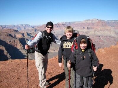
Grand Canyon Thanksgiving family hike

In 2009, we stayed home for Thanksgiving, but the following weekend we were at the Canyon hiking down to Phantom Ranch were we spent two night before trekking back out. Last year, my parents and my husband’s mom joined us on the South Rim.
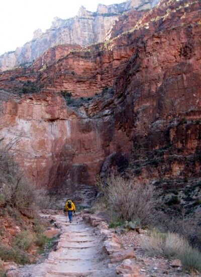
Grand Canyon hiking to Phantom Ranch

Thanksgiving is a day for traditions. This happens to be ours. It’s a tradition I hope we will continue even as our sons grow into adulthood and have their own families. We are thankful that we have found something so meaningful to us.

More on Thanksgiving and Winter at the Grand Canyon
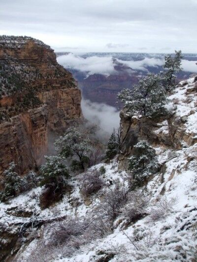
snow at the Grand Canyon in winter

Although the Winter season crowds are much smaller, it’s still important to reserve your room or camping spot at the Grand Canyon as early as you can. Reservations are taken at Xanterra up to one year in advance.

While meals at the historic El Tovar Lodge usually require reservations months in advance, no reservations are accepted for their delicious Thanksgiving Feast. Instead, you give them your name and the number in your party and they will tell you how long the wait will be.

Enjoy!
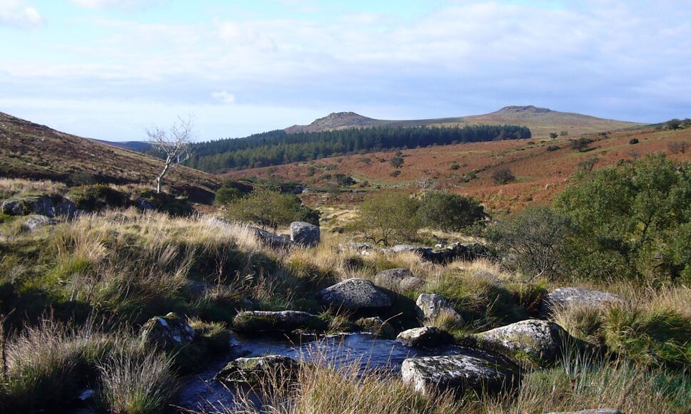
Invasive Species Apostle Islands National Lakeshore

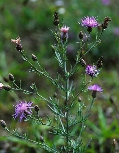
One of the constant battles for national parks is battling invasive species. One of the biggest concerns at Apostle Islands National Lakeshore is spotted knapweed.

invasive national Park plant species spotted knapweed

Apostle Islands National Lakeshore is a collection of isolated islands in Lake Superior. Its natural beauty brings thousands of people to kayak, bird watch, sight see, camp, fish, and hike. With these recreationist also comes the potential to introduce non native plants and animals to new places. One plant of major concern is spotted knapweed. It’s a beautiful purple flower, but prevents other plants from growing nearby. It’s moved accidentally from one island to another by seeds stuck to people and their gear. The National Park Service works hard to control its spread, but needs your help. Keep your gear clean, especially when moving from one trail to another or from island to island.

This is not an isolated issue — spotted knapweed has been reported at 89 National Parks across the US, Here are a few things that you can do to help prevent the spread of invasive plant species:

1. Clean your gear
2. Check tents, packs, pets, and vehicles for plant seeds and soil
3. Remove soil and plant material from equipment
4. Remove seeds from laces and brush soil & seeds off shoes
5. Use Boot Brush Stations

The Goblin of Goblin Valley Utah State Park

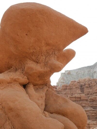
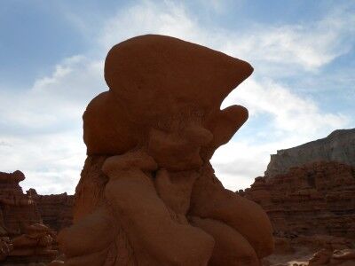
One of the first things you will discover when you begin to wander around Goblin Valley at Goblin Valley state park is that the goblins form a wide variety of shapes. Among the hundreds of goblins in the valley, I saw camels, skulls, monkeys, and snakes to name just a few. As I rounded one corner, I found myself face to face with what could only be the Goblin of Goblin Valley:

Goblin Rock at Goblin Valley State Park in Utah

the goblin of goblin valley state park in Utah

While there are a number of different formations that look like goblin rocks, this is the one that instantly proclaimed Goblin Rock to me. What do you think?

Tour of the Moon Classic Cycling At Colorado National Monument

By Kristen Lummis (enjoy her blog Brave Ski Mom, like her on facebook or follow her on twitter @BraveSkiMom)

Colorado is full of classic bicycle routes, many of which can leave you breathless at a high altitude.

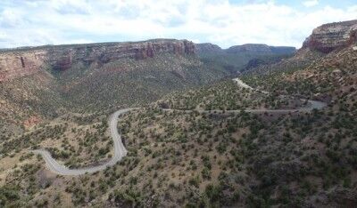
The Colorado National Monument ride is different. Located in western Colorado, just shy of the Utah border, Colorado National Monument offers cyclists never-ending vistas of stunning red rock canyons, pinyon-juniper forests, three seasons of wildflowers and a musical accompaniment of canyon wrens on almost any given day.

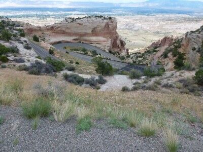
winding road through colorado national monument

The ride isn’t easy. No matter which way one rides the Monument (as the locals call it), it involves a significant climb. But with a top altitude of only 6,640 feet, a total vertical gain of 2300 feet, and a round-trip distance of 33 miles, this ride won’t leave you gasping for air.

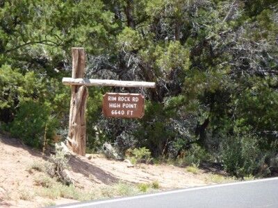
rim rock road high point colorado national monument

The Tour of the Moon

For eight exciting years, between 1980 and 1988, the Monument was the location of the “Tour of The Moon,” a popular stage of the Coors International Bicycle Classic. During its heyday, the Coors Classic was the largest men’s and women’s pro-am race in the world, attracting the top teams and top cyclists.

In 1981 and 1985, cycling legend Greg LeMond won the Coors Classic. Other famous participants included speed-skating legends Eric and Beth Heiden, with Beth winning the women’s division in 1980. The 1984 film American Flyers, starring Kevin Costner was inspired by the Tour of the Moon and filmed on site in Mesa County.

Since the late 1980s, cycling on the Colorado National Monument has been limited to amateurs, enthusiasts and just plain crazy people. We fit into all three of these categories. We are certainly amateurs. We are most definitely enthusiasts, and my husband is sometimes considered crazy. How to else to explain why he would choose to ride up and down the Monument three times on one firecracker hot 4th of July? He didn’t ride the entire 33 mile circuit each time. But he did ride the difficult climbing section three separate times — in a row.

the steep curves of Colorado National Monument road

The USA Pro Cycling Challenge

In late August 2011, professional cycling returned to Colorado with the USA Pro Cycling Challenge. The Monument wasn’t one of this year’s stages. However, with a landscape like no other in pro cycling, USA Pro Cycling Challenge organizers are hoping to resurrect the Tour of the Moon for the 2012 race. The National Park Service may have other ideas. Citing concerns for protection of the park’s natural resources, an application by the Local Organizing Committee has so far been denied.

Local organizers have a number of alternate routes in mind for 2012. But it won’t be the same. Until the Park Service changes its mind, cycling on the Colorado National Monument will be limited to amateurs. This means that while most of us can’t ride with the pros, we can ride somewhere they can’t. And if you haven’t ridden over the Colorado National Monument, you should. It truly is a classic ride.

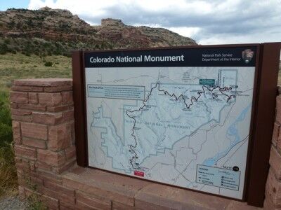
Park map of Colorado National Monument

When You Go

Colorado National Monument is located approximately 250 miles west of Denver, between the towns of Grand Junction and Fruita. The East entrance to the park is located approximately 5 miles from downtown Grand Junction on Monument Road.

Just past the East Entrance station is parking at the Devil’s Kitchen trailhead (on the left) or the Devil’s Kitchen picnic area (on the right, complete with bathrooms). Both areas have parking and are good places to begin your ride. Please note that all cyclists must have a steady white light on the front of their bikes and a flashing red light on the back. Cyclists are also required to ride single file (for more information on park requirements, click here).

From Devil’s Kitchen, the road switchbacks up about four miles, through a dark tunnel before plateauing at the Cold Shivers viewpoint. Traffic can be heavy along this portion of the road, but just about 1/2 mile past Cold Shivers is a turn off to Glade Park, a ranching community. After this point, cyclists pretty much have the park to themselves.

From here, it is another 5-6 miles of rolling uphill terrain to the high point of the Colorado National Monument. After the high point, the descent begins, with only one more significant uphill climb, at Black Ridge.

The Visitors Center (at mile 19) is worth a stop to refill water bottles and check out the new interpretive displays. Leaving the Visitors’ Center, the road descends rapidly through two shorter tunnels to the West Entrance of the park.

Leaving the park, cyclists ride east along Broadway, turning right onto South Broadway for about 4 miles. Another right turn onto South Camp takes riders back to Monument Road and back to their cars.

Back at your car, you’ve completed one circuit of the Tour of the Moon. That’s what the pro women rode back in the ’80s. The pro men did two back-to-back circuits.

Enjoy!

Park Avenue Viewpoint Arches National Park

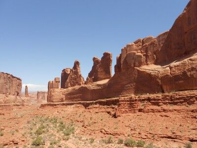
The first major stopping area once you have entered Arches National Park is at Park Avenue. There is a short walk to the Park Avenue viewpoint (accessible to all) which gives a spectacular view that you don’t want to miss. While other areas of Arches National Park are more famous, I found this to be one of my favorite spots. The view gives you a wide enough perspective to take in a number of large formations, but the valley limits what you can see so it’s not overwhelming. I also found that because there are no major arches along Park Avenue, it’s less crowded than other areas of the park:

Park Avenue at Arches National Park, Utah

view from Park Avenue Viewpoint down canyon at Arches

The information sign at park Avenue viewpoint gives the following information:

The sheer walls of this narrow canyon reminded early visitors of buildings lining a big city street. Rising majestically, these geological “skyscrapers” tell the story of three important rock layers.

These layers began forming more than 150 million years ago as tidal flats, desert, and beach deposits. Over time, more layers of rock, perhaps a mile thick, covered these deposits. Tremendous pressure from this rock compressed the buried sand into sandstone and cracked it. As erosion removed the overlying rock, the layers now exposed began to weather.

Within the past two million years, erosion of the cracks in the Entrada has left vertical slabs like the rock wall to your right. These slabs, called fins, are the first step in arch formation.

Here is a beautiful night sky timelapse video taken at Park Avenue viewpoint:

Rock Climbing Sentinel With No Ropes Video Yosemite National Park

I just can’t imagine how anyone could do this without totally freaking out. 60 Minutes cameras were rolling when Alex Honnold free-solo climbed Sentinel (a 1,600-foot rock wall at Yosemite National Park) using nothing more than his hands and feet. That’s right — he is up there on that rock face without any ropes to complete a feat never done before. Just watching makes me dizzy:

Barker Dam Loop Joshua Tree National Park

The Barker Dam loop trail in Joshua Tree National Park is often suggested for those with children since it is an easy 1.5 mile loop. The trailhead is east to find since it is right at the Barker Dam parking lot. You can also take the spur path off the main loop to see pictographs and petroglyphs and there are plenty of boulders for kids to climb to expel any excess energy they may have.

pictographs on Barker Dam trail at Joshua Tree National Park

While it is also possible to walk across Barker Dam, this activity is better suited for those that are older and have no fear of thin walking uneven paths with a drop off on either side as this video shows:

Photo courtesy of Omar Omar