Pumice Castle Crater Lake National Park

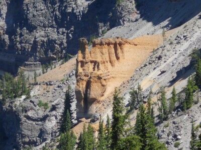
Pumice Castle is one of the most colorful (a golden orange-brown in a sea of grays) features at Crater Lake National Park, but it’s often missed because it’s located at an unmarked turnoff along East Rim Drive (the pullout is 1.1 miles west of Cloudcap Overlook road junction and 2.4 miles east of Phantom Ship Overlook). It’s well worth paying attention and not passing this unique feature within the Crater Lake caldera. The orange-brown pumice rock has emerged in the shape of a castle as the rock around it has eroded away:
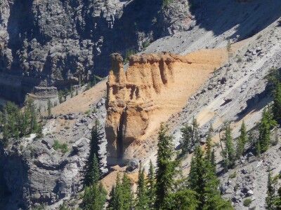
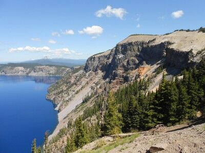
Pumice Castle at Crater Lake

Pumice Castle at Crater Lake National Park

This is what the information sign at the turnout has to say about Pumice Castle:

Mount Mazama, the great volcano that preceded Crater Lake, was built up by successive eruptions of lava over many thousands of years. Some lavas oozed or poured from the volcano’s top or sides. Some erupted as red-hot rocks that flooded down the slopes. Others exploded into the air and fell as cinders or globs.

You can see the variety of Mt. Mazama’s lavas on the steep caldera wall. Pumice Castle, with its pinkish-brown “turrets,” is the most eye-catching feature. It’s made of layers of pumice and other rocks coughed up by Mt. Mazama – some so hot they welded welded together. These air fall deposits were buried and compacted by other lavas, then exposed when Mt. Mazama collapsed. A firm foundation of andesite lava has kept Pumice Castle intact, while surrounding pumice deposits have eroded away.

Mt. Mazama is classified as a composite volcano, a cone built up by lava flows interspersed with air fall deposits. Pumice Castle is made of air fall pumice that was laid down while Mt. Mazama was still growing.
Discovery Point Crater Lake National Park

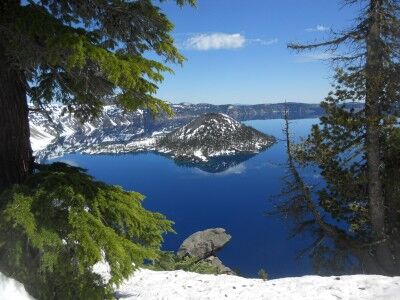
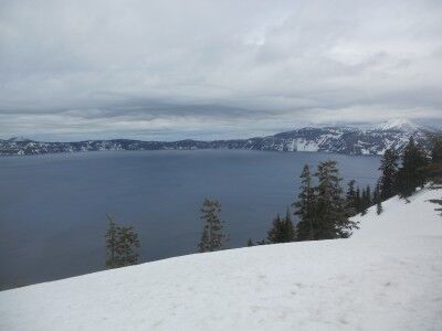
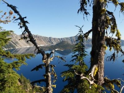
I made a couple of previous trips to Crater Lake National Park this year, but due to the heavy snow, could only see park of the park. On the second trip, Rim Drive was open to Discovery Point and I was able to get some photos and a video, but there was still a lot of snow on the ground. This time around, the entire Rim Drive was open and just a very small amount of snow remained in isolated places. I went back to the same spot (which was a lot easier to get to when you didn’t have to hike up a snow covered hill) and took the following photos:

Discovery Point at Crater Lake National Park

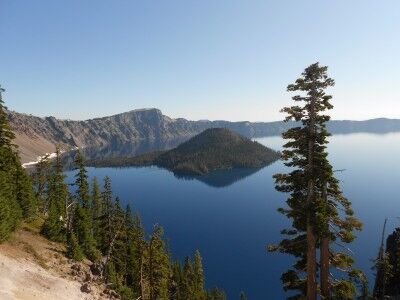
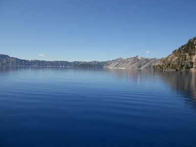
view of Crater Lake at Discovery Point

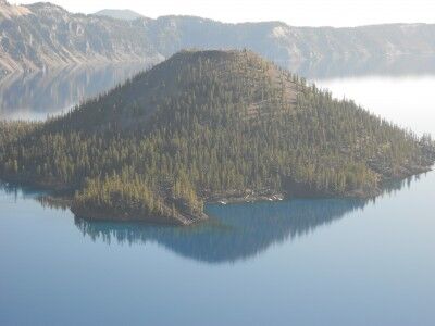
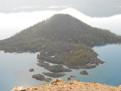
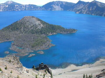
view of Wizard Island at Discovery Point

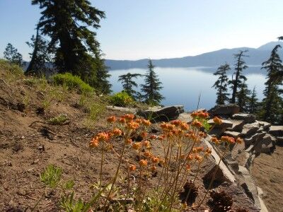
Discovery Point wildflowers at Crater Lake National Park

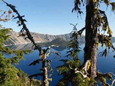
While it really is impossible to stop anywhere along Rim Drive and not get a spectacular view of Crater Lake, Discovery Point is definitely one worth stopping for. There’s a small hill to the left of the parking area with a dirt path up to a higher vantage point — it’s worth doing this short hike if you are physically able to as it gives you views of crater lake among the trees.

This is what the information sign at Discovery Point has to say:

Near this point a plodding mule stopped abruptly a few feet short of the crater rim. Its astonished rider suddenly found himself on the brink of a natural wonder few had ever seen, John Wesley Hillman had stumbled upon Crater Lake.

The day was June 12, 1853. Hillman had joined a party of goldseekers on a search for the fabled Lost Cabin Mine. They found no gold, but they knew they had discovered a scenic treasure. The prospectors erected a crude sign bearing their signatures and named the the majestic waters “Deep Blue Lake.”

In the years that followed, the lake was rediscovered and renamed several times. An 1869 exploring party gave the lake its present name and in 1902, Crater Lake became the nation’s sixth national park.

Crater Lake National Park Photos

One of the reasons I love visiting National Parks is that they’re so beautiful that even if you aren’t a professional photographer, you can still come away with some amazing photos. A perfect example of this is Crater Lake National Park. I took a trip to Crater Lake in mid August and these are just a few of the photos I came with from that trip:

Wizard Island from Discovery Point

Wizard Island from Discovery Point at Crater Lake National Park

Wizard Island from Watchman’s Peak

Wizard Island from Watchman's Tower at Crater Lake National Park

Crater Lake at lake level

Crater Lake at lake level from Cleetwood Cove Trail Crater Lake National Park

Pumice Castle

Pumice Castle at Crater Lake

Plaikni Falls

Plaikni Waterfall on Sand Creek Crater Lake National Park

The Pinnacles

The Pinnacles Crater Lake National Park

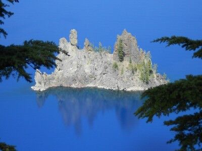
Phantom Ship from Sun Notch Trail

Phantom Ship at Crater Lake National Park

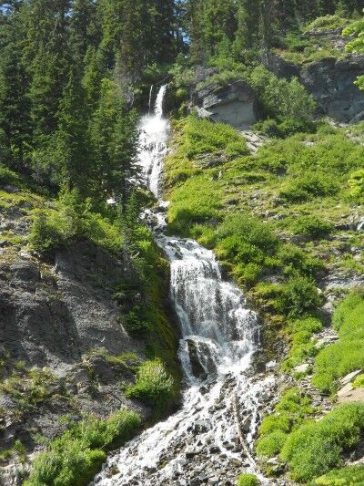
Vidae Falls

Vidae Falls at Crater Lake National Park

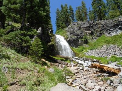
Plaikni Falls Crater Lake National Park

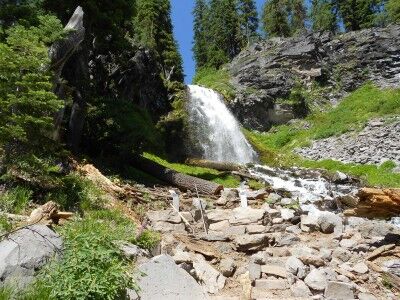
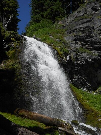
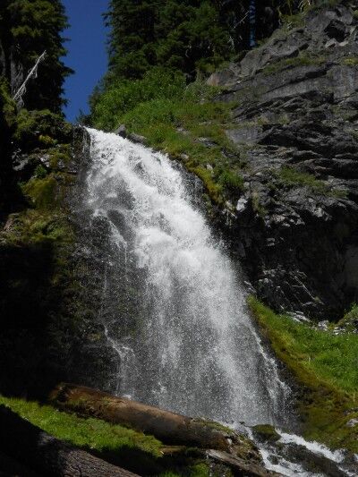
After hiking 1.1 miles along the Plaikni Falls trail, you’re rewarded with a beautiful view of Plaikni Falls. The name “Plaikni Falls” which means “from the high country” comes from the Klamath Indian Tribes whose traditional homeland includes Crater Lake National Park and who still have strong cultural ties to this area to this day.

Plaikni Falls at Crater Lake National Park

close-up of  Plaikni Falls at Crater Lake

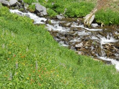
Plaikni Falls is not fed by Crater Lake. The source water for Sand Creek is snow melt which begins at Anderson Spring just above Anderson Bluffs (7000 feet above sea level — 2134 meters) Sand Creek flows approximately a quarter of a mile before hitting a glacier carved cliff which it cascades over to create Plaikni Falls. At the base of Plaikni Falls, Sand Creek continues to cascade over rocky terrain to the south through Kerr Valley, then toward the west through The Pinnacles until it eventually flows out of Crater Lake National Park.

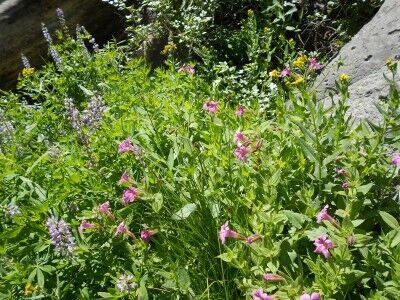
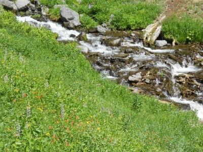
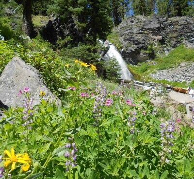
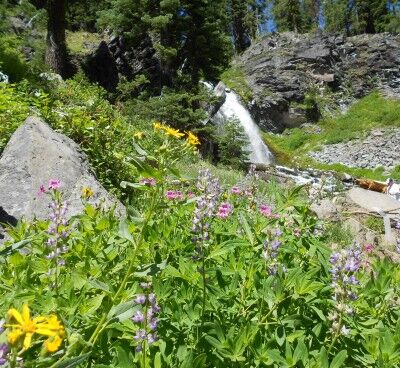
The base of Plaikni Falls is quite lush and filled with wildflowers:

wildflowers at Plaikni Falls in Crater Lake National Park

wildflowers along Sand Creek below Plaikni Falls

wildflowers with Plaikni Falls in the distance

It’s wonderful that there is now easy access to this previously “secret” waterfall at Crater Lake and the beautiful scenery around Plaikni Falls makes the hike out there well worth the time and effort. Here is a short video I took at the end of Plaikni Falls trail at the base of the falls:

10 Oldest National Parks

I received an email asking me “what are the 10 oldest national parks?” The first National Park was Yellowstone created in 1872. Number two was Sequoia National Park in 1890 along with Yosemite National Park the same year. While Kings Canyon National Park was established in 1940, it’s included with Sequoia National Park (they are connected) because Kings Canyon National Park incorporated General Grant National Park when it was created. General Grant National Park was established in 1890 to protect the General Grant Grove of giant sequoias, the same year as Sequoia National Park.


Yosemite National Park established in 1890

Here is a list of the 10 oldest National Parks in the National Park system:

1. Yellowstone National Park (1872)
2. Sequoia and Kings Canyon National Park (Sequoia 1890)
2. Yosemite National Park (1890)
4. Mount Rainier National Park (1899)
5. Crater Lake National Park (1902)
6. Wind Cave National Park (1903)
7. Mesa Verde National Park (1906)
8. Glacier National Park (1910)
9. Rocky Mountain National Park (1915)
10. Haleakala National Park (1916)
10. Hawaii Volcanoes National Park (1916)
10. Lassen Volcanic National Park (1916)

Pinnacles Overlook Crater Lake National Park

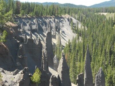
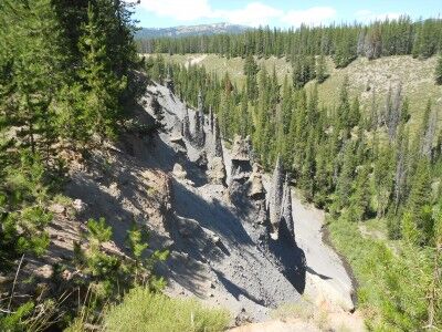
Crater Lake National Park is much more than just Crater Lake. For those that want to see more than Crater Lake when visiting Crater Lake National Park, it’s definitely worthwhile driving Pinnacles Road (off of East Rim Drive) to take the new Plaikni Falls Trail to Plaikni Falls. Once done, definitely keep going down Pinnacles Road (about another 6 miles) until you reach Pinnacles Overlook:

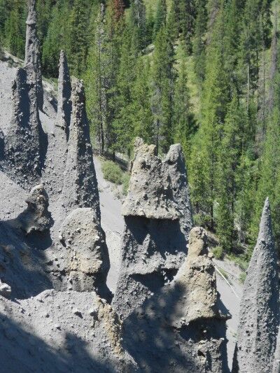
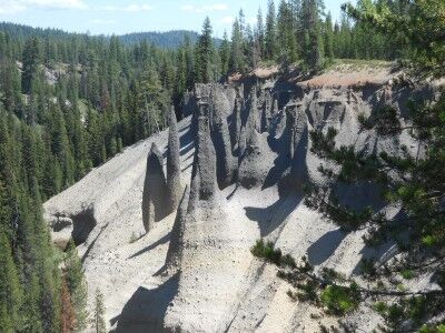
The Pinnacles are a collection of 100-foot-tall (30-meter) spires which have been created as the canyon walls around them have eroded away. The spires are “fossil fumaroles,” each marking a spot where volcanic gas rose up through hot ash deposits, cementing the ash into solid rock.

Pinnacles Overlook at Crater Lake National Park

close-up of Pinnacles at Crater Lake National Park

view from Pinnacles Overlook at Crater Lake National Park

The history of the “pinnacles” began about 7,700 years ago when the eruptions of Mt. Mazama were reaching their climax. Torrents of red-hot, gas-charged pumice poured down Mazama’s slopes at speeds of up to 100 mph (160 kph). On top of this came a flow of heavier rocks called scoria. These glowing avalanches flooded downslope for many miles, leaving deep deposits in their wake.

Temperatures in the deposits may have exceeded 750 degrees Fahrenheit (400 degrees Celsius). Plumes of vapors appeared, as gasses escaped from the settling rocks through vents called fumaroles. Minerals in the gasses combined with extreme heat, welded the sides of the fumaroles in the shape of slender cones. Since then, streams have eroded the canyon through the deposits, exposing the cones. Many of these fossil fumaroles are hollow.

The above photos were taken from the Pinnacles Overlook which doesn’t require any hiking at all (it’s a few feet away from the parking area). For those who want to see the Pinnacles from a variety of different angles, there is a short Pinnacles Trail hike that’s worth taking.

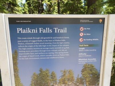
Plaikni Falls Trail Crater Lake National Park

Crater Lake National Park has a new hiking trail that will officially be opening this Saturday (8/20/2011), but I had the fortunate chance to hike it today. It’s called Plaikni Falls Trail and it’s a wonderful change of beauty from what most people only see when they visit Crater Lake National Park — the lake. The Plaikni Falls Trail leads to a gorgeous “secret” waterfall and cascading river which, until recently, few people knew how to get to.

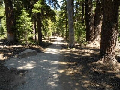
The trailhead is along Pinnacle Road, 1.2 miles southeast of the Phantom Ship overlook off of East Rim Drive. The trail begins with old growth fir and hemlock forest all around which provide a nice bit of shade:

Plaikni Falls Trail at Crater Lake National Park

Plaikni Falls trail is a pleasant hike and relatively easy at 1.1 miles to the waterfall (2.2 miles round trip). The only real issue for most is that because it’s so short, it’s difficult to get away from other people if you’re looking for a bit of solitude — it can get congested. The trail travels through the trees and along rocky bluffs until it hits Sand Creek where it opens up to wildflowers and lush vegetation at the base of Plaikni Falls:

wildflowers at Plaikni Falls at Crater Lake National Park

While Plaikni Falls isn’t grand in size, it’s quite beautiful as it comes down with abundant wildflowers (with butterflies fluttering all around while I was there — also mosquitoes, so you may want to spay on some bug spray before beginning the hike) and other vegetation to compliment the overall scene:

Plaikni Falls with wildflowers at Crater Lake National Park

Plaikni Waterfall at Crater Lake National Park

I would highly recommend this hike for those looking to see a different type of beauty other than the lake when visiting Crater Lake, especially for people like me who have a thing for waterfalls.

Note: This may not be an issue once the trail has officially opened, but it would have been today. While the trail is supposed to be a hard packed surface suitable for wheelchairs and strollers, not enough people had traveled the trail to make the hard-pack hard. A wheelchair or stroller would have definitely had some trouble getting to the falls when I went. This issue may very well be resolved by Saturday for the official opening. There were still volunteers hard at work finishing up the last touches on the trail, so they are aware that there is still work to be done.

sign at the trailhead of Plaikni Falls trail

Summer at Crater Lake National Park

I made my first visit to Crater Lake National Park (OR) earlier this year and was greeted with a lot of snow. I thought that another trip on the first day of summer would be a fun idea and quickly discovered that there is still a lot of snow up there with virtually all hiking paths still closed due to snow. Still, that didn’t stop me from taking some beautiful photos:

Crater Lake National Park on the first day of summer (June 21) in 2011

More Photos of Crater Lake

I also shot a short video of Crater Lake from the viewing area just below the visitors center:

While camping is possible and some camp grounds have been cleared of snow, they are still surrounded by as much as 10 feet of snow making for some cold weather camping. For those looking to visit Crater Lake and want to do a bit of hiking and camping, I would wait until well into July for the snow to melt off. I certainly will be back with the hopes of being able to hike some of the trails on my next visit.

Crater Lake In Winter

This was my first visit to Crater Lake National Park and although it was May, there were still piles of snow along the side of the road that stood over 15 feet high. Driving next to these snow banks was enough to make the trip worthwhile and is a great reason to visit Crater Lake in the winter.

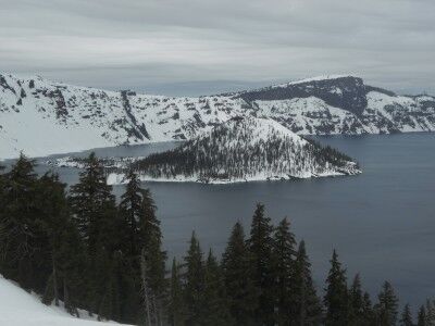
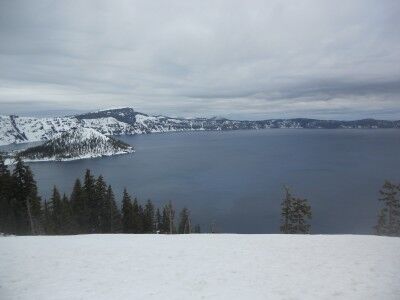
The big drawback to visiting Crater Lake in the winter is that your activities are limited. Crater Lake rim drive is closed. Due to the large amount of snow, hiking is pretty much out of the question (although cross country skiing and snow shoeing would be possible — permits are required for overnight snow camping). That means that there’s really only one spot to view and take photos of the lake:

snow covered Crater Lake Wizard Island in winter

Crater Lake in winter

Crater Lake National Park in winter

As can be seen from the photos, the other big difference is that cloud covered weather doesn’t let the beautiful blue of Crater Lake shine through, and instead leaves it a steel grey. I heard that has a much bluer tint when the sun is shining brightly even in winter, but to really get the color you need to visit in summer (which means I will be back again) when you can take photos like this:

Crater Lake Wizard Island in summer