Tour of the Moon Classic Cycling At Colorado National Monument

By Kristen Lummis (enjoy her blog Brave Ski Mom, like her on facebook or follow her on twitter @BraveSkiMom)

Colorado is full of classic bicycle routes, many of which can leave you breathless at a high altitude.

The Colorado National Monument ride is different. Located in western Colorado, just shy of the Utah border, Colorado National Monument offers cyclists never-ending vistas of stunning red rock canyons, pinyon-juniper forests, three seasons of wildflowers and a musical accompaniment of canyon wrens on almost any given day.
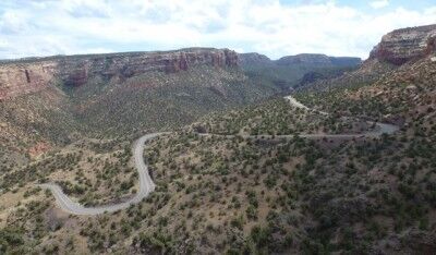
winding road through colorado national monument

The ride isn’t easy. No matter which way one rides the Monument (as the locals call it), it involves a significant climb. But with a top altitude of only 6,640 feet, a total vertical gain of 2300 feet, and a round-trip distance of 33 miles, this ride won’t leave you gasping for air.
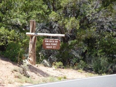
rim rock road high point colorado national monument

The Tour of the Moon

For eight exciting years, between 1980 and 1988, the Monument was the location of the “Tour of The Moon,” a popular stage of the Coors International Bicycle Classic. During its heyday, the Coors Classic was the largest men’s and women’s pro-am race in the world, attracting the top teams and top cyclists.

In 1981 and 1985, cycling legend Greg LeMond won the Coors Classic. Other famous participants included speed-skating legends Eric and Beth Heiden, with Beth winning the women’s division in 1980. The 1984 film American Flyers, starring Kevin Costner was inspired by the Tour of the Moon and filmed on site in Mesa County.

Since the late 1980s, cycling on the Colorado National Monument has been limited to amateurs, enthusiasts and just plain crazy people. We fit into all three of these categories. We are certainly amateurs. We are most definitely enthusiasts, and my husband is sometimes considered crazy. How to else to explain why he would choose to ride up and down the Monument three times on one firecracker hot 4th of July? He didn’t ride the entire 33 mile circuit each time. But he did ride the difficult climbing section three separate times — in a row.
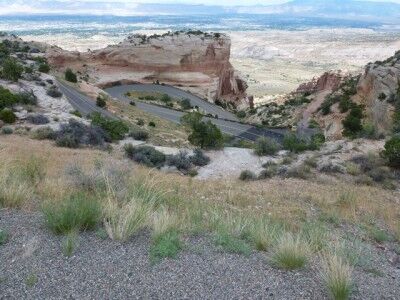
the steep curves of Colorado National Monument road

The USA Pro Cycling Challenge

In late August 2011, professional cycling returned to Colorado with the USA Pro Cycling Challenge. The Monument wasn’t one of this year’s stages. However, with a landscape like no other in pro cycling, USA Pro Cycling Challenge organizers are hoping to resurrect the Tour of the Moon for the 2012 race. The National Park Service may have other ideas. Citing concerns for protection of the park’s natural resources, an application by the Local Organizing Committee has so far been denied.

Local organizers have a number of alternate routes in mind for 2012. But it won’t be the same. Until the Park Service changes its mind, cycling on the Colorado National Monument will be limited to amateurs. This means that while most of us can’t ride with the pros, we can ride somewhere they can’t. And if you haven’t ridden over the Colorado National Monument, you should. It truly is a classic ride.

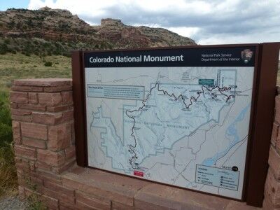
Park map of Colorado National Monument

When You Go

Colorado National Monument is located approximately 250 miles west of Denver, between the towns of Grand Junction and Fruita. The East entrance to the park is located approximately 5 miles from downtown Grand Junction on Monument Road.

Just past the East Entrance station is parking at the Devil’s Kitchen trailhead (on the left) or the Devil’s Kitchen picnic area (on the right, complete with bathrooms). Both areas have parking and are good places to begin your ride. Please note that all cyclists must have a steady white light on the front of their bikes and a flashing red light on the back. Cyclists are also required to ride single file (for more information on park requirements, click here).

From Devil’s Kitchen, the road switchbacks up about four miles, through a dark tunnel before plateauing at the Cold Shivers viewpoint. Traffic can be heavy along this portion of the road, but just about 1/2 mile past Cold Shivers is a turn off to Glade Park, a ranching community. After this point, cyclists pretty much have the park to themselves.

From here, it is another 5-6 miles of rolling uphill terrain to the high point of the Colorado National Monument. After the high point, the descent begins, with only one more significant uphill climb, at Black Ridge.

The Visitors Center (at mile 19) is worth a stop to refill water bottles and check out the new interpretive displays. Leaving the Visitors’ Center, the road descends rapidly through two shorter tunnels to the West Entrance of the park.

Leaving the park, cyclists ride east along Broadway, turning right onto South Broadway for about 4 miles. Another right turn onto South Camp takes riders back to Monument Road and back to their cars.

Back at your car, you’ve completed one circuit of the Tour of the Moon. That’s what the pro women rode back in the ’80s. The pro men did two back-to-back circuits.

Enjoy!
Devil’s Kitchen Trail Colorado National Monument

By Kristen Lummis (enjoy her blog Brave Ski Mom, like her on facebook or follow her on twitter @BraveSkiMom)

My city-girl niece visited us this summer. She lives in the Denver area and we live on Colorado’s Western Slope. She is 8 years old, full of energy and loves to be outdoors. I am much older, but still full of energy. And, I too, love to be outdoors. We are a good match.

So on a cool Saturday, despite the threat of rain, my mom and I took her hiking at Colorado National Monument. Here is our report from the Devil’s Kitchen Trail.

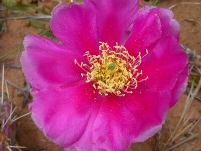
Lots of Prickly Pear Blossoms: I am mom to two boys. Thus, I am used to spotting lizards, oohing and ahhing over rocks, and identifying unique shapes and uses for twigs and sticks. My niece pointed out the brilliant cactus blossoms and spotted lizards. Rocks and sticks, not so much.

Prickly Pear Blossom at Colorado national Monument

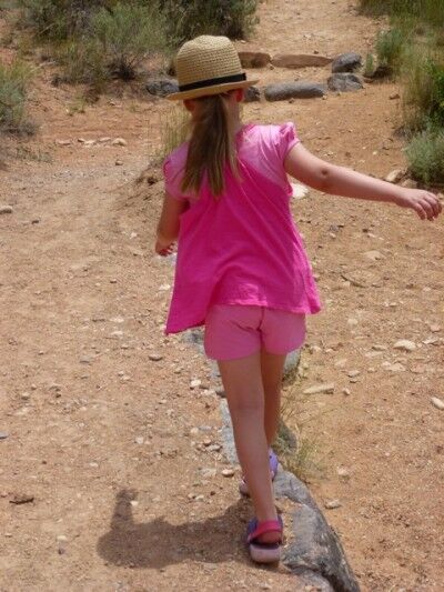
Plenty of Room to Run: And run she did. She ran, she climbed, she skipped and she balanced. An open trail, a beautiful day and nothing to do but enjoy being amidst the splendor of nature.

balancing on devil'skitchen trail at Colorado national monument

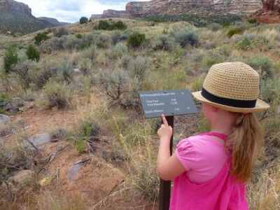
Time to Practice Trail Boss Skills: My niece is the youngest in her family. We let her choose the trail, set the pace, lead the way, and read the signs. We helped her find the cairns marking the trail and she became our official cairn-spotter. She was an excellent trail boss.

trail boss on Devil's Kitchen trail

While hiking with her, I was reminded of an article I recently read entitled Leave No Child Inside. Concerned about the trend of more and more kids spending their days indoors looking at TV and computer screens, a group of outdoor agencies and advocates in Chicago are urging families to turn off the technology and get outside. As one of the organizers put, “(Children) are excited to be outdoors.”

That is so true. No matter where you live, kids are excited to be outdoors. Some time in the sunshine, lying in the grass, hiking on a trail or chasing butterflies is exactly what our kids need.

No matter where you live, you can find the great outdoors. It’s just a matter of opening the door and walking outside: to an urban park, to a meadow, to a national monument, to wherever you can find nature.

When You Go: 2011 is a great year to get out and visit Colorado National Monument. Located near Grand Junction, approximately 250 miles west of Denver on I-70, the Monument is celebrating its 100th Anniversary as a unit of the National Park System with fireworks, special events and new displays in the Visitors’ Center.

Hiking: Comprised of 32 square miles of stunning red rock canyons and monoliths between Grand Junction and Fruita, Colorado National Monument has miles and miles of established and back country trails.

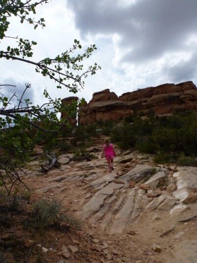
My niece, my mom and I chose the Devil’s Kitchen trail for our adventure. 1 and 1/2 miles long, the trail begins on sandy, clearly marked trail and after about 1/2-mile transitions to sandstone and slickrock.

devil's kitchen trail Colorado national monument

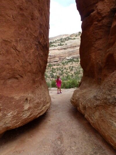
Climbing and switch-backing across slickrock, the trail offers enough adventure to keep kids engaged and ends in the Devil’s Kitchen, a sandstone “room” hundreds of feet above the valley. With rocks to climb on and ledges to peer over, kids can keep themselves busy in the Kitchen for hours.

hiking devil's kitchen Colorado national monument

Camping: Camping is available at the Saddlehorn Campground, along the upper rim of the canyons in the pinyon and juniper forest. There are no hookups for RVs, but there are flush toilets and running water, which in my mind, changes the experience from camping to glamping. Sites are available on a first-come, first-served basis.

Finally, if you’ve ever wondered why some National Park sites are called Parks and some are called Monuments, here’s your answer: Parks require the approval of Congress. Monuments do not.

In 1911, with feelings in Congress running against conservation, Colorado officials didn’t think they had the votes necessary to create a national park. In May of that year, President Taft preserved this glorious slice of canyon country with the stroke of his pen.

Enjoy!

Red Canyon Overlook Colorado National Monument

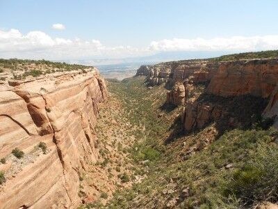
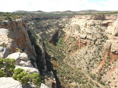
Next to Columbus Canyon (which can be seen from Cold Shivers Point) at Colorado National Monument is Red Canyon. You can get a wonderful view of Red Canyon from Red Canyon Overlook:

Red Canyon at Colorado National Monument

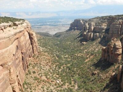
view of the double canyon at Red Canyon in Colorado National Monument

Red Canyon is also interesting because it is actually a canyon within a canyon. It’s described as such at the information sign overlooking the canyon:

Canyon in a Canyon

Red Canyon is really two canyons. Most obvious is the broad U-shaped canyon with the tall sandstone walls. But notice the smaller V-shaped cut in the middle of the canyon floor. Water has begun to carve into the hard metamorphic bedrock, but this old, pressure-treated and tempered rock wears away much more slowly than the fragile sedimentary canyon walls. By the time the small canyon reaches the depth of the large one, all of the sedimentary layers above it will probably be gone.

Cold Shivers Point Colorado National Monument

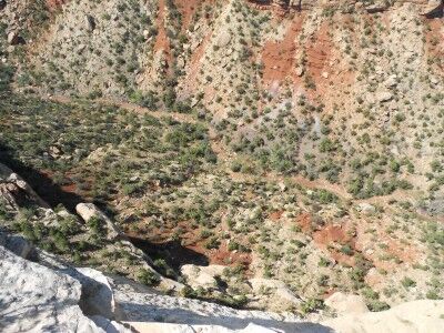
Some things are so tantalizingly named that I have no doubt that I am going to have to stop and take a look at them no matter what. That was certainly the case when I saw the name Cold Shivers Point on my map. While I’m not sure how Cold Shivers Point got its name, my guess is that it came from the chill that you get while peering over the edge of Columbus Canyon which drops 2,000 feet. It’s certainly a grand preview of what’s to come when visiting Colorado National Monument:

looking over the edge at Cold Shivers Point at Colorado National Monument

view from Cold Shivers Point in Colorado National Monument

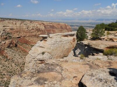
view toward Grand Junction from Cold Shivers Point at Colorado National Monument

Cold Shivers Point is a wheel chair accessible overlook along Rim Rock Drive. If you enter Colorado National Monument from the East (Grand Junction) entrance, it will be the first of many overlooks that you will be able to see. It’s certainly worth the few minutes it takes to stop and walk out to the canyon’s edge.