Point Reyes Lighthouse Parking Lot View

Even before you consider going to Point Reyes lighthouse at Point Reyes National Seashore, be sure to pack your best windbreaker and an extra layer of clothes. The Point Reyes lighthouse is the windiest and foggiest point on the Pacific coast and even on a sunny day, the wind can send chills through your body (and may provide the opportunity to see double waves). I arrived on a beautiful sunny day, but with wind gusts up to 40 miles an hour which would have left me shivering without my windbreaker.

After you park in the Point Reyes Lighthouse parking lot, you will see a gated road which you will follow to get to the Point Reyes lighthouse. To the right of the gate is a dramatic view point which looks out over rows of waves crashing onto Point Reyes Beach that makes for a wonderful photograph:
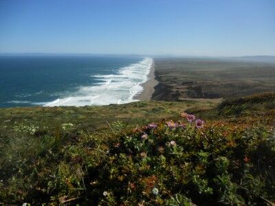
View from the Point Reyes lighthouse parking lot over the ocean

Marble Ridge Crystal Cave Sequoia National Park

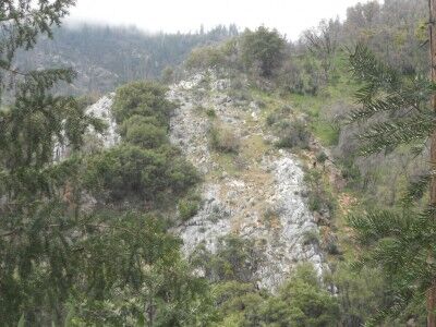
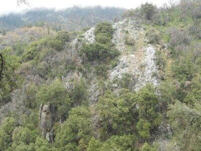
Even before you get to the entrance of Crystal Cave at Sequoia National Park (CA), there are sights to see. In order to reach the Crystal cave entrance, there is a half mile walk down a paved path that descends the equivalent of a 30 story building (which also means you need to walk up it once the cave tour is over). Half way down you come to a sign that talks about Marble Ridge which can bee seen across the valley from where you stand. The sign states:

Marble Ridge: Beyond is the ridge of marble which Crystal Cave is formed. Behind you is an extension of the same outcrop. Steeply tilted beds of marble, schist, quartzite, and other metamorphic rocks trend northwestward across the upper foothills of the park. They are the remnants of the ancestral Sierra Nevada which was eroded to a low land long before the uplift of the present range. These rocks and the granite that was intruded into them may be observed along the trail.

Marble Ridge near Crystal Cave

Marble Ridge near Crystal Cave in Sequoia National Park

Rings Trail Hole In The Wall Mojave National Preserve

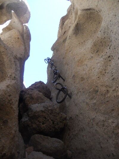
The Rings Trail at Hole in the Wall at Mojave National Preserve. (CA) gets it’s name because the only way to get out of the Hole in the Wall courtyard area is up some steep rock faces. To help make this possible, metal spikes with rings on the end have been hammered into the rocks:

Rings on Ring Trail Hole in the Wall Mojave National Preserve

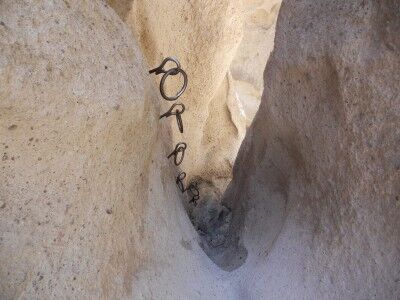
When you first see the rings, you will be tempted to try and place your feet into the ring to help you up. This doesn’t work very well as I can attest from first hand experience. Instead, you will have much more success climbing using the rings for your hands and the straight spike area for your feet. Otherwise you will find that your feet are twisting in all different directions as your try to climb as mine were. The same technique can be used for climbing down the rings:

Climbing rings at Hole in the Wall at Mojave

The rings area isn’t too difficult although it could be a challenge for small children. The gaps are narrow enough that you can also use the rock walls for support as you climb or descend.

Hole In The Wall Courtyard Mojave National Preserve

After passing the Petroglyphs along Rings Trail at Hole in the Wall in Mojave National Preserve (CA), you have another quarter mile before you will see the lava rock walls Hole in the Wall before you:

First look at Hole in the Wall

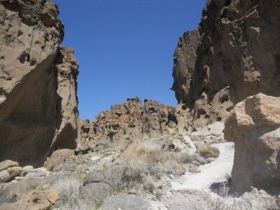
As you get closer to the cliffs, you will enter into a courtyard like area where the walls tower over you on three sides

courtyard like area at Hole in the Wall Mojave National Preserve

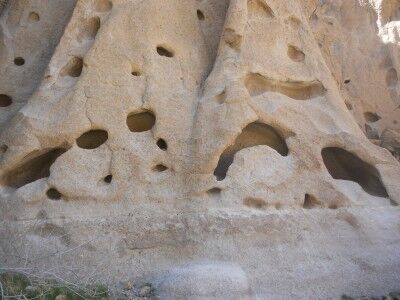
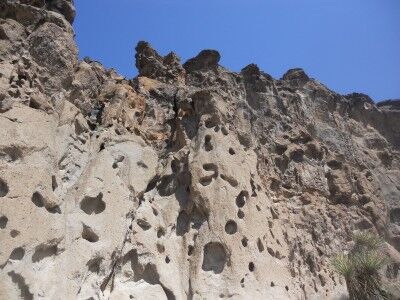
While the hike itself only takes about 45 minutes, you will want to put aside much more time so that you can explore all the interesting holes formed in the rock walls:

Holes at Hole in the Wall Mojave National Preserve

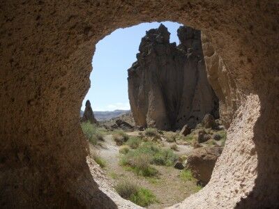
If you are into photography, you’ll want to put aside even more time as the holes can make for some interesting perspectives the more you explore:

Great opportunities for interesting photos at Hole in the Wall

California State Parks Closure List 2011

Due to budget cuts, the California State Parks system announced a plan to close 70 of its 278 parks. The first parks will start to be shuttered in September 2011 and all 70 slated California state parks should be completely shut down by July 2012. The following 70 California state parks are on the list to be closed:

Anderson Marsh State Historical Park
Annadel State Park
Antelope Valley Indian Museum
Austin Creek State Recreation Area
Bale Grist Mill State Historic Park
Benbow Lake State Recreation Area
Benicia Capitol State Historic Park
Benicia State Recreation Area
Bidwell Mansion State Historic Park
Bothe-Napa Valley State Park
Brannan Island State Recreation Area
California State Mining & Mineral Museum
Candlestick Point State Recreation Area
Castle Crags State Park
China Camp State Park
Colusa-Sacramento River State Recreation Area
Del Norte Coast Redwoods State Park
Fort Humboldt State Historic Park
Fort Tejon State Historic Park
Garrapata State Park
George J. Hatfield State Recreation Area
Governor’s Mansion State Historic Park
Gray Whale Cove State Beach
Greenwood Creek State Beach
Grizzly Creek Redwoods State Park
Hendy Woods State Park
Henry W. Coe State Park
Jack London State Historic Park
Jug Handle State Reserve
Leland Stanford Mansion State Historic Park
Lime Kiln State Park
Los Encinos State Historic Park
Malakoff Diggins State Historic Park
Manchester State Park
McConnell State Recreation Area
McGrath State Beach
Mono Lake Tufa Reserve
Morro Strand State Beach
Moss Landing State Beach
Olompali State Historic Park
Palomar Mountain State Park
Petaluma Adobe State Historic Park
Picacho State Recreation Area
Pio Pico State Historic Park
Plumas Eureka State Park
Point Cabrillo Light Station
Portola Redwoods State Park
Providence Mountains State Recreation Area
Railtown 1897 State Historic Park
Russian Gulch State Park
Saddleback Butte State Park
Salton Sea State Recreation Area
Samuel P. Taylor State Park
San Pasqual Battlefield State Historic Park
Santa Cruz Mission State Historic Park
Santa Susana Pass State Historic Park
Shasta State Historic Park
South Yuba River State Park
Standish-Hickey State Recreation Area
Sugarloaf Ridge State Park
Tomales Bay State Park
Tule Elk State Reserve
Turlock Lake State Recreation Area
Twin Lakes State Beach
Weaverville Joss House State Historic Park
Westport-Union Landing State Beach
William B Ide Adobe State Park
Woodson Bridge State Recreation Area
Zmudowski State Beach Park

If you live in California or are planning a visit to the state, you should definitely add as many of the above state parks to your visit list as possible. I will definitely be adding as many of these to my visit list this year. You can see where all the above California state parks are located here

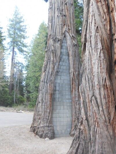
Cinder Block Tree Emerald Bay State Park California

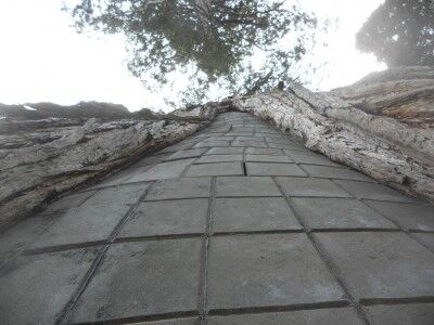
As you reach the bottom on Vikingsholm Trail and it begins to level off, there is a quite unusual sight — a cinder block tree to your left.

tree at Emerald Bay state park filled with cinder blocks

Cinder block tree at Emerald Bay CA

I’m not sure exactly what the purpose of this would be, but assume that it was a way to protect trees from further damage and rotting many years ago. When I visited, Emerald Bay visitors center was still closed for the winter season so there were no park rangers around I could ask. If anyone knows for sure why this was done, I would love to hear the explanation.

Petroglyphs Hole In The Wall Mojave National Preserve

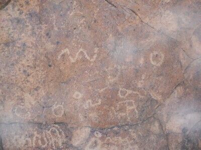
The Rings Trail loop at Hole in the Wall in Mojave National Preserve (CA) begins at the far end of the visitor center parking area. About a quarter mile into the hike, you will see a large boulder next to the trail which has a number of petroglyphs on it:

Petroglyphs along Rings Trail near Hole in the Wall, Mojave National Preserve

I always get confused what to call these when I see them (petroglyphs or pictograms), so I had to finally took the time to figure out the difference between the two. Petroglyphs (often times referred to as rock engravings) are created by removing part of a rock surface to make the picture or symbol. Pictographs are images drawn or painted on a rock face rather than engraved into it.

While the petroglyphs at Hole in the Wall aren’t the best examples to see at National Parks (they are fully accessible and it appears that people have touched them over the years), they are still worth stopping for and admiring on your hike.

Vikingsholm Trail Emerald Bay State Park California

If you have the time, you definitely want to take the 1 mile hike down Vikingsholm Trail at Emerald Bay state park to the the water’s edge. While there won’t be any issues getting down the trail, you will eventually have to hike back up and the grade is fairly steep. You definitely need to be in decent shape to do it, but the rewards are well worth it.

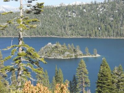
As you begin to hike down Vikingsholm Trail, you will quickly get closer to Emerald Bay and see some wonderful views of Fannette Island:

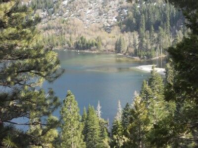
View of Fannette Island in Emerald Bay from the Vikingsholm trail

The different colors within Emerald Bay will also begin to show themselves:

The wonderful colors of Emerald Bay

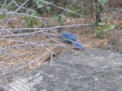
The view of Emerald Bay isn’t the only thing to keep your eyes glued to on your way down. There are a number of birds and small animals to see including a beautiful blue jay that is quite common:

Blue jay seen on the Vikingsholm trail to Emerald Bay

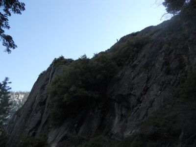
When you reach the bottom of Vikingsholm Trail, you will be next to the rock cliffs that you were moments before standing upon and you will quickly realize how far you descended in that mile walk down.

View of the rocks toward the bottom of Vikingsholm trail looking up at the view point

Once at the bottom of Vikingsholm Trail, you will be at the visitors center. From there you have the entire beach at Emerald Bay to explore as well as some other hikes to take if you are up to it.

Hole In The Wall Mojave National Preserve

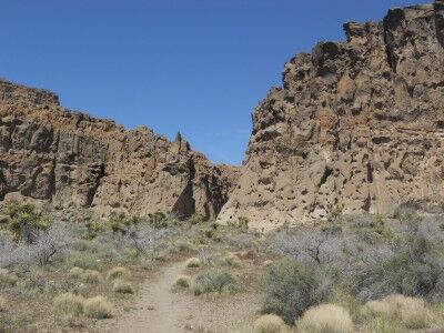
One place that I would definitely recommend when visiting Mojave National Preserve (CA) is Hole-in-the-Wall which is perfectly named. A few million years ago, the eruptions of a nearby volcano covered the area with a mixture of lava, gas and ash. As the ash cooled and the gas began to dissipate, the gas bubbles within the cooling lava expanded forming large holes. These large holes in the lava, which have been further enlarged through natural wind and water erosion, give the site its appropriate name.

Hole in the Wall Mojave National Preserve

The best place to begin your exploration of this area is at the visitors center where you can learn about the 1.5-mile loop Hole-in-the-Wall Rings Trail, nearby camping, nearby picnic areas and other activities in the area. The visitors center has running water and bathrooms and the park rangers were extremely helpful. Best of all, there are no fees to explore Hole-in-the-Wall.

If you do nothing else, you will definitely want to take the Hole-in-the-Wall Rings Trail. The Rings Trail trail-head is at the far end of the visitor center parking lot. While you can also begin the loop trail near the camping area, I would recommend doing in this direction to leave the best for last. This will lead you first through the desert shrubland to a rock with petroglyphs, then around the back side where you will get a wondrous view of the lava rocks that give the site its name which you will ultimately climb through with the help of metal rings drilled in the rock to make it possible to get through. You will emerge at the camping site and then it is a short walk from there down the main road back to the visitors center. definitely worth doing to see the interesting rock formations and you will want to give yourself some extra time to explore all the nooks and crannies that make the area so interesting.

Vikingsholm View Emerald Bay State Park California

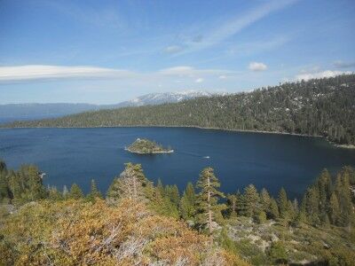
One of the main reasons that you want to drive California highway 89 around Lake Tahoe is so that you get a chance to see Emerald Bay state park. There are two main lookouts over Emerald Bay: Vikingsholm and Inspiration Point. While there is a lot more to do than look at the Emerald Bay view from the Vikingsholm stop, if you are in a rush with little time, the Vikingsholm view stop is one you’ll definitely want to make at all cost. A short 2 minute walk up some rocks will give you an outstanding view of Emerald Bay making it accessible to virtually everyone:

Emerald Bay at Lake Tahoe from Vikingsholm

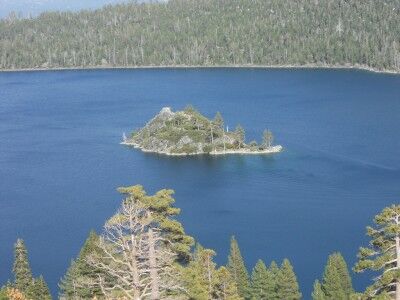
with Fannette Island in the middle:

Fannette Island in Emerald Bay State Park

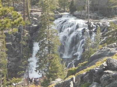
You will also be able to see a portion on Eagle Falls off to the right side:

Eagle Falls at Emerald Bay state park

While this is the absolute bare minimum you should do at Emerald Bay, Vikingsholm also has a trail head for the 1 mile hike down to the shore of Emerald Bay