Navajo Arch Devils Garden Arches National Park

When you take the side trail off the main Devils Garden trail to hike to Partition Arch at Arches National Park, this side trail splits. A left takes you to Partition Arch while continuing straight will take you to Navajo Arch.

It’s really not much of an effort to visit both and it’s certainly worth doing. Although not very far apart, they give two completely different views of Arches that are each beautiful in their own way.

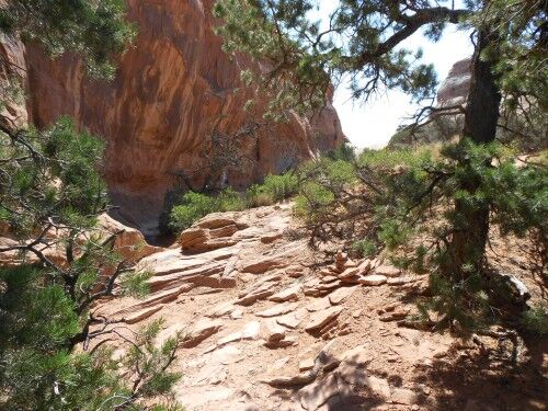
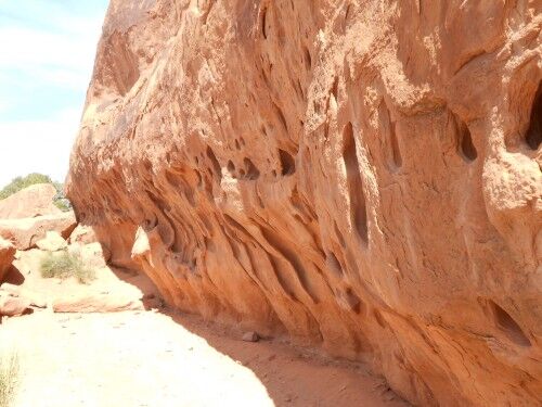
Much like the trail to Partition Arch, as you hike toward Navajo Arch you will reach a wall which you walk along. The main difference is that this one happens to be filled with hundreds of interesting, weather-worn holes.

Navajo Arch trail

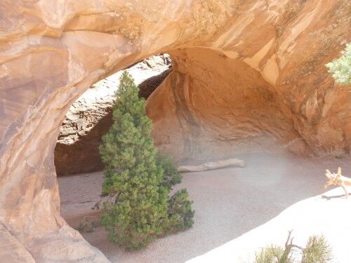
As you reach Navajo Arch, the first thing you notice is a small pine growing directly under the arch:

Navajo Arch pine

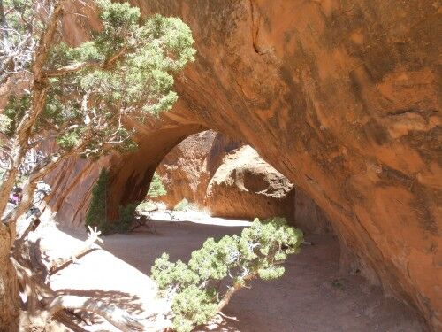
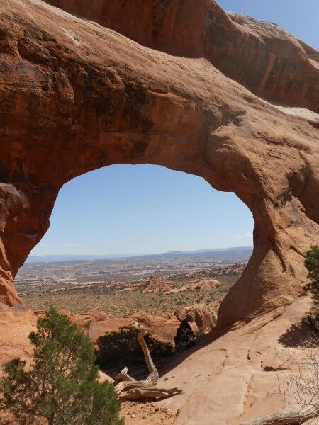
Due to the arch’s thickness and surrounding trees, Navajo Arch has a lot more shade than other arches in Arches giving it a completely different feel:

Navajo Arch

Navajo Arch Arches National Park

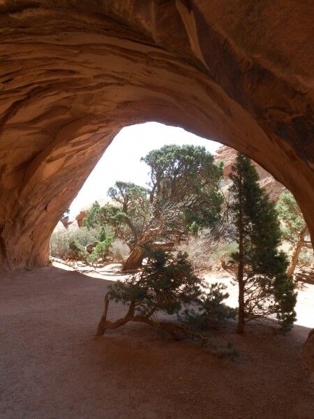
It’s possible to walk completely through the Navajo Arch into a shady, sandy cove area that gives a completely different perspective of the arch:

Navajo Arch backside

This happens to be one of my favorite arches at Arches National Park simply because the feel of it is so different from many of the others arches there. It’s almost like a little oasis under the hot desert sun. Again, Navajo Arch is not one to skip if you decide to hike the entire Devils Garden trail.

Best National Parks To See Solar Eclipse 2012

The sun and moon (rather than the stars) will align to give a great opportunity for those living in the West to view a solar eclipse on May 20, 2012 at a large number of National Parks. Even better, the 20th falls on Sunday which should allow even more people to get out and witness this exciting event.

Approximately 30 national parks are located in areas where a “ring of fire” solar eclipse can be seen with six of these National Parks offering a near perfect centering of the moon during thesolar eclipse. There are another 125 National Parks where the eclipse can be seen, but where it will only be “merely wonderful” according to the National Park Service.

full solar eclipse

For those who want to get the absolute best view of the solar eclipse, there are six National Parks where the moon will be centered and cover 96% of the sun. These include:

  • Canyon de Chelly National Monument
  • Glen Canyon National Recreation Area
  • Lassen Volcanic National Park
  • Petroglyph National Monument
  • Redwoods National Park (the best views will be on the beach away from the tree cover)
  • Zion National Park

For example, those who plan to watch the solar eclipse from Petroglyph National Monument will have the opportunity to see the moon centered while covering 96.5% of the sun. The solar eclipse “annularity” will last for four minutes and 26 seconds beginning at 7:33 PM MDT, and the eclipse will end when the sun sets behind the horizon at approximately 8:30 PM. Even when the moon is centered, there won’t be total darkness as this will not be a full eclipse of the sun, and bright ring of light will still shine outward surrounding the moon.

National Parks Where Solar Eclipse with Moon Centered Can Be Seen

Canyon de Chelly National Monument
Glen Canyon National Recreation Area
Lassen Volcanic National Park
Petroglyph National Monument
Redwoods National Park
Zion National Park

National Parks Where Solar Eclipse Can Be Seen

Visitors to these National Parks will see a solar eclipse, but the moon will be slightly off-center during the period that its shadow falls across the sun.

Aztec Ruins National Monument
Bandelier National Monument
Bryce Canyon National Park
Canyon de Chelly National Monument
Capitol Reef National Park
Cedar Breaks National Monument
Chaco Culture National Historical Park
El Malpais National Monument
El Morrow National Monument
Fort Union National Monument
Grand Canyon National Park
Great Basin National Park
Hovenweep National Monument
Hubbell Trading Post National Historic Site
Lava Beds National Monument
Mesa Verde National Park
Natural Bridges National Monument
Navajo National Monument
Oregon Caves National Monument
Pecos National Historical Park
Petrified Forest National Park
Rainbow Bridge National Monument
Salinas Pueblo Missions National Monument
Whiskeytown-Shasta-Trinity National Recreation Area
Wupatki National Monument
Yucca House National Monument

National Parks Where Partial Solar Eclipse Can Be Seen

Alibates Flint Quarries National Monument
Apostle Islands National Lakeshore
Brown v. Board of Education National Historic Site
Chamizal National Monument
Effigy Mounds National Monument
Fort Larned National Historic Site
Guadalupe Mountains National Park
Harry S. Truman National Historic Site
Isle Royale National Park
Lake Meredith National Recreation Area
Mississippi River National Recreation Area
Nicodemus National Historic Site
Pipestone National Monument
St. Croix River National Scenic River
Tallgrass Prairie National Preserve
Voyageurs National Park
Washita Battlefield National Historic Site

May 20th should be a wonderful opportunity to witness this rare event in some of the most beautiful places in the US.

(Photo courtesy of Badruddeen)

My Hike in Con Dao National Park in Vietnam

By Julie Bowman

Last summer, I had the pleasure of visiting Con Dao National Park in Vietnam. The picturesque scenery was like something out of a fairy tale. I have travelled to many places in the world, and nothing has made an impression on my memory quite like this magical island with its many rich colours and lush expanse that a large faceless city just cannot do.

The first thing that caught my attention was how verdant and green everything appeared. I’m from an urban community, so perhaps I’m just not used to it, but the lush foliage all around during the hiking we did on the first day was almost overwhelming. I could also tell a difference in the air quality compared to where I come from. The aura was natural and inspiring, an essence of pure utopia. First impressions really do make an impact as I have not forgotten my initial perceptions of Con Dao.

I chose to access the islands by plane. While you can opt to travel by boat, I spoke to a couple staying at my hotel that chose this option, and they said that they lost two days waiting on the boat due to high wind conditions. While this could have been a unique circumstance, it is something that could have been avoided by flying.

Con Dao is composed of 16 islands, and travelers to this remote destination can expect to have a jam-packed itinerary, because there is never a dull moment. I had always dreamed of scuba diving as a child. Pictures flooded my mind of what to expect, but nothing could have prepared me for the majestic beauty of the sea that I beheld when I went diving in Con Dao. The aqua waters were beautiful, smooth and tranquil during the entire length of the dive. I could hardly take my eyes off of the coral reefs. While I had seen pictures in the brochures I had studied prior to arrival, the printed images could not capture the vast beauty of the real thing. Con Dao was the perfect location to fulfil my lifelong scuba diving dream.

Perhaps the most fascinating aspect of my visit to Con Dao was seemingly the most mundane — driving around the main island. My friends and I travelled on motor bikes during our visit, which was another first for me. The scenery that opened up in front of our eyes at every bend never ceased to amaze us.

My week-long trip to Con Dao was an experience I know I will never forget. While there are many places I have visited that I would never return to, I sincerely hope the opportunity to return to Con Dao one day presents itself.

Con Son bay

The photo shows the magnificent Con Son bay on the Con Dao Islands, which only hints at the amazing national park that lies just beyond those waters. I took several boat rides around the islands after I’d completed my main trek around the national parkland, and it was a completely different experience; so serene and peaceful compared to the hot sticky trek. The area as a whole is fairly unknown, especially outside of Vietnam, so it’s great to be able to visit and be literally the only Westerner here!

I did actually meet a couple from the USA on my trip and they said they were loving the whole ambience too, although to be fair, they hadn’t yet tried the trekking element of their trip yet! The photo doesn’t convey just how hot and humid the islands can be so it’s so important to dress appropriately and also carry lots of water with you. And the guidebooks also won’t tell you that there’s a fair amount of mosquitoes and midges around too, so make sure you’re armed with some insect repellent spray etc. But most of all just enjoy it as Vietnam is getting incredibly popular now so hurry before everyone cottons on to this great destination!

Julie has travelled to many countries across the world and has a particular passion for Asian culture, history and people and her most recent independent trip was to Vietnam where she relished immersing herself into the local culture and trying the local foods.
Rare California Pitcher Plant Bog Smith River National Recreation Area

I love finding wonderful little gems in the National Park system. There is one of these hidden surprises at mile marker 17.9 along California highway 199 in Smith River National Recreation Area, but it’s extremely easy to miss. The entrance to a gravel parking area is only marked with a small, easy to miss, nondescript brown sign at the side of the road which says “Botanical Trail.”

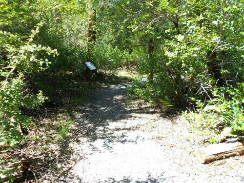
To the left side of the parking area is the trail head to a path that leads on a short .2 miles flat loop. This gravel covered path takes you to a serpentine bog where rare California Pitcher Plants (Darlingtonia californica) grow. There is a box at the trailhead which has an informational sheet that gives an excellent explanation of the area, and it’s well worth reading.

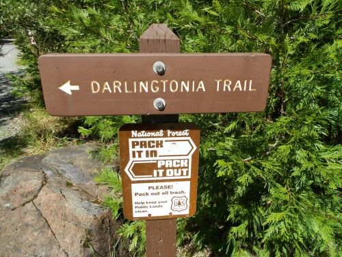
Darlingtonia trail trailhead

As you hike along the trail, there are a number of informational signs that give information about the plants and animals that live near the Pitcher Plant bog:

Darlingtonia trail

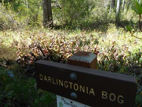
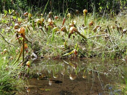
Although the bog isn’t all that big, there are a large number of Pitcher Plants growing in the area:

darlingtonia bog

California dalingtonia

pitcher plants

California pitcher plant

insect eating plants

This is what the informational sheet has to say about the California Pitcher Plants:

Pictures Plants thrive in wetland environments where few other plants can survive. Most plants receive essential nutrients like nitrogen and phosphorus from the soil and not many can survive in wetlands. Wetlands typically have few nutrients available for plants. Darlingtonias receive their nitrogen and other nutrients from an unusual source — the insects and other small organisms that become trapped within the hood of the plant.
The hood and other appendages secrete a nectar that lures the insect into the hole on the underside of the hood. Light enters the transparent top of the hood and insect flies toward the light. But the hood’s slippery interior walls, with many downward-pointing hairs, impeded an escape and the invading insect falls into the “pitcher’s” water in the stem and drowns. Many minute organisms living in the water slowly consume the insect and, in the process, release essential nutrients that are absorbed by the Darlingtonia.

Do you see any Darlingtonia flowers? They almost appeared to be a separate plant, their reddish lily-like blossoms rising beside and often above the parent plant. The flower turns upright after pollination and you may see some of last year’s crop. Botanists are uncertain as to how exactly the flower is pollinated. Wouldn’t it be ironic if the Pitcher Plant’s source of pollination and food were the same insect? A real predicament!

Partition Arch Devils Garden Arches National Park

After reaching Landscape Arch along the Devils Garden trail at Arches National Park, the trail becomes a lot more difficult. It isn’t anything that a fit hiker can’t do, but those with mobility issues will have trouble as there is some scrambling necessary to get up parts of the trail. Despite the difficulty of the trail from this point, it’s well worth continuing to see some other magnificent arches along the trail. The first side trail you will reach after Landscape Arch will take you to Partition Arch and Navajo Arch.

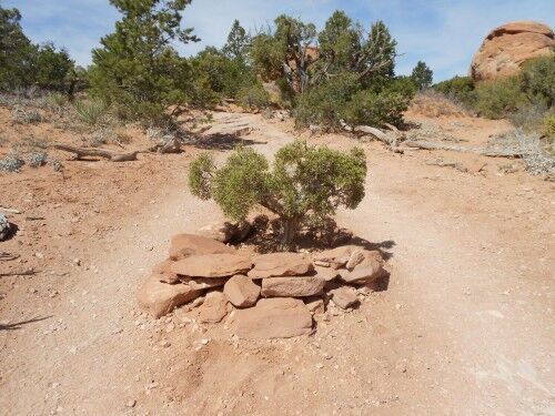
The side trail to Partition Arch has a small pine tree that has inexplicably decided to grow in the middle of the trail. Those not wanting to see it trampled have placed rocks around it to help protect it:

partition arch trail pine

Not much further on you reach a rock wall to your left that you will follow until you reach Partition Arch:

partition arch trail

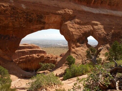
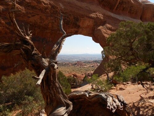
At the end of the rock wall you will reach Partition Arch which will make you stop in your tracks and gawk for a bit (it’s actually fun to sit on some rocks and watch the reaction people have when they reach the arch). Partition Arch gives a beautiful window view of the landscape below with a smaller window arch to the right:

partition arch

partition arch arches national park

Partition Arch Devils Garden trail

It’s a perfect place to stop for a short rest and simply bask in the beauty all around. It’s definitely one of the arches to make sure to visit if you decide to hike the entire Devils Garden trail.

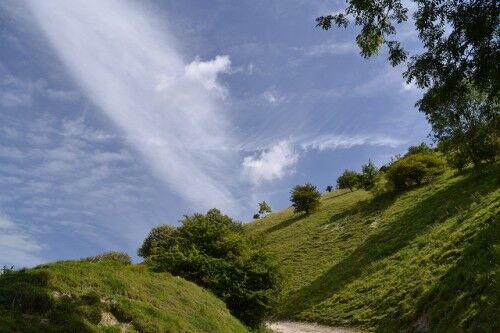
South Downs Way at South Downs National Park (England)

Britain’s newest National Park, the South Downs National Park, was granted National Park Status in April 2011 and it wasn’t a minute too soon. So beautiful are the 1627 square kilometres within the park that people who live in the area have been wondering for years why it had not already been accorded the title and protections. The South Downs National Park reaches East to Eastbourne all the way through to Winchester to the West, and takes in the stunning southern counties of East Sussex, West Sussex and Hampshire. Within that area the landscape encompasses the long undulating forests of the Weald over sandstone and clay vales and hills, the world-famous and iconic white cliffs at Beachy Head and the gorgeous chalk ridge of the South Downs and the rolling South Downs Way. Designated as an Area of Outstanding Natural Beauty and packed with hundreds of archaeological sites as well as the endless beautiful villages and market towns and the Cathedral City of Winchester, South Downs National Park is a true highlight of southern England and one of my favourite walks.

south downs national park

The best way to experience the national park is along the South Downs Way. This traverses the length of the National Park, from the coastal town of Eastbourne all the way to stunning Winchester. It will take you into the heart of the very best of England’s green and pleasant countryside and you can travel the trail either on foot, mountain bike or by horse. There are some steep inclines along the way but for people with an average level of fitness there is nothing that should trouble you too much. And the rewards are worth it – on a clear day you can stand and look out over Hampshire and Sussex and further, over the English Channel. Stand at the top of one of the many hills and enjoy the green patchwork of fields, woods, rivers and forests, as well as the beautiful villages dotted around the landscape. Indeed as you walk along the trail you will pass through farms and farmland, woods and forests, gentle streams and flowing rivers, castles and forts, quaint English villages and bustling market towns. Stop en route for a pint (or three) of local ale in one of the hundreds of traditional pubs, or combine your walk with one of the many festivals in Brighton, Winchester, Arundel or Glyndebourne.

No matter when you go, or how you decide to do it, the South Downs Way is one of England’s most enjoyable and picturesque trails. It is the oldest bridleway in the United Kingdom and it is packed with beauty and history at every turn. If you have a choice, the best way to go (and my favourite route) is from Winchester to Eastbourne, meaning you start at the Cathedral and finish the walk amidst the stunning views of the Seven Sisters and Beachy Head.

Alex is a travel writer and blogger. He regularly writes about traveling and hiking around the UK and Europe. He also writes for a Kefalonia tourist information guide.

(Photo courtesy of Globalism Pictures)

Hiking in the Lake District National Park (England)

England’s Lake District National Park might be the most picturesque hiking destination in the UK. It’s got everything a hiker could hope to find in the great British outdoors- craggy mountain peaks, beautiful lakes stretching off into the distance, ancient stone circles, wild deer roaming the hillsides, ruined castles, and a scattering of excellent traditional pubs.

If you’re familiar with Wordsworth’s poem ‘I wandered lonely as a cloud…’ you’ve already heard about the Lake District. Wordsworth was inspired to write those lines after a walk near Ullswater (one of the bigger lakes) in 1802. Sir Walter Scott also wrote about this part of the world, and so did Samuel Taylor Coleridge, Robert Southey, and many of the great poets of the Romantic Movement.

It was also home to hiking pioneer Alfred Wainwright, a man who penned descriptions of no less than 214 hills and mountains — locally known as ‘fells’. That figure should give you some idea just how hilly the Lake District really is. There are easy day walks suitable for families, week-long expeditions for the more adventurous, and scrambles and full-blown rock climbs for those who like their terrain a little more vertical. Winter or summer, it’s a paradise for hikers.

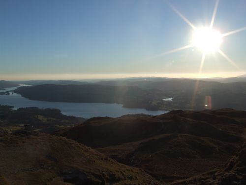
windermere lake district national park

Scafell Pike is one of the most popular summits. At well over 3000ft it’s the highest in England. On a good day it offers views of peaks up to 100km distant and sometimes it’s even possible to catch a glimpse of the sharp peaks of North Wales or the Mourne Mountains in County Down far away across the Irish Sea.

Those who want to try scrambling should choose Helvellyn, a little further south. It’s not quite as high as Scafell Pike but still tops the 3000ft mark, and there are two classic ridge walks to the summit. Hikers can either go up Striding Edge and down Swirral Edge or vice-versa. The exposure is stunning and the views are spectacular, right beneath your feet. This is one for those with plenty of experience and a good head for heights. In winter conditions crampons and ice-axes are definitely recommended.

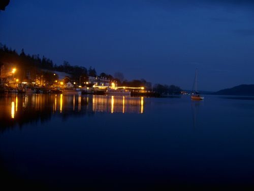
In the evenings it’s time to relax by the water’s edge. Sunset from Ambleside, just on the edge of Windermere, is often absolutely incredible:

ambleside at dusk lake district national park

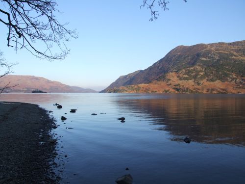
If you happen to be driving along the edge of Ullswater on a still evening you’ll see the mountains reflected with almost unreal clarity:

ullswater in autumn lake district national park

Even if you come just to hike it’s worth taking a day off to hire a bike and wander by the waterside or hop on a boat tour.

Jess Spate is a UK-based hiker and a rock and ice climber. Understandably, the Lake District is one of her favourite places to be. When not out on the fells or clinging to the rocks she writes for Appalachian Outdoors (follow them on twitter @AppOutdoors), an American hiking and camping retailer.

Point Bonita Lighthouse New Bridge Photos Golden Gate National Recreation Area

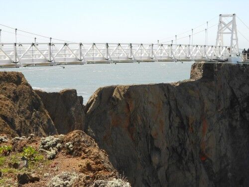
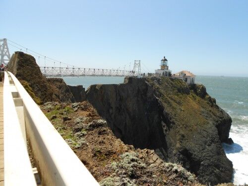
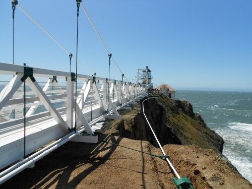
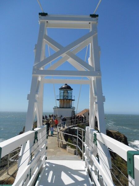
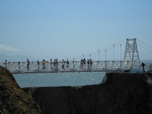
After a two year wait, people can once again visit the Point Bonita lighthouse located in Golden Gate National Recreation Area via a newly built $1 million dollar, 132-foot-long bridge which spans rocky cliffs to the lighthouse. The old bridge became unsafe and the lighthouse was closed to the public until this new span could be built.

The sparkling white, narrow bridge is a much safer replica of the previous bridge and was built to withstand the high winds that frequent the area. The former bridge had a two-person limit before it became unsafe and was closed while the new bridge tops out at 50 people.

While the new bridge is built to last 50 years, it won’t be for everyone. For those that like their bridges solid and sturdy, this probably isn’t the bridge for you. When I visited the winds were in the mid to high teens and there was a sway and bounce as I crossed. With rocky cliffs below, it might also be a challenge for those with a great fear of heights. The national park volunteer who was monitoring the flow of people across the span said the bridge would remain open to visitors crossing as long as the wind remained under 27 miles per hour.

While the Coast Guard is in charge of operating and maintaining Point Bonita lighthouse, the National Park Service manages the lighthouse for visitors. The lighthouse is currently open to the public three days a week (Saturday, Sunday and Monday) from 12:30 PM to 3:30 PM (there is a tunnel that you must walk through before you reach the bridge and lighthouse — this door is closed promptly at 3:30 so you will miss seeing both completely if you are even a minute late)

Many of those who visit focus on the Golden Gate bridge and miss this incredible gem that is only a few miles away. It is one to definitely add to your list if you happen to be in the area visiting:

point bonita lighthouse bridge new

new point bonita lighthouse bridge

brand new point bonita lightouse bridge

Point Bonita lighthouse new bridge

point bonita lighthouse bridge visitors

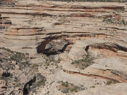
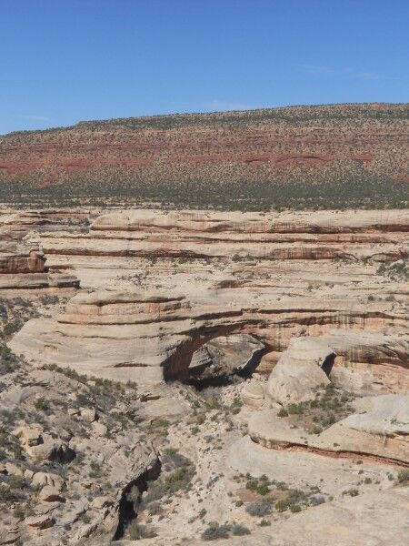
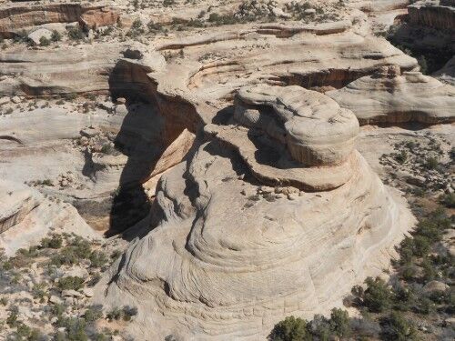
Sipapu Bridge Natural Bridges National Monument

When people visit Utah, and the many national parks there, Natural Bridges National Monument often gets overlooked (I have to honestly admit that I have bypassed it a couple of times in the past in order to make my way to more famous national parks in the area). Now that I have gone, I know that I will be back to do what appears to be an absolutely breathtaking canyon hike which I didn’t have time to do this time around.

Natural Bridges National Monument offers a 9 mile loop drive that has overlook pullouts to view the three main bridges in the park. This makes it a destination for those who don’t want to (or can’t) hike, as well as those that love to hike. The first bridge view along the road is of Sipapu Bridge (220 feet high, 268 feet long, 31 feet wide and 53 feet thick) and gives a good indication of the beauty of the entire national monument (wouldn’t you just love to hike the winding canyon along with river under all the natural bridges?)

Sipapu Bridge

Sipapu Natural Bridges national monument

Sipapu natural bridge

Sipapu Bridge Natural Bridges National Monument

The information sign at the bridge view give the following information:

Several names have been given the the bridges over the years. Sipapu has had at least two other names — President and Augusta — but these were later changed. Cliff dwellings and rock art in the area reminded William Douglass, the leader of the 1908 government survey, of the Hopi culture he had studied extensively in Arizona. Charged with finding “appropriate Indian names” for the bridges, he chose Sipapu, meaning “place of emergence.”

Cedar Mesa, a million acre plateau encompassing the monument and surrounding are, is composed of nearly horizontal sedimentary rock layers. During the Permian Period, wind blown sands from the north and west were deposited here as dunes. Later sediments buried these dunes and with time, pressure and moisture, they became”petrified” sand, or sandstone. Today geologists label this layer Cedar Mesa Sandstone.

Buried, then tilted and uplifted, the sandstone was slowly exposed by meandering streams which carried away the overlying sediments. These streams helped carve Sipapu and other bridges.

Canyon Overlook Trail Zion National Park

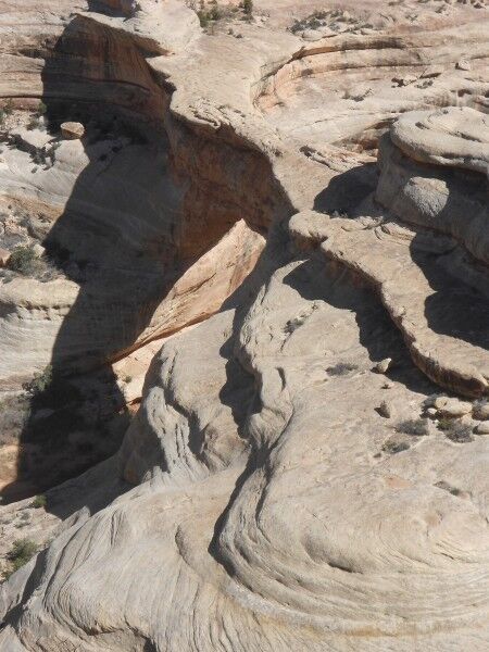
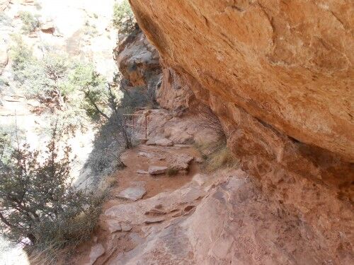
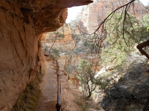
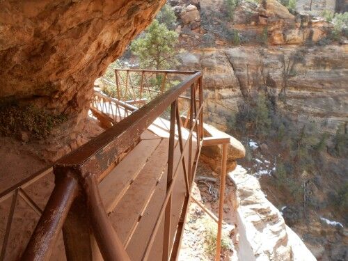
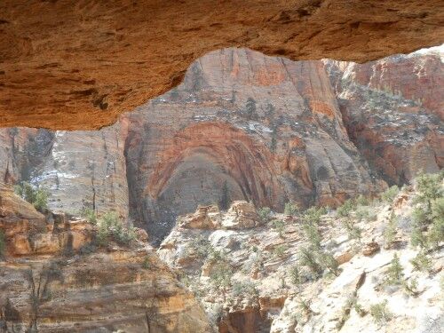
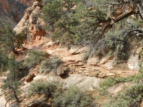
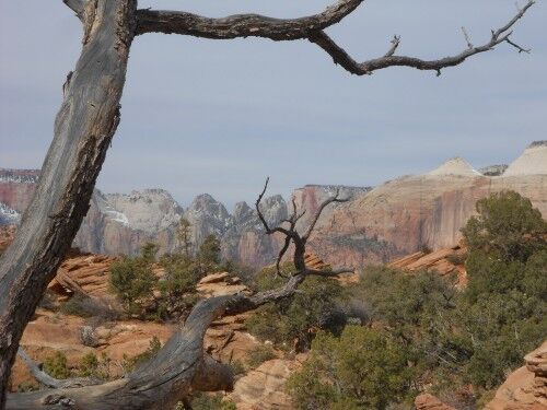
One of my favorite (relatively) easy hikes (there is some steepness at the beginning and those really scared of heights won’t like the bridge — sections of the trail have rails to keep you from accidentally wandering too close to the steep edges) at Zion National Park is one that too many people miss due to its location. The Canyon Overlook trailhead is at the east end of the tunnel after leaving Zion Valley (there is a small parking lot at the end of the tunnel where you can park). Since it isn’t in Zion Valley where most people instinctively head and spend all their time, they miss this little gem which definitely is worth making the time to do.

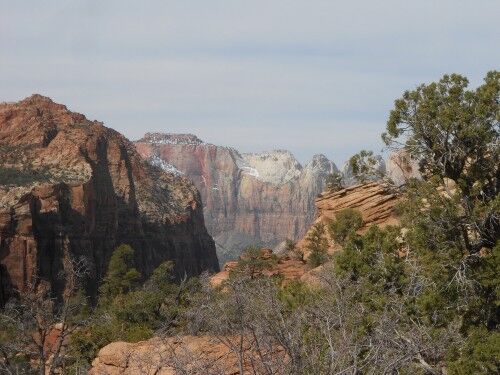
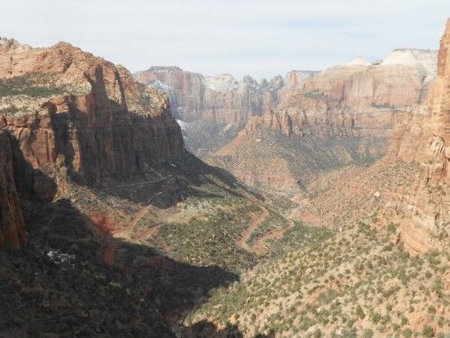
The Canyon Overlook hike is only 1 mile round trip and gives a wonderful view of Zion Valley. For those who want to see a grand view of part of Zion Valley, but don’t want to (or can’t) tackle the more rigorous hikes like Observation Point, this will give a spectacular view. The trail winds along Pine Canyon Creek with the Zion-Mt Carmel Tunnel on the opposite side. The hike ends at a railed observation overlook with lower Zion Canyon below (with the famous Zion road switchbacks) and the Beehives, West Temple, East Temple, Towers of the Virgin and the Streaked Wall across the valley. Here are a few photo so you can judge for yourself:

canyon overlook trail

canyon overlook trail railing

canyon overlook trail bridge

canyon overlook trail cove

canyon overlook trail hike zion

canyon overlook trail hike

canyon overlook trail zion national park

canyon overlook trail zion valley