Limekiln Beach Limekiln State Park California

After hiking to Limekiln Falls and to the historic lime kilns, it’s also worthwhile visiting Limekiln State Beach at Limekiln State Park (CA). The beach is at the other end of the parking lot as the hiking trails (easily seen from the parking lot). You cross a small bridge over Limekiln Creek and enter the Limekiln beach campground. The Limekiln beach is at the far end of the campground just beyond a huge bridge that carries cars across the Limekiln Canyon on highway 1:
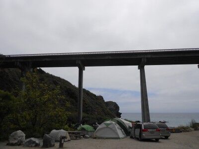
Limekiln beach campground at Limekiln State Beach California

Although it would seem that the beach would be quite noisy with the highway bridge right above, that is not really the case. The bridge is high enough that there is very little car noise on the beach. When I visited, someone has set up a small love seat directly next to one of the bridge support columns:
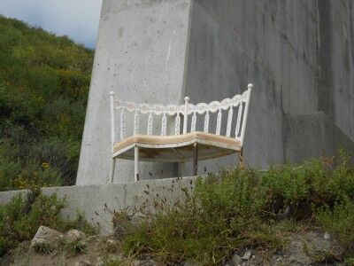
Loveseat at Limekiln State Beach

That provided a wonderful view of Limekiln Beach when sitting on it:
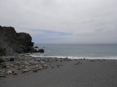
the view of Limekiln Beach from loveseat

Limekiln Beach itself is pretty interesting. On the left side, Limekiln Creek empties into the ocean bringing down a rocky bed of stones and boulders to the sea:
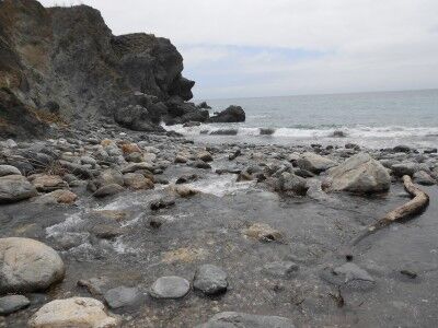
Limekiln Creek emptying into the ocean at Limekiln beach

To the right is a the beach, although it is littered with large stones that have been swept down the creek in the past:
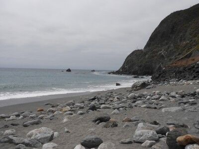
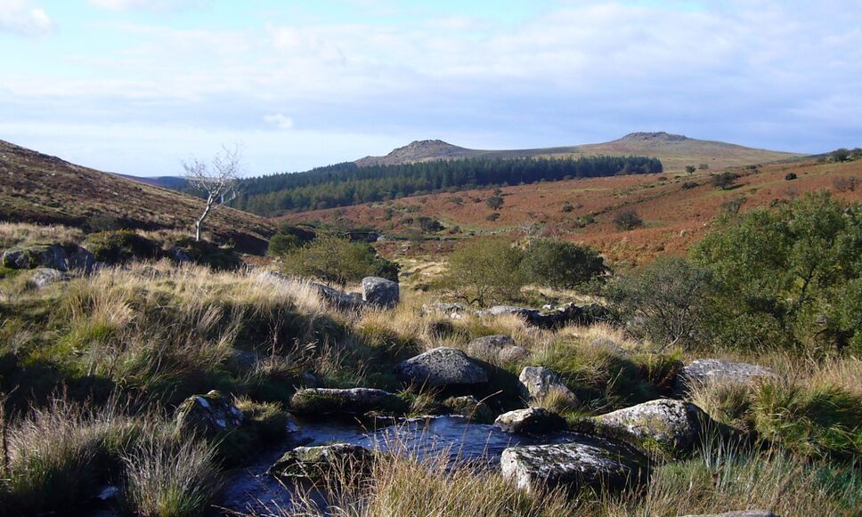
With the campgrounds nearby, there were plenty of kids and families enjoying the beach and the creek. I would imagine that it would be a wonderful place for families to camp giving everyone plenty of choices of how to spend the day depending on what they enjoyed doing most. If interested, here are some more photos of Limekiln State Park. Unfortunately, Limekiln State Park is on the list of California State parks to close.
Pfeiffer Beach National Forest

Pfeiffer Beach (run by the National Forest Service) is a hidden gem where you may be able to escape the crowds clogging up all the other beaches and state parks along highway 1 in the Big Sur area of California. There are a couple of reasons for this.

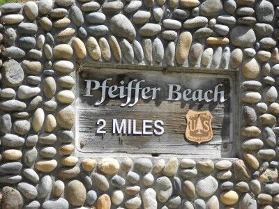
First, the Pfeiffer Beach isn’t marked with a sign along highway 1 so you would drive right on by it unless you knew exactly where to turn. Coming south on highway 1, it is 0.5 miles past the US Forest Service Ranger Station. You make a tight right turn when you see the yellow “Narrow Road” sign (which you need to be looking for because it’s hidden a bit too — there is no sign for “Pfeiffer Beach”). About 100 yards down the road you will get confirmation that you are one the correct road when you see this sign:

The second reason that less people go to this beach is that the next two miles of road down to the beach are mostly one lane so that campers and RVs can’t make it down it. Combine the lack of marking and the no RVs and you have a beach that, although beautiful, gets a lot less traffic than the other beaches in the Big Sur area.

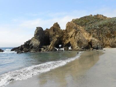
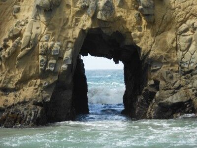
The beach has plenty of sand with a number of rocky outcrops just offshore, many with arches and tunnels within them:

There is a small creek that runs down the beach and empties into the ocean. Sea lions playing in the waves just offshore when I was there and the many rocks outcroppings (which also make Pfeiffer beach part of the California Coastal National Monument) were the home of sea birds and resting sea lions. There is a $5 fee to enter. If interested, here are more photos of Pfeiffer Beach. It’s definitely a beach to visit, especially when the crowds at the other main stops are beginning to get to you.

Sea Glass Beach Fort Bragg California

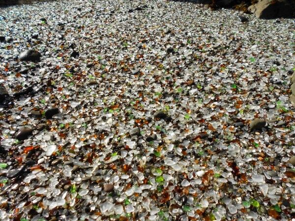
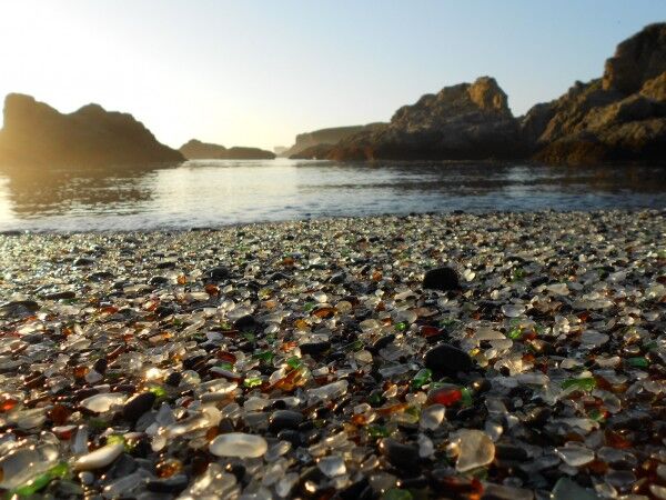
While not technically a National Park (there are a lot of rock outcroppings along the shoreline which are all part of the California Coastal National Monument), Glass Beach in Fort Bragg, CA is definitely worth a visit. It’s not often that you see a beach that is almost entirely made of sea glass (also called beach glass, mermaids tears, lucky glass, ocean glass and sea gems) that is several inches thick in some places:

a beach made up almost entirely of sea glass in Fort Bragg, CA

Most people assume that sea glass comes from glass garbage dumped out at sea that eventually makes its way to the shore. In many cases, this is how sea glass arrives on the beach, but not in the case of Glass Beach in Fort Bragg. Instead, the glass has been there for up to 100 years getting churned by ocean waves and sand.

Towns along the sea coast used to dump all their garbage into the oceans. In most areas, the tide would come in and sweep all the garbage out to sea, but the rock formations at Fort Bragg create a unique wave pattern that kept everything on the beach. Basically, all the glass garbage that was dumped in the Fort Bragg dumps from 1906 – 1967 remains where it was dumped and over the years the sand and tides have smoothed the sharp glass into smooth, rounded sea glass pebbles of many different colors making the entire beach a “glass beach.” It also has resulted in Fort Bragg having the highest concentration of sea glass in the world.

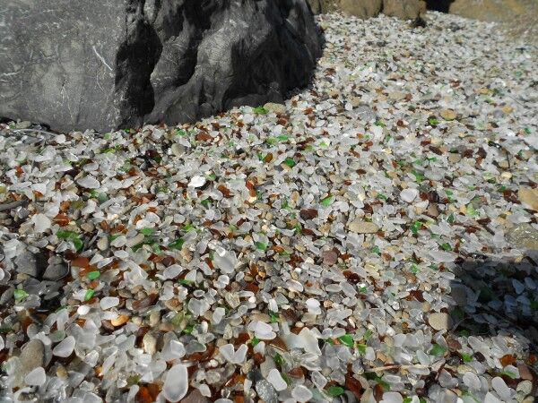
beach glass from Glass Beach in Fort Bragg California

It’s a pretty incredible sight with the sea glass several inches thick in some areas. It also makes for excellent foreground photographs of the California Coastal National Monument outcroppings just off the coast:

seaglass beach

Here is a short video I took at Glass Beach:

There are actually 3 Glass Beaches in Fort Bragg. The one that is most famous is part of MacKerricher State Park (CA) and was the Fort Bragg dump from 1949 – 1967. I took these photos and video at the 1943 – 1949 dump site which is just south of MacKerricher State Park. There is another dump site that ran from 1906 – 1943, but it’s only accessible by sea kayak.

For those interested in directions how to get to 1943 – 1949 dump site, there is a Glass Beach Museum on highway 1 toward the south end of Fort Bragg where you can get a map of all the glass beaches in Fort Bragg (and see an amazing display of sea glass).