Unusual National Parks Vehicles

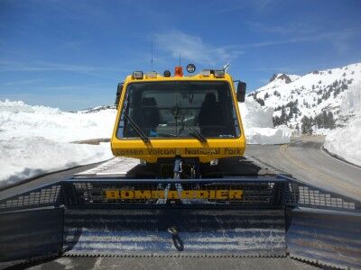
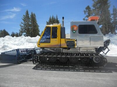
As I took my hike up to where they were removing snow in mid June on the road at Lassen Volcanic National Park, I came across a National Parks snowplow:

National parks snowplow at Lassen Volcanic National Park

National Parks Service snowplow at Lassen Volcanic National Park

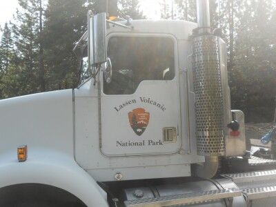
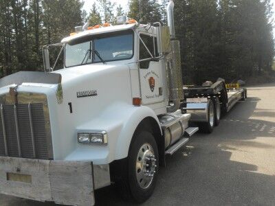
This caught my eye because when I was entering the park, I also saw a National Parks big rig 18 wheel truck:

18 wheel big rig truck for Lassen Volcanic National Park

National Park service big rig for Lassen Volcanic National Park

This got me thinking that with National Parks in the mountains to the sea and everything in between, there must be some pretty unusual vehicles owned by the National Parks service. If you have come across some unusual vehicles owned and operated by the National Park service on your travels, let me know about them (or even better, send me a photo so I can share them with everyone). I bet we can gather a pretty interesting collection.

Lassen Volcanic National Park Struggling With Snow

Like many of the mountain national parks, Lassen Volcanic National Park is struggling with the large amount of snow it received this year. I visited the park yesterday and most of it is still closed due to snow. From the Southwest entrance, the road is only open for about half a mile to the Sulphur Works area and all hiking paths on that side of the mountain are still covered in snow pack (you need snowshoes or cross country skis). The road is clear up to the Bumpass Hell parking area, but the park isn’t allowing cars up there yet because snow removal crews are still working and they are having some issue with rock slides as the snow melts:
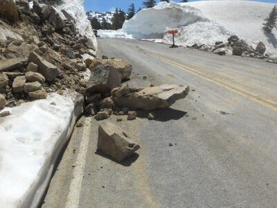
rocks fall onto the road at Lassen Volcanic national Park

Even though the road was closed to cars, I decided to hike up to where they were clearing snow. It was about a 2.5 mile hike along the road without anyone else around (Protip: If you enjoy biking, it would be the perfect time to bike the closed road). As the road wound its way upward, the snowbanks on the side of the road increased, reaching as high as 20 feet in some spots:
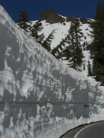
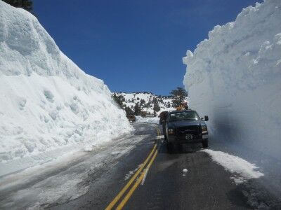
Snow wall on side of road at Lassen Volcanic National Park

Truck next to snowbank at Lassen Volcanic National Park

When I reached the area where they were removing snow, there were 6 snowplows working feverishly, yet making extremely slow headway due to the amount of snow on the road.
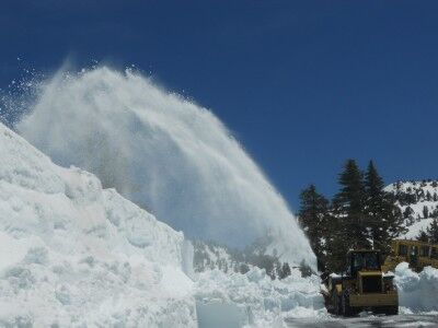
Clearing snow on the road at Lassen Volcanic National Park

I talked with a ranger who said the goal is to have the road open by July 1, but I’m not sure they are going to make it. They still have about 10 miles of road to clear that is buried under 15 feet of snow. Caltrans has stepped in and is now helping Lassen Volcanic National Park try to open the road (the snowplows that were working while I was there were Caltrans plows), but even with the additional help they still have a lot of work to do up there.

For those wanting to visit Lassen Volcanic National Park, there is a bit more open at the Manzanita Lake entrance. Hiking trails around Manzanita Lake (there were a lot of people on the lake fishing today) and Reflection Lake / Lily Pond are clear and the road is open for 10 miles to Devastated Area (although the Devastated Area loop hike was still covered in snow)

For those interested, more photos from the hike
Junction Room Crystal Cave Sequoia National Park

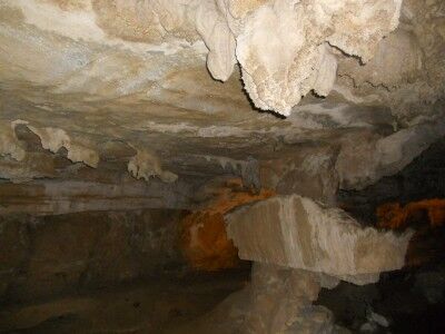
After passing Emerald Pools and continuing to follow Yucca Creek within Crystal Cave in Sequoia National Park (CA), you soon come to Junction Room. This is the first large room that you come to in Crystal Cave, and as the name indicates, is a junction room that you will eventually come back to during the tour of Crystal Cave. The room is distinctive from the large rectangular rock formation in the center of the room:

Junction Room in Crystal Cave at Sequoia National Park

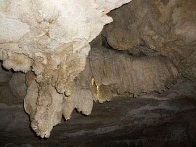
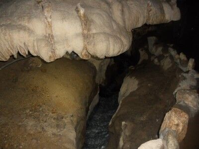
In addition to being the junction area of the cave, Junction Room also has a nice display of soda straws and popcorn cave formations:

Junction Room in Crystal Cave

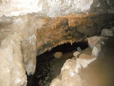
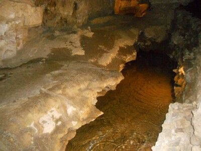
Yucca Creek also flows directly through Junction Room:

Yucca Creek flows through Junction Room in Crystal Cave

Point Reyes Lighthouse 308 Steps

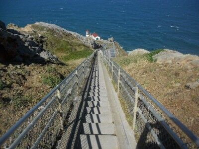
When you first see the Point Reyes Lighthouse from the observation deck at Point Reyes National Seashore (CA), your first instinct is to want to see the lighthouse up close. Then you take a look at these:

Steps going down to Point Reyes lighthouse

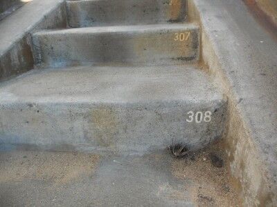
There is a sign that warns that the over 300 steps is the same as a 30 story building and while it’s easy to get down, you need to be in decent shape to make it back up. To help with the effort, there are three rest areas with a bench where you can stop to catch your breath on the way up. You begin the hike back to the top at step number 308:

Step 308 at Point Reyes Lighthouse

I consider myself to be in pretty decent shape and I was a bit winded by the time I reached the top. The key is to take it slow, rest when needed and give yourself plenty of time to make it back to the top. Even with the physically taxing climb, a visit to the lighthouse is well worth it.

Kayaking Biscayne National Park

I previously mentions that I would really like to see all National Parks eventually have virtual drives such as the Big Bend National Park virtual drive. The one thing I forgot to consider was that not all National Parks are necessarily on land. Such is the case with Biscayne National Park which is 95% water. So I tried to find the next best thing and what I came up with was a friendly kayak tour of part of Biscayne National Park bay (with some funky music to go along with it)

Of course, the real beauty of Biscayne National Park is found underwater on her coral reefs:

I am really looking forward to getting a chance to explore this National Park on land, by boat and underwater.

Big Bend National Park Virtual Drive

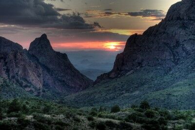
The first thing I do when I begin thinking about going to a specific National Park is to look at photos that people who have been to the park have taken. Robbie’s Photo Art had this gorgeous photo of a sunset when I was searching for photos of Big Bend National Park:

Sunset at Big Mend National Park

As I did some more searching, I came across a couple of videos that I’m pretty sure will replace what I look for first when thinking about going to a National Park. That is the virtual drive. There were two virtual drives available for Big Bend National Park:

This drive takes you up into the scenic center of Big Bend National Park, the Chisos Basin, then back down to the main road, before heading east to the Boquillas Canyon area.

This drive begins in the middle of the Ross Maxwell Scenic Drive, at the Chimneys trailhead, then heads north, east, and north again, until passing through Persimmon Gap and out the northern park entrance.

I don’t think that the virtual drive will replace the beauty of the photos, but I do think it gives a much better overall feel of the place you are thinking of going, and a more realistic view of the National Park. I would love to see these available for all National Parks and hope to see more National Park virtual drives available for viewing soon.

Badlands National Park

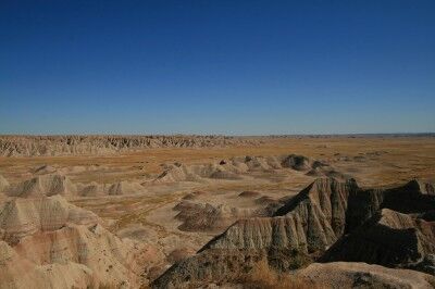
One of the things I love most about many of the National Parks is their rugged beauty and that is exactly why I can’t wait to visit Badlands National Park in the near future. One photo (this one courtesy of wormwould) shows that Badlands could be the poster park for the “rugged beauty” title:

scenic view of Badlands National Park

I am also intrigued by Badlands National Park because it contains one of the world’s richest fossil beds and the terrain has yielded the bones of many ancient mammals such as the rhinos, horses, and saber-toothed cats. For those not convinced by the above, the following video should erase all doubt (it did for me) that I definitely need to visit Badlands National Park at the next opportunity:

Wind Caves Mount Diablo California State Park

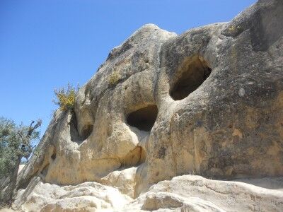
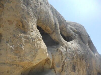
When you enter the Rock City area of Mount Diablo California state park, you can find a small parking lot towards the top that places your next to Wind Caves. This is an area where sandstone rock has been eroded away leaving large pocket holes in the stone:

Wind Caves at Mount Diablo California State Park

The Wind Caves at Mt. Diablo State Park

Although the name “Wind Caves” gives the impression that the wind has formed these hole ridden rocks, an information sign gives a better explanation of the process:

Erosion Creates Dramatic Rock Sculptures

Along the trail here in Rock City, you will see dramatic caves sculptured in the sandstone. Though commonly called “Wind Caves,” these cavities have a more complex origin.

These cavities began to form when the sandstone once buried far below the Earth’s surface was exposed in recent geological time during the uplift of Mt. Diablo. Rain, mixed with carbon dioxide from the air, formed weak acidic water that ran over and into the rock. It dissolved the calcite cement that acts as a “glue” holding the sand grains together. Each summer, heat drew water out of the rock and, over the centuries, evaporation left a hard carbonate crust on the surface.

Here and there, the crust cracked and fell away exposing the weakly cemented sandstone inside. The softer material eroded more quickly than the crust, leaving behind the cavities. This sculpturing process continues today.

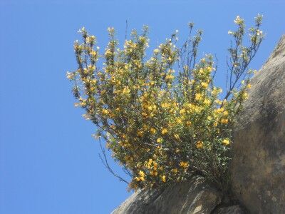
These are fun to look at and explore (although they have unfortunately been covered in graffiti). One discovery that you will make is that plants have been able to eek out an existence in the most unlikely of places amount the sandstone formations:

Flowering plant growing out of Wind Caves at Mt. Diablo state park

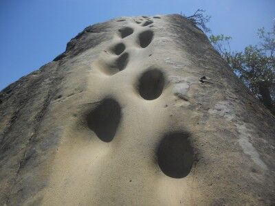
For those not satisfied with seeing the formations from the bottom, it’s also possible to make it to the top using a series of footsteps that have been worn into the sandstone:

steps that lead to the top of Wind Caves at Mt. Diablo state park

It’s definitely a fun place to take photos and explore for an afternoon. For more information on how you can help protect and preserve this state park, you can get information at Save Mount Diablo or on their facebooke page

The Arches of Arches National Park

Although I have been to a lot of National Parks in the west, one that I have not yet been to is Arches National Park. Hopefully that will no longer be the case by the end of this year. I am planning a trip this September that should allow me to spend a few days there, and while I was doing a bit of research on it, I came across this video showing many of the arches and landmarks to be seen there:

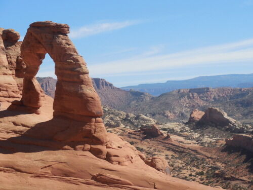
For anyone still not convinced that Arches National Park is worth a visit, take a look at this absolutely stunning set of Arches photos taken by james.gordon6108. Here is just one of them to wet your appetite:

Delicate Arch at Arches National Park

I can’t even tell you how excited I am to see this National Park.

Yucca Creek Crystal Cave Sequoia National Park

The water that flows through Crystal Cave in Sequoia National Park (CA) is Yucca Creek which flows into Cascade Creek. As soon as you move into the entrance of Crystal Cave and pass through the spiderweb gate, you can here the gurgling of Yucca Creek as it passes through the cave:

Yucca Creek in Crystal Cave Sequoia National Park

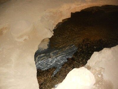
Yucca Creek also reveals that Crystal Cave is a rare marble cave (only about 5% of the caves in the world are marble caves) like at Oregon Caves National Monument and the river bed reveals the marble of Crystal Cave:

Marble exposed in Yucca Creek Crystal Cave

Yucca Creek is evident well into the cave even after passing Emerald Pools:

Yucca Creek in cave