Natural Entrance Lehman Caves Great Basin National Park

My first impression standing outside Lehman Caves at Great Basin National Park was that I wasn’t sure that I was going to find it all that exciting. Part of this was due to deciding to take a hike up to the natural entrance of the cave before the cave tour began. Instead of the lushness at the entrance of Oregon Caves National Monument or the beautiful hike down to the spider web gate entrance at Crystal Cave at Sequoia National Park, there was simply a small opening surrounded by a cage of bars.
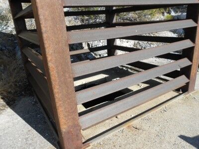
The natural entrance at Lehman Caves Great Basin National Park

Luckily, there was an information sign that explained why the natural entrance looks the way it does:

It was at this spot in about 1885 that Ab Lehman first entered the cave. From then until 1940, when the present tunnel was constructed, this natural entrance was used by people visiting the cave.

In the early 1900s, visitors descended into the cave through a wooden shed covering the natural entrance. In 1939, the national Park Service blasted a tunnel into the hillside behind the visitor center, providing easier access. The natural opening was closed or severely restricted in the ensuing years, disrupting airflow and limiting bat access. Bat use of Lehman Caves declined. In 1997, the bat-compatible gate was installed to correct these problems

Why the gate design? When bats leave the cave, they spiral upward, exiting through gaps in the horizontal bars. The gate extends upward allowing bats to gain speed and altitude. This allows them to escape nearby predators.

Why do bats use caves? Bats need hibernation sites that fall within a narrow temperature and humidity range. Lehman Caves remains close to 50 degrees Fahrenheit (10 degrees Celsius)and 90% humidity year round. During the summer, bats establish nursery colonies in caves, where they birth their young. Bats roost in the dark of the caves during daylight, exiting them at night to feed on insects.

Once I entered Lehman Caves, any initial reservations I had quickly disappeared with the many wonderful cave formations found inside…
Half Dome View Yosemite National Park

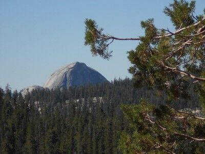
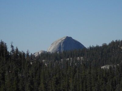
As you drive along Tioga Road from Crane Flat toward the Tuolumne Meadows at Yosemite National Park, there will be a small, unmarked turn out a few hundred feet before you reach Olmsted Point. The turnout only fits a few cars at most and it’s easy to pass. Trees block the view until you are already directly in front of the turnout, but by that time most cars are traveling too fast to make the stop. If you do manage to stop, you will be rewarded with a beautiful view of Half Dome with a pine forest in front:

Half Dome behind forest

Half Dome from Tioga Road at Yosemite National Park

There are so many beautiful views in Yosemite that it’s simply not possible to stop at every one, so most people end up going for the main ones. While you’ll definitely want to stop at Olmsted Point where there is also a spectacular view of Half Dome, it’s worthwhile to try and make this stop. The view of Half Dome with a pine forest in front is one that not many people see or get the chance to take photos of making it one of those unmarked turnouts you want to add to your list.

Crater Lake National Park Photos

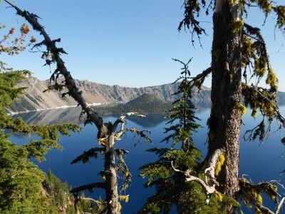
One of the reasons I love visiting National Parks is that they’re so beautiful that even if you aren’t a professional photographer, you can still come away with some amazing photos. A perfect example of this is Crater Lake National Park. I took a trip to Crater Lake in mid August and these are just a few of the photos I came with from that trip:

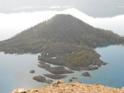
Wizard Island from Discovery Point

Wizard Island from Discovery Point at Crater Lake National Park

Wizard Island from Watchman’s Peak

Wizard Island from Watchman's Tower at Crater Lake National Park

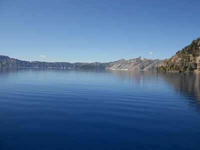
Crater Lake at lake level

Crater Lake at lake level from Cleetwood Cove Trail Crater Lake National Park

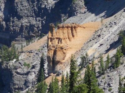
Pumice Castle

Pumice Castle at Crater Lake

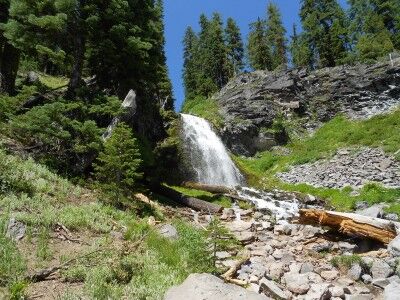
Plaikni Falls

Plaikni Waterfall on Sand Creek Crater Lake National Park

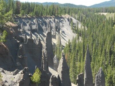
The Pinnacles

The Pinnacles Crater Lake National Park

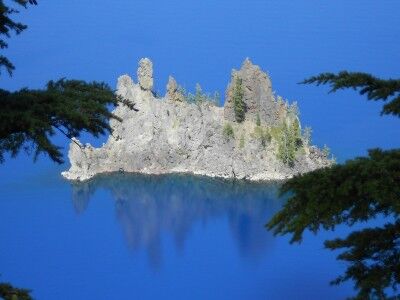
Phantom Ship from Sun Notch Trail

Phantom Ship at Crater Lake National Park

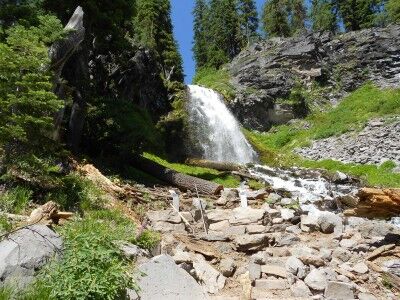
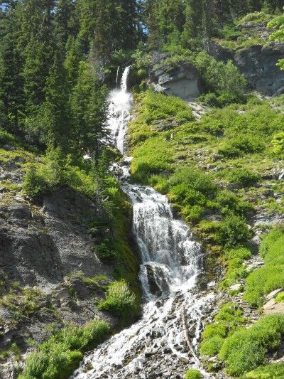
Vidae Falls

Vidae Falls at Crater Lake National Park

Best Day Hike in Zion National Park: Observation Point Trail

Submitted by: Terry Tyson, A Hiking Fool and his Photo Log

Impressions: The Grand Canyon may touch your heart with its massive grandeur, but Zion National Park touches your soul. Unless you venture beyond the rim of the Grand Canyon, it’s likely to remain as humbling and impressive as the beautiful prom queen you admired, but never dated in high school. But Zion demands a personal connection because there is no other way to experience the canyon other than to be physically immersed in its beauty and wonder.

“Zion” in Hebrew, refers to a place of refuge, a holy sanctuary. It’s easy to understand why this special place was named Zion for it does provide you with a sense of spiritual solace.

There are many “classic” hikes within the canyon, each with their own special characteristics and charms. But for me, the best of the “classic” hikes is to Observation Point. It’s likely the most difficult of the classics, but the payoff for your efforts are many.

Tips: Park your car and take the shuttle. The park shuttle will take you from the front gate to the end of the canyon and back. The cost of the shuttle is included with your entrance fee. It’s handy, comfortable and allows you to enjoy the place without worrying about traffic.

The town shuttle (aka “Springdale Shuttle”) is also handy. It will take you from the front gate to the end of town, dropping you off at convenient locations near eateries, shops and hotels. It’s also a bargain because it’s free.

Both shuttles run from early April to the end of October.

Oh yeah, don’t forget to bring a lot of water on any hike you do in the park. Natural water sources are unreliable and may not be safe to drink.

Must-sees: If you even of moderate stamina, don’t miss Observation Point. The hike is longer and higher than its more well-known cousin, Angels Landing, but provides more incredible visual treats. Echo Canyon, a hanging, hidden canyon about 1/3 of the way up is a stunning surprise. It’s mentioned sometimes only in passing in some guides, but the first time you encounter it will be one of the reasons you’ll want to return.

Because it’s a more challenging hike, you’re likely to see fewer folks on the trail. But be prepared to gain elevation fast as the trail presents not only the entire canyon to view, but also the less seen East Mesa portion of the park.

When you do reach Observation Point, take a moment to look down upon the Big Bend of the Virgin River, Angels Landing and the entrance to The Narrows from this lofty perch. Bring a map so you can identify all of the landmarks within the view.


Echo Canyon; Observation Point Trail


East Mesa from Observation Point Trail


View from the top: Observation Point

Terry Tyson also had this to say: Zion gets busy during the summer, despite the heat. The best time to visit is in the spring or fall. If you’re wanting to hike in The Narrows, it’s best to wait until late summer or early fall when the water level is lowest.

Locks and Ledges: Ledges Trail Cuyahoga Valley National Park

Submitted by: Terry Tyson, A Hiking Fool and his Photo Log

Impressions: Cuyahoga Valley National Park offers a unique mix of natural and historical attractions that makes it unlike many other parks in the system. It resides in a long, somewhat meandering northern Ohio valley that’s bordered by small to medium-sized communities and oft times crossed by Interstate Highways and township owned roads. This makes the park accessible from a number of entrance points but also makes it difficult at times to determine where the park begins and ends. But this aspect also makes the park worthy of a visit because it does offer so much diverse activity and ease of access.

If it could be described in just a few words they might be: Historical landmarks surrounded by hiking trails, streams and an occasional waterfall.

Tips:: Pack a lunch and cooler full of cold drinks since the park offers these in only a few places. Since many of the entrances aren’t marked by a proper gate, information on what to do and where to go should be researched before you arrive.

Must-sees

1. Canal Visitor Center: Historical exhibits, trains, locks and rangers.

2. Tow Path: Wide and flat, a perfect biking and walking path. Makes an all day ride if going from end to end.

3. Ledges Trail: Moderate loop hike that encompasses interesting exposed bedrock cliffs, narrow slots and caves. Kid-friendly.


Narrow Slot: Ledges Trail


A determined tree takes root in the rocks: Ledges Trail


Exposed Bedrock: Ledges Trail

Terry Tyson also had this to say: Although the park doesn’t offer the awe and wonderous sights of many of parks, it well worth a day or two to see if you’re in the area.

Plaikni Falls Crater Lake National Park

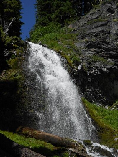
After hiking 1.1 miles along the Plaikni Falls trail, you’re rewarded with a beautiful view of Plaikni Falls. The name “Plaikni Falls” which means “from the high country” comes from the Klamath Indian Tribes whose traditional homeland includes Crater Lake National Park and who still have strong cultural ties to this area to this day.

Plaikni Falls at Crater Lake National Park

close-up of  Plaikni Falls at Crater Lake

Plaikni Falls is not fed by Crater Lake. The source water for Sand Creek is snow melt which begins at Anderson Spring just above Anderson Bluffs (7000 feet above sea level — 2134 meters) Sand Creek flows approximately a quarter of a mile before hitting a glacier carved cliff which it cascades over to create Plaikni Falls. At the base of Plaikni Falls, Sand Creek continues to cascade over rocky terrain to the south through Kerr Valley, then toward the west through The Pinnacles until it eventually flows out of Crater Lake National Park.

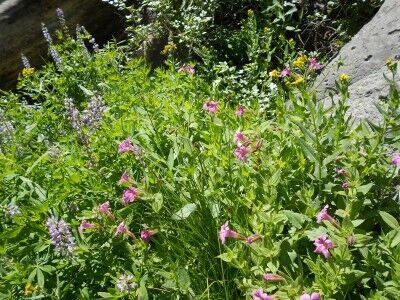
The base of Plaikni Falls is quite lush and filled with wildflowers:

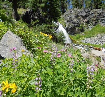
wildflowers at Plaikni Falls in Crater Lake National Park

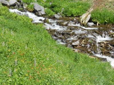
wildflowers along Sand Creek below Plaikni Falls

wildflowers with Plaikni Falls in the distance

It’s wonderful that there is now easy access to this previously “secret” waterfall at Crater Lake and the beautiful scenery around Plaikni Falls makes the hike out there well worth the time and effort. Here is a short video I took at the end of Plaikni Falls trail at the base of the falls:

Hopi Salt Mines Grand Canyon National Park Rafting

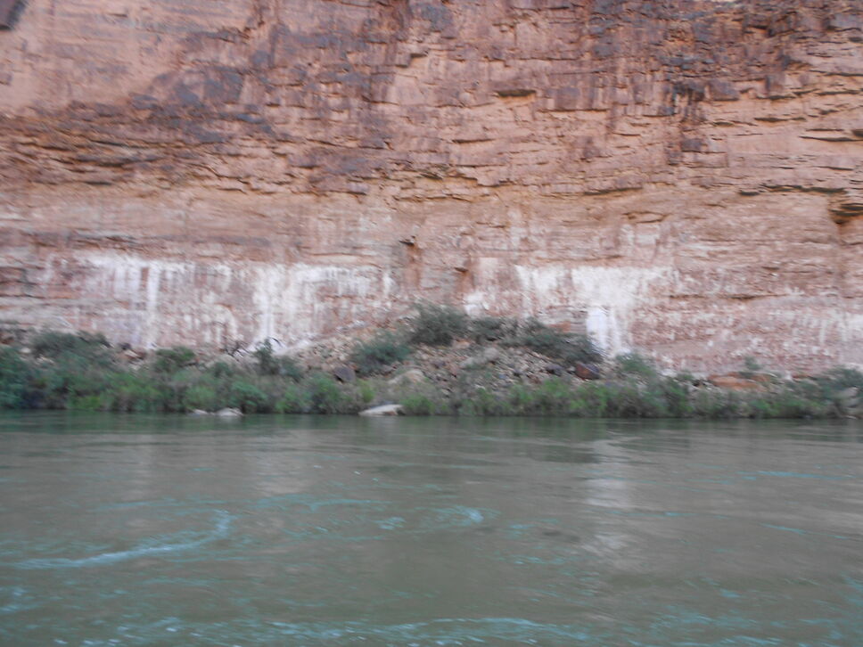
After passing by the Little Colorado River between miles 63.5 and 65 while rafting in Grand Canyon National Park, you begin to see white deposits against the red rock toward the bottom of the Colorado River canyon walls. These are the sacred Hopi Indian salt mines where the Hopi Indians would come to gather salt for seasoning and preserving their food.

Hopi salt mines in Grand Canyon

This area is considered sacred ground and river rafts are not allowed to stop to inspect the salt mines in more detail. In addition to using the salt for everyday uses, a pilgrimage to these Grand Canyon salt mines was traditionally the culmination of a Hopi Indian right of passage bringing males into adulthood.

10 Oldest National Parks

I received an email asking me “what are the 10 oldest national parks?” The first National Park was Yellowstone created in 1872. Number two was Sequoia National Park in 1890 along with Yosemite National Park the same year. While Kings Canyon National Park was established in 1940, it’s included with Sequoia National Park (they are connected) because Kings Canyon National Park incorporated General Grant National Park when it was created. General Grant National Park was established in 1890 to protect the General Grant Grove of giant sequoias, the same year as Sequoia National Park.


Yosemite National Park established in 1890

Here is a list of the 10 oldest National Parks in the National Park system:

1. Yellowstone National Park (1872)
2. Sequoia and Kings Canyon National Park (Sequoia 1890)
2. Yosemite National Park (1890)
4. Mount Rainier National Park (1899)
5. Crater Lake National Park (1902)
6. Wind Cave National Park (1903)
7. Mesa Verde National Park (1906)
8. Glacier National Park (1910)
9. Rocky Mountain National Park (1915)
10. Haleakala National Park (1916)
10. Hawaii Volcanoes National Park (1916)
10. Lassen Volcanic National Park (1916)

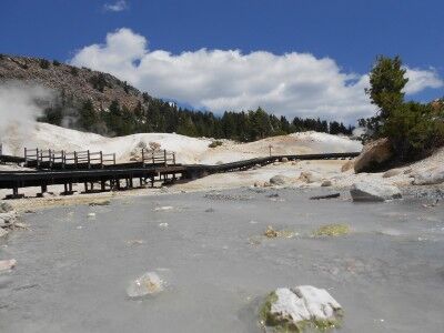
Bumpass Pass Boardwalk and Creek Lassen Volcanic National Park

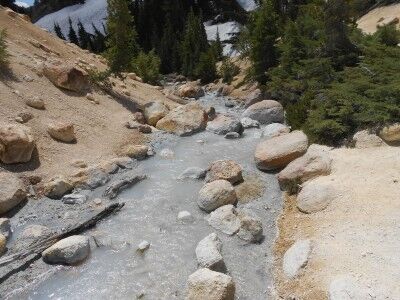
When you reach the end of the Bumpass Hell trail at Lassen Volcanic National Park (just a short walk after you get a glimpse of the hydrothermal activity at Bumpass Hell), you reach the Bumpass Hell boardwalk. Just to the right of the boardwalk, you’ll also see Bumpass Hell creek where all the water that is part of the hydrothermal activity drains out of Bumpass Hell:

the boardwalk at Bumpass Hell with Bumpass Hell creek

Bumpass Hell creek at Lassen National Park

The Bumpass Pass boardwalk allows you to get a much better view of all the different types of hydrothermal activity taking place and it has a nice variety of information signs to explain exactly what hydrothermal activities are going on:

information sign at Bumpass Hell boardwalk

Molten rock — magma — lies miles below your feet. The magma that is chambered there is the same that fed the eruptions of Lassen Peak and other dacite-dome volcanoes like Bumpass Mountain. The magma superheats a reservoir of groundwater deep within the Earth. Steam, as hot a 464 degrees Fahrenheit (240 degrees Celsius), rises and condenses into water again, mixing with the percolating groundwater nearer the surface. The mixture produces sulfate water that escapes through park hydrothermal features at temperatures about 200 degrees Fahrenheit (93 degrees Celsius)

Bumpass Hell is the largest “escape valve” for the underground boiler or hydrothermal system and is the main upward vent. Lesser upward flows exit as Sulfur Works, Devil’s Kitchen, Boiling Springs Lake and Little Hot Springs Valley. One Furnace, One System