Sprague Lake Fishing Rocky Mountain National Park

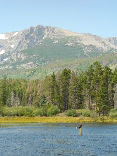
One of the things that you’ll immediately notice when hiking around Sprague Lake (besides the beautiful scenery) at Rocky Mountain National Park are the large number of people fishing on the lake. The scenery combined with those fishing can make for some dramatic fishing photos:

fishing in Sprague Lake at Rocky Mountain National Park

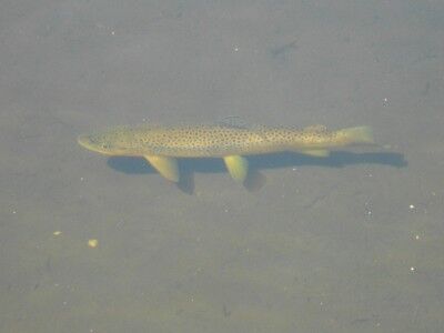
Sprague Lake is the remnant of a resort once owned by Abner Sprague who used to stock the lake for fishermen visiting the resort, so there are plenty of fish in the waters. In fact, simply walking around the edges of the crystal clear water of Sprague Lake will usually allow you to see the fish within:

fish can be seen from the banks of Sprague Lake at Rocky Mountain National Park

Red Canyon Overlook Colorado National Monument

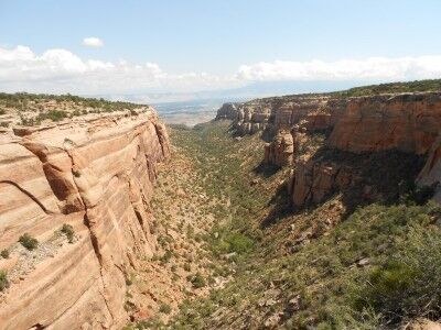
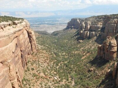
Next to Columbus Canyon (which can be seen from Cold Shivers Point) at Colorado National Monument is Red Canyon. You can get a wonderful view of Red Canyon from Red Canyon Overlook:

Red Canyon at Colorado National Monument

view of the double canyon at Red Canyon in Colorado National Monument

Red Canyon is also interesting because it is actually a canyon within a canyon. It’s described as such at the information sign overlooking the canyon:

Canyon in a Canyon

Red Canyon is really two canyons. Most obvious is the broad U-shaped canyon with the tall sandstone walls. But notice the smaller V-shaped cut in the middle of the canyon floor. Water has begun to carve into the hard metamorphic bedrock, but this old, pressure-treated and tempered rock wears away much more slowly than the fragile sedimentary canyon walls. By the time the small canyon reaches the depth of the large one, all of the sedimentary layers above it will probably be gone.

Discovery Point Crater Lake National Park

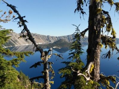
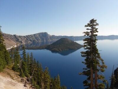
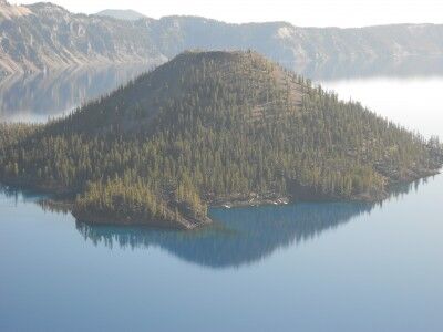
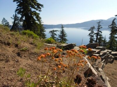
I made a couple of previous trips to Crater Lake National Park this year, but due to the heavy snow, could only see park of the park. On the second trip, Rim Drive was open to Discovery Point and I was able to get some photos and a video, but there was still a lot of snow on the ground. This time around, the entire Rim Drive was open and just a very small amount of snow remained in isolated places. I went back to the same spot (which was a lot easier to get to when you didn’t have to hike up a snow covered hill) and took the following photos:

Discovery Point at Crater Lake National Park

view of Crater Lake at Discovery Point

view of Wizard Island at Discovery Point

Discovery Point wildflowers at Crater Lake National Park

While it really is impossible to stop anywhere along Rim Drive and not get a spectacular view of Crater Lake, Discovery Point is definitely one worth stopping for. There’s a small hill to the left of the parking area with a dirt path up to a higher vantage point — it’s worth doing this short hike if you are physically able to as it gives you views of crater lake among the trees.

This is what the information sign at Discovery Point has to say:

Near this point a plodding mule stopped abruptly a few feet short of the crater rim. Its astonished rider suddenly found himself on the brink of a natural wonder few had ever seen, John Wesley Hillman had stumbled upon Crater Lake.

The day was June 12, 1853. Hillman had joined a party of goldseekers on a search for the fabled Lost Cabin Mine. They found no gold, but they knew they had discovered a scenic treasure. The prospectors erected a crude sign bearing their signatures and named the the majestic waters “Deep Blue Lake.”

In the years that followed, the lake was rediscovered and renamed several times. An 1869 exploring party gave the lake its present name and in 1902, Crater Lake became the nation’s sixth national park.

Puzzle Rocks Lassen Volcanic National Park

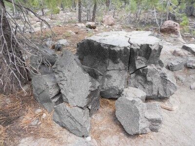
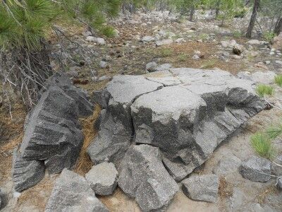
There is a 0.5 mile loop trail at the Devastated Area at Lassen Volcanic National Park (CA) appropriately named the Devastated Area Trail. The trail is an easy hike with a number of information signs teaching about the rocks left behind from Lassen Peak’s 1915 eruption. One of the most interesting of these I found were the puzzle rocks which had the following description sign by them:

After the May 19 avalanche carried hot lava rocks, the surrounding air temperature quickly cooled them. As they cooled — from the outside in — some of the rocks fractured internally, breaking into pyramid-like shapes. Like a jigsaw puzzle, many of the pieces could easily be reconfigured — solving a hot puzzle from the past…

Puzzle Rock Lassen National Park

Puzzle Rocks at Lassen Volcanic National Park

As the description indicates and the photos show, these rocks really do look like puzzles that could easily be shaped back together with a bit of effort. I always enjoy finding tidbits of information like this when I travel to the various National Parks.

Three Goblins: Goblin Valley Utah State Park

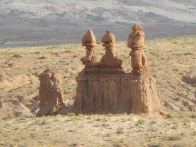
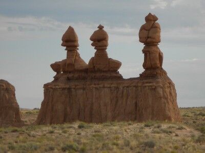
One of the first formations you come upon once you enter Goblin Valley State Park in Utah are the three goblin guards. The three goblin guards stand by themselves off to the left of the road as you drive toward Observation Point. The three stand out because they are the only goblins in the general area and seem to be welcoming you to their little world (or there to warn all the other goblins of your presence).

The three goblins at the entrance of Goblin Valley Utah State Park

The 3 goblins at the entrance of Goblin Valley state park in Utah

The three goblin guards are also deceiving in foretelling what you are about to see once you reach Goblin Valley. They make it appear that you will be entering a world where there will be many distinct formations in their own area, when in reality you’ll soon be seeing hundreds of goblins scattered all over the valley floor.

National Parks Yurt: Cedar Breaks National Monument

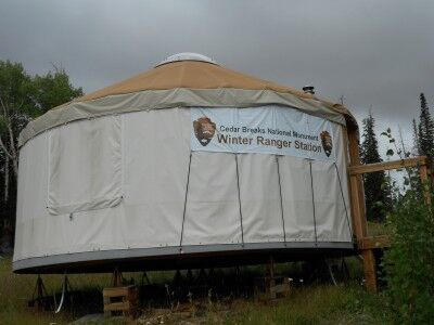
One of the things that I always find fascinating is the wide range of the unexpected I find when I go to a National Park. On my first visit to Cedar Breaks National Monument, I learned that there is actually a National Parks Yurt:

national parks yurt at Cedar Breaks National Park

This was the sign on the Yurt’s door:

What: Warming hut and resting spot for winter visitors (cross country skiers, snowshoers, snowmobilers). Wood stove, hot drinks, park information available. No restroom facilities. Cross-country ski and snowshoe trail marked on upper Alpine Pond trail, starting at yurt; 2 mile round trip to Chessmen overlook.

When: Friday, Saturday, Sunday and holidays from December 1 to about April 15, from 10:00 am to 2:00 pm, but only when highway 143 is open above (south of) Brian Head.

Who: Hosted by volunteers for Cedar Breaks National Monument.

Warning: Severe weather conditions possible, which may cause highway 143 to be closed without warning. Check weather forecast and plan accordingly.

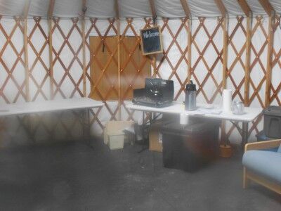
The inside, although sparse, I’m sure is a welcome sanctuary from the cold for cross-country skiers and snowshoers:

a peak inside the yurt at Cedar Breaks National Monument

I may just have to take up snowshoeing to give the National Parks’ yurt a try…has anyone taken advantage of the yurt and, if so, what are your impressions of it?

Sprague Lake Hike Rocky Mountain National Park

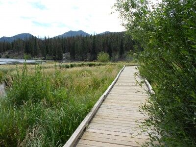
The Sprague Lake Hike at Rocky Mountain National Park is an easy half mile loop around Sprague Lake at an elevation of 8,970 feet. The lake is actually the remnant of a resort once owned by Abner Sprague (where it gets its name) which he dammed in 1915 to make it about 13 acres. The trail is mostly dirt, but it’s level and wheelchair accessible with boardwalks along the trail where needed:

Sprague Lake hiking path at Rocky Mountain National Park

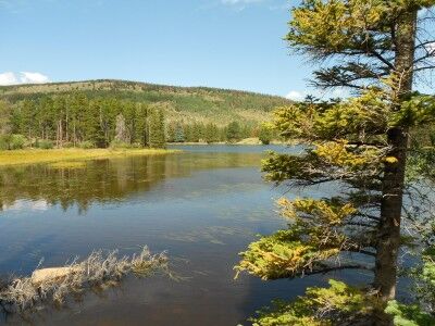
The hike provides numerous beautiful views of both the lake

Sprague Lake at Rocky Mountain National Park

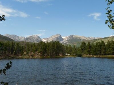
and the surrounding mountains, including many peaks which make up the Continental Divide:

mountain view from Sprague Lake hike at Rocky Mountain National Park

It’s a wonderful place to take kids on an easy walk to see the outdoors. The lake is shallow with a large number of fish which can sometimes be seen from the lake’s bank (and there are plenty of fishermen around the lake as well).

California State Park Closures Talk

What do America’s parks, whether they be national or state, mean to you? Have you ever really thought deeply about it? Christopher Grant Ward, who operates a non-profit advocacy focused on supporting parks and preserved spaces across California and around the world called Folk4Parks.org, recently sat down to give at talk about what parks mean in light that 70 California State Parks will be closed by Labor Day 2012 due to state budget issues. It’s well worth the time to listen to his talk and hopefully get you thinking a bit more about what parks in the US mean to you as an individual and for all of us:

I think this is the part of the talk that spoke to me the most:

…what is it exactly that parks give us? I’ve heard the value of parks described as an escape, a release, a reconnection with nature. John Muir described this as, “Saving the American soul from total surrender to materialism.” You know, I’ve thought about this a lot, living a modern life full of web design, travel, office politics and something called social media strategy. I live most of my life outside of the present moment. I focus on plans and goals. We all worry to some degree about what people will think when we do one thing or another. If you’re like me, then your daily actions are not always the things you most desire to do, but we do them because they work to move us toward those goals. And that’s OK, that’s not a bad thing. But when we work with purpose, what’s important in our lives is rarely situated in the present moment.

When I stand in the face of a natural scene in Del Norte Redwoods, Mt. Diablo or Yosemite, I am utterly enthralled, captivated. But I am captivated without intent or purpose. I have no goals but to experience the now. The natural world has no judgment of my actions. This break from purpose is what gives us rest. True rest. This break from purpose gives us reprieve from past mistakes and a pause from worry about what is to come. And we can do this with others. Standing amidst nature with your loved ones, with perfect strangers, we also can share and celebrate with each other the absence of purpose.

Christopher also sets up a challenge that anyone that enjoys our parks needs to consider accepting:

How will California espouse preservation to the next generation, as they watch us underfund the oldest, most extensive and diverse visions of state preservation in the world? How do we learn the importance of conservation when we can no longer visit places that help us understand what must be conserved?

California needs everyone to get involved. There is no time where times were so tough that people could not act to make a difference for parks, or where they should be considered ancillary to more fundamental things. 175 years ago, parks were established as preserved places with public access. Today, parks also need public support. These are your parks. If these ideas matter to you, if this resonates with you, show your support and get involved.

While the focus is on California state parks, I would suggest that it can be expanded to all parks, from local to national, in the US. If you enjoy our parks and they resonate with you, figure out a way to show your support and get involved. Today, they need our support and involvement more than ever.

Rock and Awe: Joshua Tree National Park

Submitted by: Terry Tyson, A Hiking Fool and his Photo Log

Impressions: Joshua Tree National Park is weird. And wonderful. And just a little mind-blowing. Imagine giants carefully (but playfully) stacking boulders as big as buses to create secrete canyons, petroglyph-filled grottoes and massive rock walls. Add to this scene evidence of hard-scrabble miners who lived and died seemingly at the whim of this almost alien landscape. That’s what it’s like there.

Well, it’s like that and so much more. Like any desert environment, its true nature is only fully revealed when you spend some time absorbing all that the park presents.

The park can certainly be viewed and awed over by merely driving from one gate to another. The stacked boulders are impressive beyond words, but the visitor who ventures just beyond the paved road is treated to beauty that’s hidden from the highway. Even the most casual of hikers will be able to enjoy the mysterious landscape more fully.

It’s best to find a place to park near a boulder stack, get out and just sit there and slowly and quietly take it all in.

Tips

1. It’s the desert so it’s hot during the summer. Sometimes because of it’s elevation it can turn surprisingly cold to the point of snowing, so be sure to check the weather before arriving.

2. It’s the desert, so bring lots of water. Camping is primitive (no electricity or running water) and day use areas are equipped with tables and chemical toilets. Any water you do find is for the locals only, i.e. Big Horn Sheep, coyotes and the like.

3. The town of Joshua Tree is a funky village with colorful locals. A few good places to eat can be found there, but only a few. Twentynine Palms is much larger and more ordinary, but offers traditional lodging, markets and eateries.

3. Don’t forget a hat and other considerations (sunglasses, sunscreen, etc.) for being in the sun all day.

4. The visitor center in Joshua Tree is worth a stop. There are knowledgeable rangers, a deli and a few shops nearby. Pay your entry fee there to make getting into the park faster.

5. The park is a world renown rock climbing destination. A casual scan of the many rock faces will no doubt reveal more than a few clinging climbers.

Must-sees: Two short nature trails are worth the price of admission alone: Barker Dam and Hidden Valley. Easy and spectacular. There’s a cave bearing petroglyphs near Barker Dam worth looking for.

Lost Palms Oasis and the “Maze – Window Rock Loop” provide two very different and exciting experiences for hikers.


Joshua Tree NP; Stacks, cracks and branches


Barker Dam; After a wet winter, water for wildlife


The Locals

Terry Tyson also had this to say: If you can stay until after the sun sets, you’ll be treated to a night sky that you might not have seen for many years. On moonless nights, the Milky Way is bright enough to read by.

This is my suggestion for the Best Day Hike in Joshua Tree. For those interested in more photos, you can view a photo set of the Joshua Tree National Park.
Cold Shivers Point Colorado National Monument

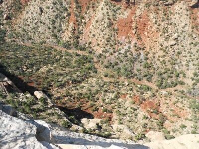
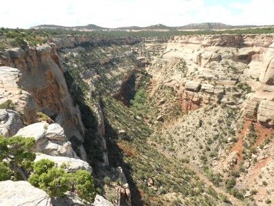
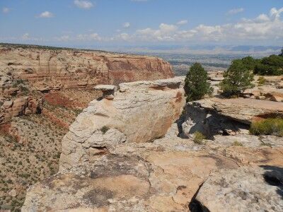
Some things are so tantalizingly named that I have no doubt that I am going to have to stop and take a look at them no matter what. That was certainly the case when I saw the name Cold Shivers Point on my map. While I’m not sure how Cold Shivers Point got its name, my guess is that it came from the chill that you get while peering over the edge of Columbus Canyon which drops 2,000 feet. It’s certainly a grand preview of what’s to come when visiting Colorado National Monument:

looking over the edge at Cold Shivers Point at Colorado National Monument

view from Cold Shivers Point in Colorado National Monument

view toward Grand Junction from Cold Shivers Point at Colorado National Monument

Cold Shivers Point is a wheel chair accessible overlook along Rim Rock Drive. If you enter Colorado National Monument from the East (Grand Junction) entrance, it will be the first of many overlooks that you will be able to see. It’s certainly worth the few minutes it takes to stop and walk out to the canyon’s edge.