Sequoia National Park wildflowers

I sometimes get asked why I go back to the same national parks again and again. Some of my friends seem to think that national parks are static and never changing. Their assumption is that once you have seen one place, then there is no real reason to see it again because you’ll simply be seeing the same thing that you saw the last time you visited. I think that most of them don’t realize how much national parks change depending on the time of year that you visit them, or even the time of day.

The truth is that national parks are dynamic and ever changing. I don’t remember a time when I have visited an national park and thought “nothing has changed.” Whether I am viewing iconic landscapes in a different season where plant and flowers are completely different, or simply in a different light due to where the sun happens to be, I constantly find new and interesting things with each visit.

While much of Sequoia national park was covered in snow during my last visit, coming to the park in June allowed me to discover this:

sequoia national park wildflowers

pink wildflowers Sequoia

One of the greatest parts of national parks is their ability to get you to slow down a bit and relax. if you can manage to do this, you will notice that while the general landscapes may appear to stay relatively the same over time, the truth is that you will never see them the same way twice no matter how many times you visit. Please visit them often to try and prove me wrong 🙂

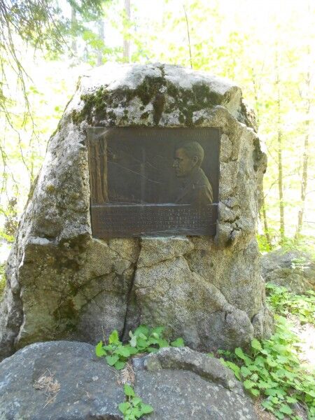
Stephen Tyng Mather Memorial Plaque Sequoia National Park

One of the things I like most about wandering in national parks is that by simply taking a path a bit different than most people, you often stumble upon little things that many people may not know about. Walking along the road from Tunnel Log to Crescent Meadow (the road was closed to traffic except shuttle buses, so it seemed to be a great way to get some solitude on a busy weekend at Sequoia National Park when there were a lot of people at most places), I spied a something off on the left hand side of the road. While I wouldn’t say that the area was overgrown, it was definitely not a place that had been kept pristine.

The rock was off the road a ways and shrouded by trees so that most people driving by in the shuttle bus or in their own car would never even notice it was there. Even if they did happen to see it, there is no turn-out or place for a car to stop. Only those who happen to be walking in that area are likely to have ever seen it.

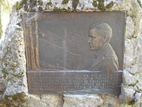
As I came closer to it, I saw that it was a memorial plaque dedicated to Stephen Tyng Mather:

Stephen Tyng Mather Memorial Sequoia national park

This is what the inscription read:

Stephen Tyng Mather July 4, 1867 – January 22, 1930

He laid the foundation of the national park service, defining and establishing the policies under which its areas shall be developed and conserved unimpaired for future generations. There will never come an end to the good he has done.

Stephen Tyng Mather Memorial Plaque at Sequoia national park

While I know that most people won’t think this is something that is worth going out of their way to see when they visit Sequoia national park due to limited time and so many places to see in the park, it’s a secret bit of knowledge that you can try to spy if you ever happen to be in the area…

Tijuca National Park Brazil

Unusually for a city, Rio de Janeiro has its very own National Park within the city. In fact the Tijuca Forest National Park is itself one of the main attractions of Rio, and is famous for being home to Corcovado Mountain, the statue of Christ the Redeemer, and numerous other well-known landmarks and attractions. It’s easy to spend a full day there, whether you’re exploring on foot, bicycle, or in the back of a Jeep being driven by a local guide.

One of the last remaining areas of Atlantic Rainforest in the state, the Tijuca Forest actually isn’t primary rainforest. Until the mid-19th century, what is now Tijuca Forest National Park was covered in sprawling sugar and coffee plantations. As the plantations took their toll on the soil and environment in general, The Portuguese King Dom Pedro II ordered that the forest be replanted to restore the natural splendour of the area. After thirteen years of slave labour, the project was a spectacular success, the results of which can be seen and enjoyed today.

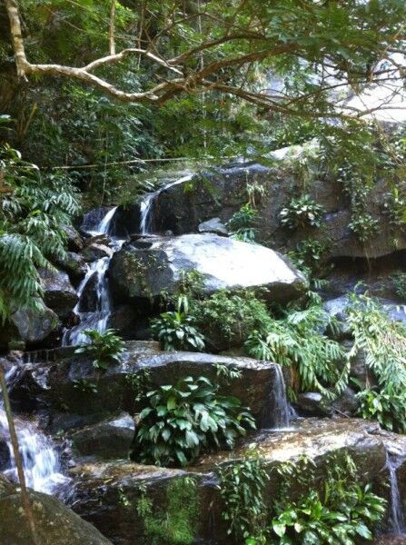
 Rio Corcovado Waterfall Brazil

Like national parks around the world, Tijuca offers a multitude of outdoor activities to its visitors. Mountain climbing is a popular choice, and the park boasts access to a few stone mountains, including Pedra Bonita, Pedra da Gávea, Bico do Papagaio, and Rio’s highest peak, Pico da Tijuca. Any of these spots offer amazing views of the city, and tandem paragliding and hang gliding tours take off from Pedra Bonita for those who really want to engage nature and see Rio from a truly special perspective.

As a protected forest, it probably comes as no surprise that it’s a good place to see animals, and birds in particular. For those interested in bird watching it’s a great spot, as over 500 species of bird call Tijuca home. Even if you’re just casually walking through the forest on your own or as part of a Jeep tour, there’s every chance you’ll see monkeys as well — or at least hear them. There are numerous beautiful waterfalls and streams to be seen as well, and even more options for explorations underground if you’re not the claustrophobic type. Gruta Luiz Fernandez is a limestone cave where visitors to the park can go spelunking, rappelling, or wandering just for fun.

Christ Statue Brazil

Last but not least, and probably a fairly obvious omission thus far, is the statue of Christ the Redeemer, symbol of Rio and even Brazil in general. As one of the New Seven Wonders of the World, it is a sight not to be missed, and though it’s visible from all over the city, it really is different seeing it up close. Apart from the view of the statue itself, looking down on the city of Rio from the vantage point of Corcovado Mountain it absolutely worth the trip up.

Dan Clarke is a regular visitor to Brazil as part of his work for Real Brazil Holidays, a UK tour operator specialising in tailor-made travel to Brazil, including the Tijuca Forest and Iguazu Falls national parks.

Tunnel Log Sequoia National Park

While recently visiting Sequoia National Park, I decided I wanted to see Moro Rock, but the road was closed except to shuttle buses. The shuttle bus stop after Moro Rock is for Tunnel Log. Although the bus I was on was full (all the seats were taken with plenty of people standing), I was surprised when we reached Tunnel Log to see nobody outside and not a soul on the bus move to step outside. I saw this as my chance to escape the weekend crowds for at least a little bit and stepped off the shuttle. The bus took off and, to my delight, I was left there by myself.

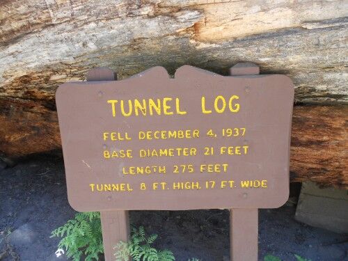
The first thing I did (well, besides a little happy dance to be on my own) was to take a look at the impressive statistics of the hollowed out log:

tunnel log sign Sequoia National Park

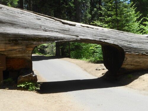
Any tree that is big enough that a car can drive through it is pretty damn impressive:

Tunnel Log at Sequoia national park

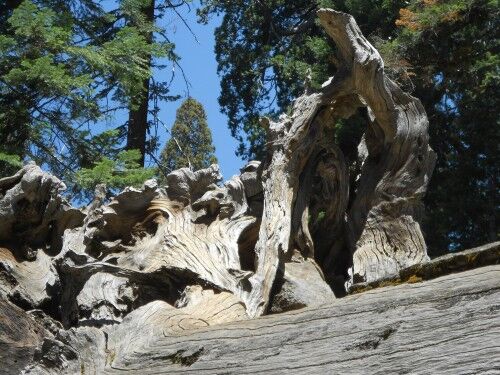
While the tunnel is what I assume most people would focus upon, I also found the weather root system of Tunnel Tree to be both beautiful and on par in impressiveness as the tunnel itself:

root system of Tunnel Log

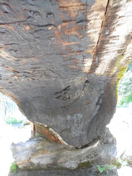
And just because I know most people wouldn’t even bother to take a photo of what the inside roof of the Tunnel Log looked like, I had to do it (charred with graffiti on top)

top inside of Tunnel Log

I am still a little baffled why nobody wanted to explore this area, but I thoroughly enjoyed the chance to do so without anyone else around…

Uccellina Park In Tuscany

My wife and I were staying in a Tuscan villa near Grosseto, and our property owners told us that in the whereabouts there was one of the most unique Italian national reservations, the Uccellina nature park in Maremma. Both my wife and I are hiking and nature lovers, so we could not let this one pass.

We went on a self guided hike that presented very little challenges. Our GPS signaled that along our path we were to climb on the highest elevation of the Maremma region in Tuscany, Poggio Lecci at 417 meters. Our guide book advised to hike that hill to enjoy the best views in the southern part of Tuscany!

Uccellina Park beach

We started our walk from Pratini at around 9:30 AM, since we had 5 walking hours ahead of us and did not want to get caught on our way up during the hottest time of the day. 300 meters into our hike we started climbing up the most difficult section of the trail, the one that takes up to the ridge. Although fatiguing, the higher we climbed the wider and more beautiful the view over the park.

With the increasing elevation the vegetation started to become more sparse, until we reached the summit of Poggio Lecci at 417 meters of altitude. The last stretch was less demanding on our legs, and once there, we stopped for a while to enjoy the wonderful 360-degree views and eat our sandwiches. From here we were able to see the islands of the Tuscan Archipelago: Montecristo, Giglio, Elba, and the peaks of Corsica, which gave us the amazing feeling of being part of something so grand.

After the lunch break, we reached the Abbey of St. Rabano. The original heart of the monastery dates back to the Eleventh century and was a Benedectine-monks settlement of great importance in the Middle Ages. It was sad to see that these ruins are not at all in good shape, even though the restoration process started in the Seventies. Nevertheless, you can discern all the various sections of the structure, and the place holds a magic fascination similar to castles in fairy tales.

Uccellina Park abbey

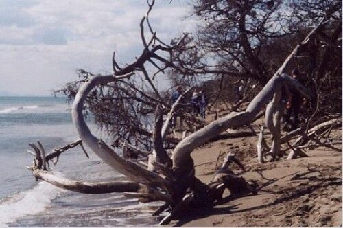
The return route runs along the western flank of the hill, until you reach the so-called Road of Olives. The route is flanked all along by lush vegetation. I could recognize holms, oaks, rosemary bushes and wild strawberry plants. We took a detour towards the beach, where we took off our rigid hiking shoes and deeply enjoyed a refreshing foot bath. We continued along the beach, rich of trees and branches carried by the sea, white-washed by salty waves, resembling sculptures shaped by the wind. We continued until Marina di Alberese, which we reached at about 4:30 PM.

This was just one of 6 possible routes, but I have to say it’s the one I enjoyed the most. We loved the Uccellina Park in the Tuscan Maremma so much that we return there whenever we are traveling to central Italy. It is such a wild and untouched land that it is capable of bringing you back to your adventurous childhood dreams.

Matt loves Tuscany so much that he works as a travel adviser about the region and the best vacation Tuscany villas to rent. You can find great villa deals on Twitter @ThriftyTuscany and Facebook page on Tuscany.

Iguazu National Park in Argentina

By Laura Elise

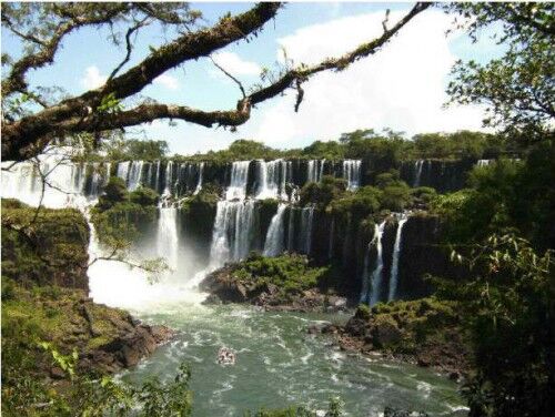
I was never impressed by waterfalls until I visited Iguazu, which I think says something considering I grew up a few hours from Niagara Falls. Iguazu Falls is a complex of 275 waterfalls pouring through the subtropical jungles of Argentina and Brazil. It stretches 1.7 miles across and at its highest plunges 270 feet to the river below. The area surrounding the waterfalls is protected by two national parks: Parque Nacional do Iguaçu in Brazil and Parque Nacional Iguazu in Argentina.

Although I was lucky enough to visit both this past February, I preferred Argentina’s National Park. Although it’s difficult to get “off the beaten path” in either park, there is little reason to want to, as the waterfalls are the main attraction. The area became a National Park in 1934 and a UNESCO World Heritage Site in 1984.

The park is connected by walkways and a mini-train, which takes you to the far end of the park. This is where the largest fall, Devil’s Throat, is located. This horseshoe waterfall plunges dramatically, sending plums of mist high into the air. The view point is reached by metal walkway suspended over the deceivingly tranquil Iguazu River.

Iguazu Falls

Iguazu National Park contains two main walking circuits, called the Upper and Lower Circuit. They correspondingly take you to the best view points to see the falls from the top and bottom of the waterfalls. In 2012, it cost 130 pesos to enter the park (about $30 USD, although you must pay with local currency). Although a boat ride to the foot of the falls costs extra, there are additional activities, such as visiting San Martin Island or hiking the Macuco Trail, which takes about three hours. To see the full panoramic view of the falls, you need to visit the Brazilian side of the falls, which charges an additional entrance fee.

Visitors are allowed to bring food and drink inside the park, a nice option since everything inside the park is a bit pricy. There are also a few drinking fountains where you can refill your water bottle — a rarity in Latin America. And although you’re required to stick to the main paths, you’re still likely to see wildlife. When I was there I saw iguanas, butterflies, coatis (raccoon-type mammals), and many types of birds. The subtropical vegetation contains over 2,000 species of vascular plants, and is extremely lush close to the falls thanks to the constant spray.

This area was originally occupied by the Caingangues Indians and then the Guaranies. The latter gave Iguazu its name, which means “Big Water.” Spaniards arrived to the region in the 1540s.

Laura lives in Peru and writes for SA Luxury Expeditions, a travel company that specializes in South America tours. Due to Iguazu’s remote location, she recommends combining Iguazu tours with a visit to Rio de Janeiro or Buenos Aires. Follow her on twitter @SA_Expeditions. Photo belongs to author.

Nine Great Olympic National Park Hikes

One of the largest parks in the continental United States, the Olympic National Park consists of over 900,000 acres of pristine wilderness, and has more than 2,000,000 visitors every year from around the world visiting its wilderness beaches, temperate rainforests, old growth forests and alpine peaks. The park is also an International Biosphere reserve and World Heritage Site due to its unique composition. The Olympic National Park can be thought of as consisting of four different sections – the Pacific coastal areas, the western Olympics that contain the Hoh Rain Forest and Quinault Rain Forest (the only rain forests in the continental U.S.), the northern Olympics that lie along the Strait of Juan de Fuca and Lake Crescent, and the eastern, drier section of the park that contains typical western U.S. old growth forest.
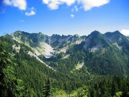
Mount Olympus

Coastal Hikes

coastal hikes at Olympic National Park

Cape Alava Loop: Wilderness beach hiking is one of the rare treats you can do in the Olympic National Park, and the Cape Alava Loop gives you this in spades. The 8.8 mile loop starts in the coastal forest but quickly emerges on the sandy and rocky beaches of the Washington coast, affording hikers with tidepools, sea caves, rocky monoliths, and the wonderful sounds and smells of the ocean. The Cape Alava Loop can be completed in a day, but camp for the night for an unmatched sunset and morning.

Shi Shi Beach and the Point of the Arches: Considered one of the most beautiful beach trails in the region, this area was one of the last to be added to the Olympic National Park in 1976. The trail begins in the coastal rain forest, winding through Sitka spruce and rain-soaked bogs before winding down a steep bluff to Shi Shi Beach. The amazing beauty of this wilderness beach is evident as the trail heads toward Point of the Arches, a long stretch of beach crowded with sea stacks and rock arches. The round-trip takes you 8 miles, with a total elevation change of only 200 feet.

Western Olympics and the Hoh River Area
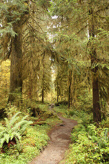
Olympic rainforest

Hoh River: Possibly the busiest location in the Olympic National Park, the Hoh attracts busloads of tourists from Seattle and around the world each summer, and with good reason. Hike the easy trail to Five Mile Island to witness some of the most amazing scenery in the world – the path winds through old growth rainforest on this 10.6 mile round-trip, and the sheer volume of birds and flora is mind-boggling. Though crowded, the Hoh River is one area you can’t miss.

Pete’s Creek: This steep and rough hike thankfully ends with a wonderful payoff – the top of Colonel Bob Peak, at 4500 ft towering above the rainforest-filled valleys below, and offering stunning views of Mount Olympus, Mount Rainier, and Lake Quinault. The 8 mile round-trip hike gains almost 3300 ft in elevation, stepping over rocky creeks, crossing avalanche slopes, and straddling basalt cliffs. But it’s worth it.

Northern Olympics and the Sol Duc Area
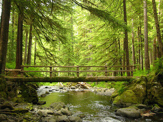
Olympic Sol Duc

Elwha River: The Elwha River is the most important river in one of the largest tracts of old growth forest left in America, and the Elwha River hike takes you through the heart of the area. The Elwha River trail thankfully bypasses the Grand Canyon of the Elwha (which is as steep as it sounds) and continues on for nearly 5 miles through the Olympic interior, affording the wonderful sights of wildflower clogged slopes and fern and moss speckled rocks throughout the hike.

Grand Ridge: One of the highest and most scenic hikes in the Olympics, Grand Ridge is either a short and awesome 5-mile round-trip hike, or a brutal 15 mile out and back haul that few can make. Thankfully the 2.5-mile jaunt to Elk Mountain reaches the highest point on Grand Ridge, and gives hikers a seemingly never-ending view of the glacier-covered Olympic Mountains – at a height of 6600 feet above sea level, you can see from the Strait of Juan de Fuca to Mount Olympus.

Spruce Railroad Trail: An easy 8-mile round-trip along the shores of Lake Crescent, the Spruce Railroad Trail is also one of the few trails in the Olympic National Park to allow mountain bikes. The breathtaking views of Lake Crescent are incredible – the lake is 9 miles long and over 600 feet deep, and the waters are amazingly clear. On a nice day you can see nearly 50 feet into the depths of the lake.

Eastern Olympics and the Hood Canal Area
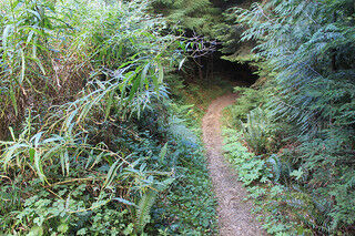
Olympic Quilcene trail

Big Quilcene Trail: One of the great trails on the dry side of the Olympic Peninsula, the Big Quilcene Trail is a somewhat steep 10.6 mile round-trip that climbs about 3500 through the steep valleys and peaks of the Buckhorn Wilderness. The trail ends at Marmot Pass, affording survivors with amazing views from the 6,000 foot elevation. The Big Quilcene Trail is one of the best hikes in the Olympics, with wonderful old growth forest, a crystal-clear river, alpine meadows, and the amazing views from Marmot Pass at the end.

Upper Dungeness River: One of the most beautiful (and easiest) wilderness trails in the Olympics, the Upper Dungeness River Trail never gets too far from the river, always allowing peeks at its crystal-clear water. The trail ends at Camp Handy, situated in a lovely meadow surrounded by old growth Douglas Firs. This is a perfect trail for the young and the new to hiking.

Randall Pinkston is the founder and editor of Neotravel.com Travel, a travel deals aggregator based in Seattle, USA – you can also find them on Facebook and on twitter @neotravel. When not traveling, Randall is most likely thinking about where to travel next.

Creative commons images courtesy of: Jason Pratt, anselm, Brett Holt, smithfischer, lorenzolambertino
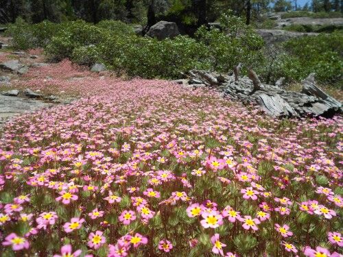
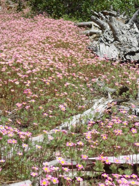
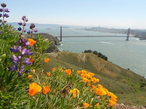
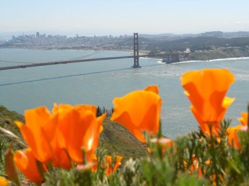
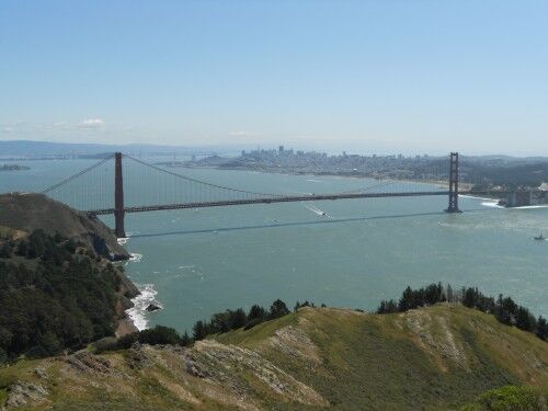
Hawk Hill Golden Gate National Recreation Area

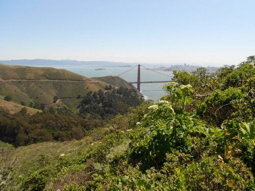
If you are looking for a beautiful and unique view of the Golden Gate Bridge, you definitely want to head to Hawk Hill in Golden Gate National Recreation Area. When driving north, cross the Golden Gate Bridge and take the Alexander Avenue exit which is immediately after the Golden gate Bridge Vista Point turnout where you park to walk across the Golden Gate Bridge. After exiting, turn left and go under the highway. You will then make a right onto Conzelman Road. It’s a fairly steep road and the turn is the first right hand turn yo can make.

There are number of pullouts and parking stops along the road which all offer spectacular views of the Golden Gate Bridge. Hawk Hill is at the very of the hill (approximately a mile up). You’ll go around a small roundabout as you make your way to Hawk Hill and you have reached it when the two-way road turns into a one-way road. Here are a few photos taken from Hawk Hill.

Hawk Hill Golden Gate

Hawk Hill wildflowers

Hawk Hill California poppies

Hawk Hill Alcatraz

Golden Gate Bridge Hawk Hill

Daintree National Park Rainforest: Six Animals You May Encounter

If you are looking to see some unusual animals on your next adventure to Australia, you should seriously consider adding time for a trip to Heritage Daintree National Park to your itinerary. Comprising the largest continuous area of tropical rainforest in Australia, the World Heritage Daintree National Park Rainforest is an ancient wonderland of flora and fauna.

Australia is known for its unique wildlife and Daintree National Park doesn’t disappoint. Known for its rare and diverse wildlife, the Daintree Rainforest contains 30% of all frog, reptile and marsupial species, 65% of all bat and butterflies, and roughly 18% of all bird species found in Australia.

Some of its more interesting inhabitants include:

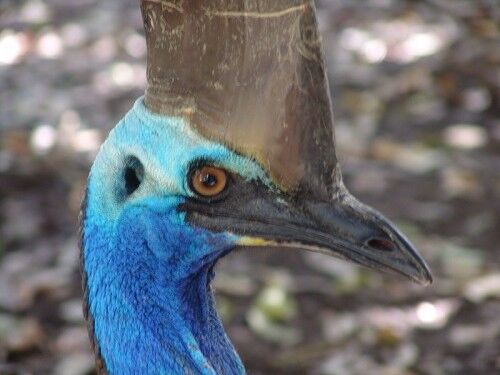
The Cassowary

cassowary

Creating a striking figure against dense rainforest foliage, the Cassowary, Australia’s heaviest flightless bird, looks as if it just walked out of a nearby spaceship. Standing tall, with a pointed head, vivid blue neck and drooping red wattles, the Cassowary helps to disperse rainforest seeds while it feeds on small fruit, plants and a range of unfortunate invertebrates.

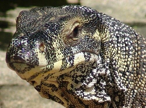
The Lace Monitor

lace monitor

These chunky, wild looking lizards are adept at running, swimming, burrowing and scaling trees, and are clad in camouflage-like skin. A type of navy seal reptile, the lace monitor is known to aggressively launch into bird nests for a hearty feast, while feeding on insects, reptiles and small animals during its more passive moments.

The Musky Rat-Kangaroo

musky rat kangaroo

Drawn towards the creeks and rivers of the rainforest, theses small, dark, hairy marsupials have five toes on their hind foot and move with a type of ‘bunny hop’. Generally a solitary creature, the friendless musky rat-kangaroo hops it way towards the fruits of rainforest trees and small marsupials. It also hangs it hat amongst a bed of dried leaves and ferns at night.

The Osprey

osprey

The majestic looking Osprey is a diurnal fish eater that dwells typically near the ocean, but also near any body of water with the potential for a good meal. Possessing unique, avian, fish hunting characteristics, the Osprey has a reversible outer toe, fit for grabbing slippery fish. It also has a short tail, long narrow wings, and five feather-like fingers to give it an atypical airborne appearance.

The Red Eyed Tree Frog

red eyed green tree frog

More seldom seen than its relative the Green Tree Frog, the Red Eyed Tree Frog, true to its name, has bright red eyes and a glowing green back, giving it an appearance of ‘otherworldliness’. This nocturnal creature roams the dark forests feasting on moths and other insects. Able to create exceptionally loud noises, these vampiric looking amphibians create a ‘waa-aa…waa-aa’ sound, followed by a soft trill.

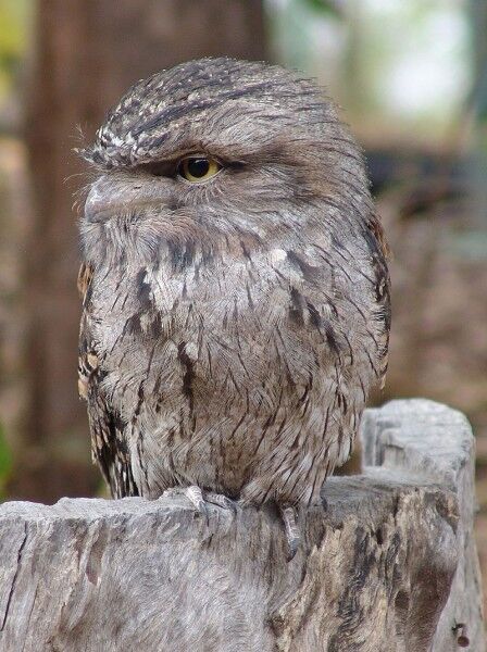
Tawny Frogmouth Owl

tawny frogmouth owl

This nocturnal ‘weak footed’ creature is actually more related to the nightjar than the owl, and can be found in less dense parts of the rainforest. Its plumage is silver-grey, and is streaked and mottled with black and auburn. Creating a deep, soft and continuous ‘oom oom’ sound, this rather clumsy clawed inhabitant is known to fly into car headlights when in pursuit of a good insect.

This post is courtesy of Thala Beach Lodge which is a Port Douglas Eco Resort offering accommodation in close proximity to Daintree National Park.

Purple Sand Beach

I really enjoy finding unique beaches. A prime example is sea glass beach in Fort Bragg. I managed to stumble across another one this weekend when I traveled to Pfeiffer Beach in Big Sur California.

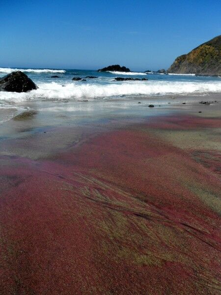
I actually have been to Pfeiffer Beach before (with direction on how to get there), but didn’t realize that it had a little secret — it’s one of the few purple sand beaches in the world. I missed this because the main part of beach doesn’t have much purple sand (if you look closely, you can see little bits here and there, but if you weren’t specifically looking for it, you wouldn’t notice it — at least I didn’t on my first visit).

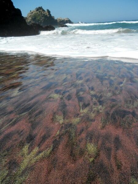
To really see the purple sand, you need to walk beyond the main beach area toward the north. The father up the beach you head in this direction, the more purple sand that can be seen. The easiest place to spy the purple sand is at the base of the hills, but there will be certain areas of the beach that also have purple sand patterns woven into the mix. For those who go to the beach expecting that the entire beach will be purple, they will be disappointed. The vast majority of the beach is white sand like any other beach. There are, however, areas where purple sand mixes with the white sand (usually with black sand as well) to make some wonderful patterns:

purple sand

What is amazing is that each time a wave comes up the beach and washes over the purple sand, the pattern changes making it like a constantly changing giant sand painting:

purple sand beach

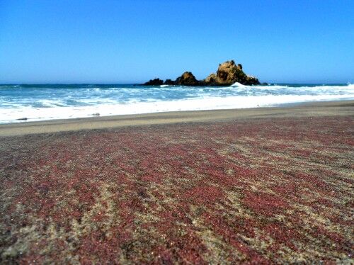
Due to the numerous rock outcroppings just off shore, you can see California Coastal National Monument from Pfeiffer Beach as well:

Pfeiffer beach

The purple sand is the result of manganese garnet deposits which are found in the hills surrounding the beach. For anyone that enjoys seeing the unexpected and interesting phenomenon at the beach, scheduling a day to explore the purple sands at Pfeiffer Beach is definitely worth taking the time to do.