National Parks By State List

the emblem of the National Park Service

The very first post I made on this blog was a list of National Parks in alphabetical order. I recently received an email asking if I had a list of the National Parks by state, and since I didn’t, I decided that it was time to place one on this blog. Only half of the states have at least one National Park (plus the Virgin Islands). Of those 25 states that do have a National Park, 13 only have one National Park while the other 12 have multiple National Parks. Here is a list of National Parks by state:

Alaska National Parks

Denali National Park
Gates of the Arctic National Park
Glacier Bay National Park
Katmai National Park
Kenai Fjords National Park
Lake Clark National Park
Wrangell-St. Elias National Park

Arkansas National Parks

Hot Springs National Park

Arizona National Parks

Grand Canyon National Park
Petrified Forest National Park
Saguaro National Park

California National Parks

Channel Islands National Park
Death Valley National Park
Joshua Tree National Park
Lassen Volcanic National Park
Redwood National Park
Sequoia and Kings Canyon National Park
Yosemite National Park

Colorado National Parks

Black Canyon of the Gunnison National Park
Great Sand Dunes National Park
Mesa Verde National Park
Rocky Mountain National Park

Florida National Parks

Biscayne National Park
Dry Tortugas National Park
Everglades National Park

Hawaii National Parks

Haleakala National Park
Hawaii Volcanoes National Park

Idaho National Parks

Yellowstone National Park

Kentucky National Parks

Mammoth Cave National Park

Maine National Parks

Acadia National Park

Michigan National Parks

Isle Royale National Park

Minnesota National Parks

Voyageurs National Park

Montana National Parks

Glacier National Park

North Carolina National Parks

Great Smoky Mountains National Park

North Dakota National Parks

Theodore Roosevelt National Park

Nevada National Parks

Great Basin National Park

Ohio National Parks

Cuyahoga Valley National Park

Oregon National Parks

Crater Lake National Park

South Carolina National Parks

Congaree National Park

South Dakota National Parks

Badlands National Park
Wind Cave National Park

Texas National Parks

Big Bend National Park
Guadalupe Mountains National Park

Utah National Parks

Arches National Park
Bryce Canyon National Park
Canyonlands National Park
Capitol Reef National Park
Zion National Park

Virginia National Parks

Shenandoah National Park

Virgin Islands National Parks

Virgin Islands National Park

Washington National Parks

Mount Rainier National Park
North Cascades National Park
Olympic National Park

Wyoming National Parks

Grand Teton National Park
Yellowstone National Park
Lake Helen Lassen Volcanic National Park

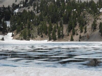
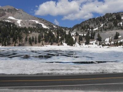
Lake Helen at Lassen Volcanic National Park, much like Emerald Lake (which is just below it), is still covered with a thin sheet of ice even though it’s the middle of August. In fact, it has quite a bit more ice than Emerald Lake:

Lake Helen at Lassen Volcanic national Park

ice covered Lake Helen at Lassen Volcanic National Park

Lake Helen can be seen both from the Main Park Road and while on Bumpass Pass trail, but with all the snow it was a bit too dangerous for me to go down to the lake edge (there are a lot of “thin ice” hazard warning signs all around) since in many areas it’s difficult to tell where the snow on the ground ends and the thin lake ice begins. I’m sure this is another beautiful lake with crystal clear water that delivers a magnificent reflective photo opportunity when all the snow is gone and the sky is blue and I hope I get a chance to get back in the near future to see it this way as well.

Emerald Lake Lassen Volcanic National Park

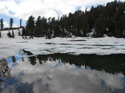
Being August, I knew that Lassen Volcanic National Park would be much more snow free than it was on my last visit. Even so, the park was definitely not snow free. Driving Main Park Road, I reached Emerald Lake to find that half the lake still had a sheet of thin ice covering it:

Emerald Lake covered with ice at Lassen Volcanic National Park

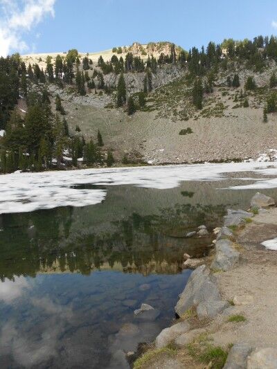
I’m sure that when Emerald Lake is free of ice and it’s a clear day, the reflection in it is absolutely beautiful. I was able to get a small glimpse of this on the side that was somewhat free of ice:

reflection in Emerald Lake at Lassen Volcanic National Park

Rock Slide Grand Canyon National Park Rafting

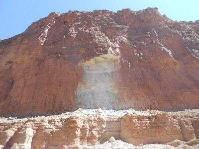
One of the most interesting things I learned while river rafting down the Colorado River in Grand Canyon National Park is that much of the Grand Canyon sandstone isn’t originally red. When you look from the rim of the Grand Canyon down toward the river and see the huge expanse of red sandstone walls, it isn’t difficult to assume that all that color is the original color of the canyon walls. In reality, much of the lower Grand Canyon walls that are red in appearance have simply been stained on the outside by upper layers of the canyon that are red. A perfect illustration of this is the scar left by a recent rock slide within the Grand Canyon we came across after leaving Redwall Cavern:

Grand Canyon rock slide Colorado River rafting

As the rock slide shows, the color of the rock is actually white and not the red of the surrounding rock that has been stained over time. Of course, this newly exposed rock will also eventually get stained to the red we all associate with the Grand Canyon, but I found it interesting to consider what impressions we would all have of the Grand Canyon if it were mostly white instead of red…

Limekiln Falls Limekiln State Park

I always love when I come across the unexpected. As I was traveling highway 1 down the coast of California, I heard that it would be worthwhile stopping at Limekiln State Park (CA) to see the waterfall that they had there. I enjoy waterfalls and think that they have a mysterious beauty in themselves so it was a no brainer that I would make the stop, but I was pleasantly surprised at how beautiful Limekiln Falls actually is.

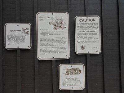
There isn’t much parking at Limekiln State Park (maybe 20 spaces total outside of the camping area) as it is mainly a place set aside for those camping. To get to the Limekiln Trail (which will lead to Falls Trail), you park your car and head toward the bathrooms at the end of the parking lot. As you pass the bathrooms, you’ll get a see of all the dangers that you could face on the trail.

hiking warning signs displayed at Limekiln State Park

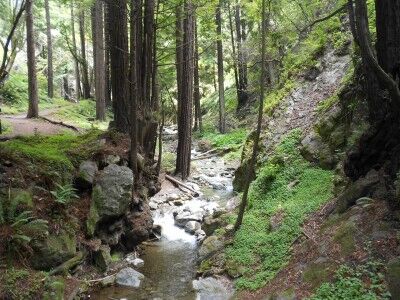
Once past the bathrooms, you need to walk through the camp ground to the far end where the Limekiln Trail Head is located. Once on the trail, it will fork about 200 yards in with Hare Creek Trail to the right and Limekiln Trail to the left following Limekiln Creek:

Limekiln Creek at Limekiln State Park California

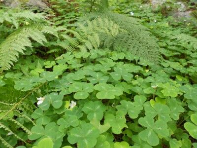
The trail is shaded and cool with huge clovers covering the ground in many areas:

giant clovers at Limekiln State Park California

Stay to the left at the fork on Limekiln Trail and about 1/4 of a mile further on the trail will fork again with Limekiln Trail to the left and Falls Trail to the right. Stay right. Once you reach this fork, it’s about another half mile to the falls (about 1 mile in total).

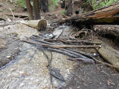
The Falls Trail has some obstacles, but most people should be able to manage it. There are several places where you must cross Limekiln Creek. Fallen branches and logs have been placed down at these crossings, but it does require a bit of balance if you don’t want to fall into the water:

Creek crossing Limekiln Creek California

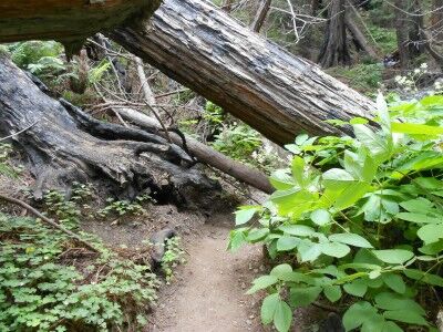
There are also several places where fallen trees have blocked the trail and you must scramble under or over them to remain on the trail:

fallen tree across Falls Trail at Limekiln State Park

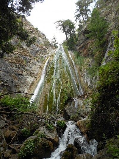
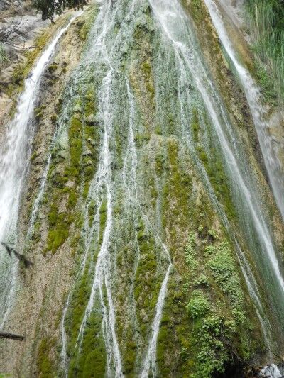
Once you reach Limekiln Falls, I immediately realised why people recommended to place it on the lists of places to see. The waterfall fans out and much of it cascades down mossy vegetation in the center of the falls. It reminded me a bit of the waterfalls in Fern Canyon at Redwood National Park, but on a much larger scale (it’s about 100 feet in height) and with the sun making everything sparkle:

Limekiln Falls at Limekiln State Park California

close-up of Limekiln Falls at Limekiln State Park

If you happen to being driving the coast of California, it’s definitely worthwhile making a stop to see this waterfall. If interested, here are some more photos of Limekiln State Park. Unfortunately, Limekiln State park is on the list of California State parks to close.

Redwall Cavern Grand Canyon National Park Rafting

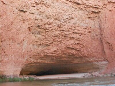
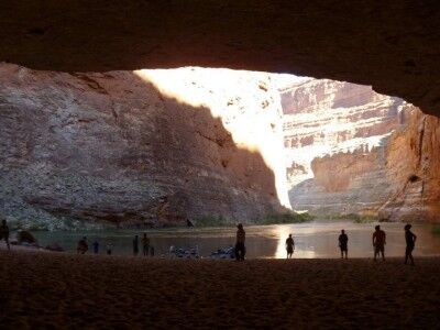
Located between mile 33 and 34 along the Colorado River in Grand Canyon National Park (and just over a mile downriver from Vasey’s Paradise) Redwall Cavern is a giant symphony-sized amphitheater created by the river eroding away the limestone Grand Canyon walls. John Wesley Powell, upon seeing Redwall Cavern, guessed that 50,000 people would fit into it. Although it would be a perfect place to camp, it’s one of the sandbars along the Colorado River where it’s prohibited to camp or build fires.

Redwall Cavern Colorado River rafting

When you land at Redwall Cavern, you will immediately see the fresh feet and tail tracks of countless lizards and other small animals that make their home within the cavern. The wide open space in the shade makes for a perfect place to take out a football or Frisbee to toss around with friends, and it’s a must to walk to the back of the cavern to touch the far wall (this gives you a good perspective on how big Redwall Cavern really is).

Redwall Cavern looking onto the Colorado River
Photo courtesy of Angela Saurine escape.com.au

If you look closely at the rocks toward the front left (when looking out at the river) of Redwall Cavern, you should be able to spot fossils within them. Our guide showed us some and then I spent about half an hour looking at the rocks and found numerous other fossils within the rocks there.

Monitoring Glaciers at Mount Rainier National Park

In the continuing series of videos I have been posting about National Park science (Restoring Native Prairies, Black Bear Science and Tidepool Science), the latest science video talks about monitoring glaciers at Mount Ranier National Park and the three main reasons that it is done:

1. To monitor changing habitats for species and the alpine food web.
2. To monitor for indicators of climate change.
3. To monitor water levels.

The scientists visit at least twice a year to monitor the amount of snow that has accumulated and then how much melt has occurred. This has shown that there has been a decrease of the glacier area of more than 50% in the last century:

National Park Service scientists have been monitoring glaciers at Mount Rainier, North Cascades, and Olympic national parks to document their rates of growth and decline. Not only are glaciers awe-inspiring elemental forces, but they are absolutely critical resources for northwest ecosystems and for human populations. Glaciers are also the clearest evidence of climate change. Measuring glaciers is not for the faint of heart. Besides snow, ice, blasting winds, and crevasses, the necessary equipment is heavy and the distances on foot are long and go up steeply. This video features the people who do this tough work.

Vasey’s Paradise Grand Canyon National Park Rafting

While it’s possible to hike to Vasey’s Paradise (also called Vaseys Paradise) from Stanton’s cave (only about 1/4 of a mile further away), I chose not to do so. There is thick vegetation at the bottom of Vasey’s Paradise includes the one area in Grand Canyon National Park where poison ivy is abundant, and getting poison ivy was not how I wanted to spend my grand canyon rafting trip. It’s also where the critically endangered Kanab Ambersnail lives.

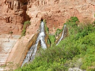
Vasey’s Paradise is the first waterfall on the Colorado River rafting trip which flows year round (there are plenty of waterfalls along the river that are active during flash floods, but quickly dry up). Vasey’s Paradise was named after a botanist who travelled with Powell surveying the river in 1868. The waterfall gets its water from rain that seeps through the upper sandstone layers of the canyon until it hits harder rock where it gathers. It flows out from the upper cliff faces from two cave holes in the canyon wall.

Vasey's Paradise waterfall

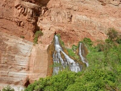
This is the first oasis that is seen from the river on the rafting trip, but for the aforementioned reason, isn’t a place where rafts usually stop to explore. It does make for a wonderful contrast to the desert environment as you float past it down the river.

Vaseys Paradise waterfall from Colorado River

Stanton’s Cave Grand Canyon National Park Rafting

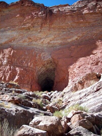
With the South Canyon hike thwarted, I decided to try and make my way to Stanton’s cave in Grand Canyon national Park. To make it to Stanton’s cave from our camping area was a short hike downriver toward Vasey’s Paradise after climbing up a rock ridge above the beach. A good pair of hiking shoes is definitely recommended if you want to attempt this hike.

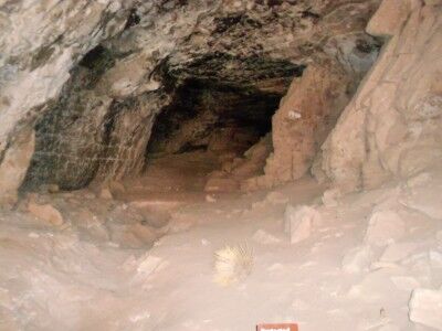
Stanton’s cave is quite large and many artifacts were discovered in it, but it is no longer possible to access the cave as there have been large steel bars placed across its entrance to protect the endangered Townsend’s big-eared bats that live and roost there (This is a good resource if you are looking for more information on the history of Stanton’s cave and bats, and preservation efforts that have taken place over the years). While the cave does first appear to be a former mine and the original signing describes it as such, it’s actually a natural cave.

hiking to entrance of Stanton's Cave

view of Stanton's cave through restricting bars

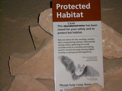
Just inside the bars is a sign explaining why the cave is blocked:

bat sign found in Stanton's Cave

Protected Habitat

This abandoned mine cave has been closed for your safety and to protect bat habitat.

Bats use mines for day roosting, rearing their young during summer, hibernating during winter, gathering for social activities such as courtship and mating, and for crucial rest stops during nightly feeding or spring and fall migrations.

Bats are among the world’s most beneficial but vulnerable mammals. Townsend Big-Eared Bat

The hike to Stanton’s cave is about half a mile (1 mile round trip) from the South Canyon camping beach. It does require some rock scrambling to get up to the ridge above the beach. A path is well worn to the cave, but you do need to be cautious while walking it as there are quite a few loose rocks. Simple head in the direction of Vasey’s Paradise. You may also spot big horn sheep while hiking to the cave (I did).

Pfeiffer Beach National Forest

Pfeiffer Beach (run by the National Forest Service) is a hidden gem where you may be able to escape the crowds clogging up all the other beaches and state parks along highway 1 in the Big Sur area of California. There are a couple of reasons for this.

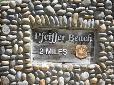
First, the Pfeiffer Beach isn’t marked with a sign along highway 1 so you would drive right on by it unless you knew exactly where to turn. Coming south on highway 1, it is 0.5 miles past the US Forest Service Ranger Station. You make a tight right turn when you see the yellow “Narrow Road” sign (which you need to be looking for because it’s hidden a bit too — there is no sign for “Pfeiffer Beach”). About 100 yards down the road you will get confirmation that you are one the correct road when you see this sign:

The second reason that less people go to this beach is that the next two miles of road down to the beach are mostly one lane so that campers and RVs can’t make it down it. Combine the lack of marking and the no RVs and you have a beach that, although beautiful, gets a lot less traffic than the other beaches in the Big Sur area.

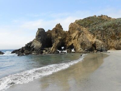
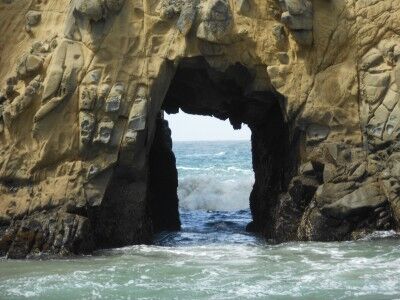
The beach has plenty of sand with a number of rocky outcrops just offshore, many with arches and tunnels within them:

There is a small creek that runs down the beach and empties into the ocean. Sea lions playing in the waves just offshore when I was there and the many rocks outcroppings (which also make Pfeiffer beach part of the California Coastal National Monument) were the home of sea birds and resting sea lions. There is a $5 fee to enter. If interested, here are more photos of Pfeiffer Beach. It’s definitely a beach to visit, especially when the crowds at the other main stops are beginning to get to you.