Point Bonita Lighthouse Trail Golden Gate National Recreation Area

While nearly everyone that visits San Francisco makes sure to visit the Golden Gate bridge, they often miss the other scenic areas of Golden Gate national Recreation Area that they certainly would want to see if they were a little better informaed and knew were just a few miles away. One of these is the Point Bonita lighthouse and hike.

While the main goal of doing the short hike to make your way to Point Bonita Lighthouse and the new Point Bonita lighthouse bridge, you should certainly slow down a bit and not make a beeline for the lighthouse. Taking your time will allow you to take advantage of the beautiful sights along the way. There are plenty of gorgeous views of the California coastline at the Marin Headlands, along with an abundance of wonderful plant life and trees which make for some incredible photographic opportunities:
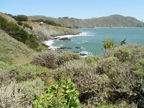
point bonita lighthouse trail scenery

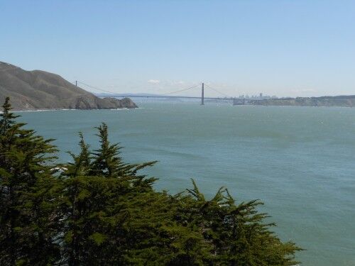
This includes some beautiful views of the Golden Gate Bridge that many visitors to San Francisco never see:
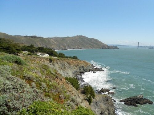
Point Bonita lighthouse trail start

point bonita lighthouse trail Golden gate bridge

The trail definitely is not flat with a hill that you descend (and thus must climb back up on the way out), bit it is paved and is wheelchair accessible:
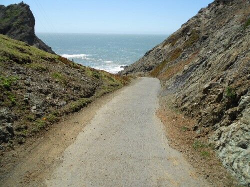
point bonita lighthouse trail path

In addition to the beautiful views, there is also the opportunity to see wildlife such as harbor seals basking on the rocks just offshore below the cliffs:
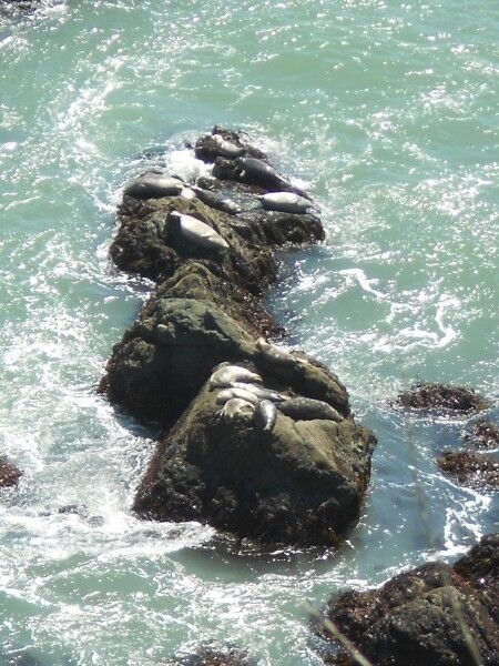
point bonita lighthouse trail harbour seals

Toward the end of the trail you reach a tunnel that you must go through to reach Bonita lighthouse. When the lighthouse is open to the public (Saturdays, Sundays and Mondays from 12:30 PM to 3:30 PM), the tunnel is open. When the lighthouse is closed, there is a steel door that blocks you from entering which also means that you can’t see the lighthouse even from a distance:
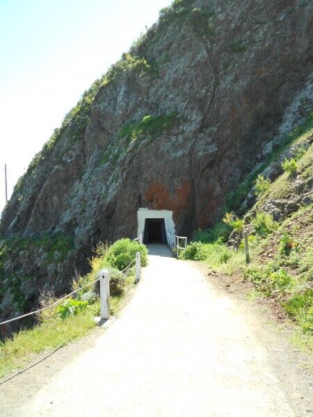
point bonita lighthouse trail tunnel

Once you make it through the tunnel, you emerge to see this breathtaking sight:
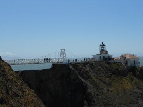
point bonita lighthouse

If you have the opportunity to visit San Francisco, make sure that you give yourself at least a full day to explore some of the lesser known areas of Golden Gate National Recreation Area…
Route 66 Petrified Forest National Park

As you drive through Petrified Forest national park in Arizona, you’ll reach a highway overpass which separates the painted desert section of the park from the petrified forest area. To the north of this overpass is an unexpected displays on the side of the road which celebrates old Route 66. The old Route 66 used to travel right through Petrified Forest national park, and this small display is a recognition of this part of the park’s past.

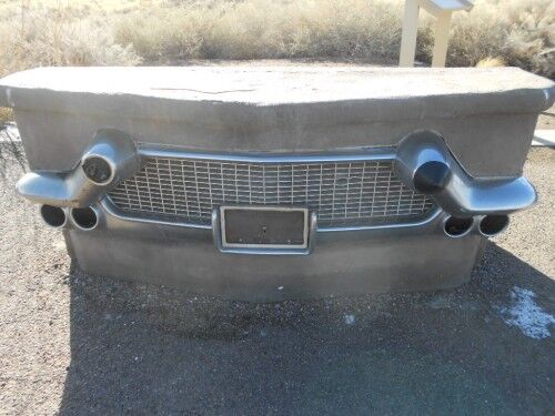
There are several parts to the display. The first one you come across is a bench with the back side displaying the bumper and tail lights of an older car:

route 66 car bench bumper

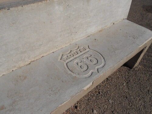
The front side of the cement bench has the Route 66 logo / sign etched into the sitting area:

route 66 car bench

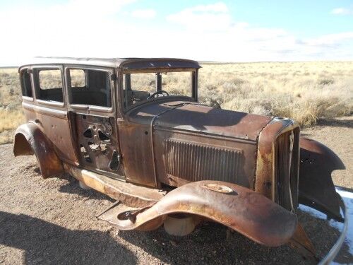
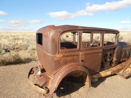
Probably the most prominent part of the display (which seems to catch most people’s eyes as they drive by) is an old, rusted-out car.

route 66 car

route 66 old car

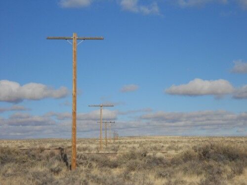
While the bench and the old car are what most people seem to focus on when visiting this display, for me the most interesting part of it was the long, abandoned line of telephone poles. Looking at them shows exactly where Route 66 once ran (if you click on the photo to enlarge it and look closely at some of the distant poles, you can see some still have the glass conductors used for the lines on them)

route 66 telephone poles

This is what the informational sign at the display says:

You are standing near old Route 66. The line of the roadbed and the telephone poles in front of you mark the path of the famous “Main Street of America” as it passed through Petrified Forest National Park. From Chicago to Los Angeles, this heavily traveled highway was not only a road, it stood as a symbol of opportunity, adventure, and exploration to travelers.

A trip from Middle America to the Pacific Coast could take about a week — no interstate speeds here! For many, the journey was not just across miles, it was across cultures and lifestyles — from the most mundane to the exotic. Of course, getting to your destination was important, but the trip itself was a kind of reward. From the neon signs of one-of-a-kind motels to burger and chicken fried steaks of the multitudes of restaurants, from the filling stations that served as miniature oases to gaudy tourist traps, these more than 2,200 miles of open road were magical.

While it’s the unexpected beauty of Petrified Forest national park which makes it one of my favorite parks, I think it’s well worthwhile making this quick stop to learn a little about the history of the park as it relates to those traveling across the US.

Devil’s Golf Course Death Valley National Park

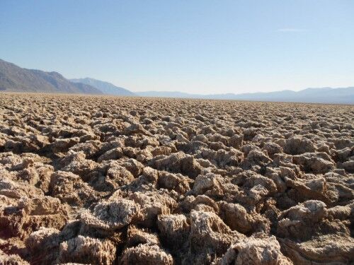
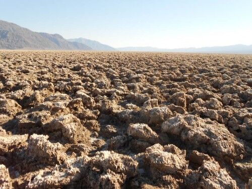
One of my favorite places in Death Valley is the Devil’s Golf Course. A lot of people skip this area because they’re in a hurry to reach Badwater Basin, the lowest point in the continental US at 282 feet below sea level (and all the temporary graffiti that is unfortunately there). While Badwater certainly shouldn’t be missed, taking some time to go down the half-mile dirt road which leads to the Devil’s Golf Course is well worth the time.

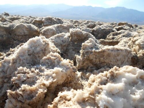
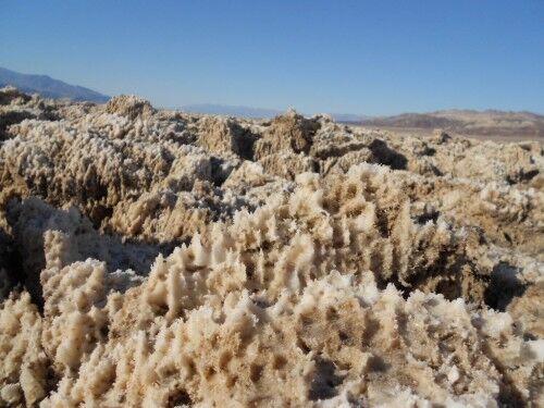
One of the most surprising aspects of this area is that the bigger salt crystals aren’t easily broken (there are more delicate crystals which can be found hidden in the crevices which are fragile). From a distance, the large crystals look delicate, but as soon as you touch one you know why this area received the name it did. Not only are they hard, they are sharp and pointy. It’s no coincidence that there are warning signs all around the area letting people know that “a fall cold result in painful cuts or even broken bones.”

devil's golf course

death valley devils golf course

salt flat devils golf course

death valley national park

This is how the information sign in the area describes the Devil’s Golf Course formation:

Crystallized salts composed the jagged formations of this forbidding landscape. Deposited by ancient salt lakes and shaped by winds and rain, the crystals are forever changing.

Listen carefully. On a warm day you may hear a metallic cracking sound as the salt pinnacles expand and contract.

The Death Valley saltpan is one of the largest protected saltpans in North America. Salt continues to be deposited by recurring floods that occasionally submerge the lowest parts of the valley floor. Delicate salt formations are hidden among the harsh and rigid spires. Close inspection may reveal the tiny salt structures. Take care — one curious touch can cause them to crumble.

So if you’re visiting Death Valley, be sure to set aside a little time to visit this area. You won’t regret it.

Is Rock Stacking Graffiti?

I wrote recently about people feeling free to scratch their names into the salt beds at Badwater in Death Valley National Park and whether we should be ambivalent toward this “temporary” graffiti. Even if nature can eventually erase it, doesn’t it just encourage others to mark more areas of our national parks with their names where it’s not nearly as easy for nature to remove the graffiti?

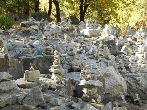
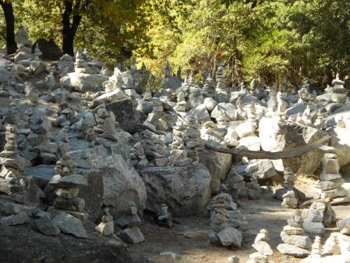
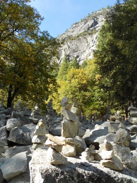
Here is another one of those questions that I recently began to wonder about with a recent trip to Yosemite National Park. Just beyond Mirror Lake to the left is a large area that has been completely taken over by rock stacking. There are literally thousands of rocks which have been stacked and balanced by people completely transforming this are from its natural state:

rock stacking near mirror lake

rock stacking mirror lake

rock stacking Yosemite

The first reaction from most of the people who stumbled across it was the thought it might be a cemetery of some type, but it quickly becomes apparent that people simply decided to begin stacking rocks and continue to do so. While many would not consider this being nearly as disruptive as people scratching their name into sandstone or spray painting their name on walls, isn’t rock stacking nothing more than another way of leaving a type of graffiti in our national parks by moving nature into unnatural arrangements? Just because it looks better than a name written on a rock, does that make it OK to do?

What do you think? Is rock stacking fundamentally different from other types of graffiti and therefore OK, or is it something that should be discouraged just as much as what we would consider typical graffiti?

Cholla Cactus Garden Joshua Tree National Park

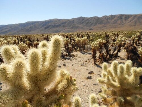
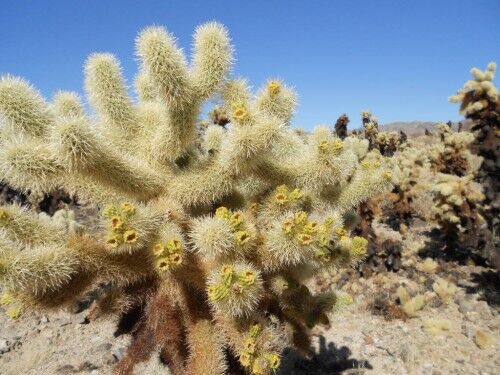
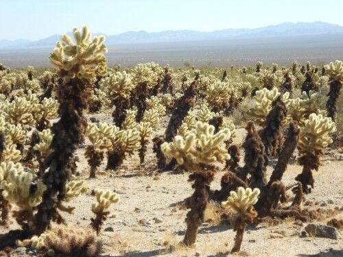
While certainly most famous for the Joshua Tree, Joshua Tree national park has a variety of other plant life that is well worth exploring. Just like it’s worth taking the time to stop to see the Ocotillo in the southern part of the park, it’s most definitely worthwhile stopping at the Cholla (pronounced choy-ya) Cactus Garden located in the Pinto Basin (which usually only receive 4 inches of water a year) near the center of Joshua Tree national park.

Cholla cactus garden Joshua Tree national park

It’s a pretty amazing sight, and the Cholla cactus looks terrifyingly like a cactus that you would never want to mess around with. In fact, there is a great quote on the information sign before entering the cactus garden:

“If the plant bears any helpful or even innocent part in the scheme of things on this planet, I should be glad to hear of it.” — J Smeaton Chase

cholla cactus

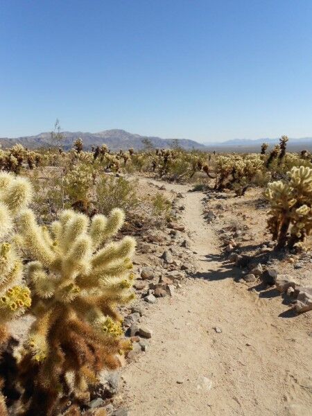
The cactus garden has a short 1/4 mile nature trail that is definitely worth taking, but be sure to leave the dogs behind (they aren’t allowed and wouldn’t fare too well against the Cholla) and keep a close eye on children so they don’t try to touch the cactus (the spines are needle sharp).

Cholla cactus garden path

One thing you will immediately notice is that it appears that a fire recently swept through the area burning the base of most of the Cholla in the garden:

Cholla Cactus fire

The truth is that this is natural and simply the dead spines of the Cholla cacti, and none of these have ever been burned. Even with the dark discoloration, the plants are healthy with the upper portion of the plant continuing to grow new stem segments. These segments with drop off as the plant gets older which will then produce a new plant.

I had not expected to see the Cholla cactus garden while driving through Joshua Tree, but I’m definitely glad that I made the stop. The sheer concentration of them in this one area is breathtaking and certainly a sight to see. In many ways, they were just as impressive as the Joshua trees, just in a different way. If you find yourself anywhere near the garden while driving through the park, it’s a stop that you won’t regret making even if it takes you a little bit out of your way.

2012 National Park Photo Contest

A call to all amateur photographers (you can’t earn 20% or more of your income from photography to participate) out there that love to visit national parks — the 2012 national park photo contest is live. This is a great excuse to get out into national parks to take photos while enjoying the beautiful scenery. If this sounds like something that would interest you, here are the details:

The photo contest has a goal of highlighting the best of America’s national parks (the photos must be taken on land owned by the National Park Service, the U.S. Bureau of Land Management, the U.S. Bureau of Reclamation, the U.S. Fish and Wildlife Service or the U.S. Forest Service). The winning photo will be featured on the America the Beautiful National Park Pass for 2014.

Photographs which are eligible need to be taken between January 1, 2010 and December 31, 2012. Photo entry submissions will be accepted from June 28, 2012 to December 31, 2012. Photo winners will be announced by March 15, 2013 in the following five categories:

  • Adventure and Outdoor Recreation
  • Historical and Cultural
  • Scenic, Seasons and Landscapes
  • Friends, Family and Fun(ny) on Federal Lands
  • Wildlife

All contest photo entries will be judged by the following five criteria:

  • Originality
  • Artistic Composition
  • Technical Quality
  • Photographic Technique
  • Showcasing the best of America’s recreational opportunities

The contest sponsors ask that you follow these rules when taking your photos and submitting them:

  • No photo manipulation except for cropping, red-eye removal and/or adjustment of contrast and brightness
  • No breaking of any laws or rules on federal lands
  • Stay safe — don’t put yourself in danger to get the photo
  • Refrain from taking photos of anything that is inappropriate, indecent or obscene

The contest’s grand prize is $15,000 with the winner’s photo being places on the 2014 America the Beautiful National Park Pass. Second prize is $10,000 and an America the Beautiful National Park Pass. Third prize is $2,500 and an America the Beautiful National Park Pass. There are also a number of honorable mention prizes that consist of 2-night hotel stays at historic hotels across the U.S.

To participate, get more information and submit photos for the 2012 National Park Photo Contest, go to sharetheexperience.org. You should only submit photos that you have taken between the dates listed and all photos should be in JPEG format. All contest photos should be high-resolution 3 mb or larger as the winning photos must work in print. You can find the official rules here (PDF).

Stephen Tyng Mather Memorial Plaque Sequoia National Park

One of the things I like most about wandering in national parks is that by simply taking a path a bit different than most people, you often stumble upon little things that many people may not know about. Walking along the road from Tunnel Log to Crescent Meadow (the road was closed to traffic except shuttle buses, so it seemed to be a great way to get some solitude on a busy weekend at Sequoia National Park when there were a lot of people at most places), I spied a something off on the left hand side of the road. While I wouldn’t say that the area was overgrown, it was definitely not a place that had been kept pristine.

The rock was off the road a ways and shrouded by trees so that most people driving by in the shuttle bus or in their own car would never even notice it was there. Even if they did happen to see it, there is no turn-out or place for a car to stop. Only those who happen to be walking in that area are likely to have ever seen it.

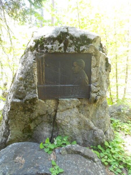
As I came closer to it, I saw that it was a memorial plaque dedicated to Stephen Tyng Mather:

Stephen Tyng Mather Memorial Sequoia national park

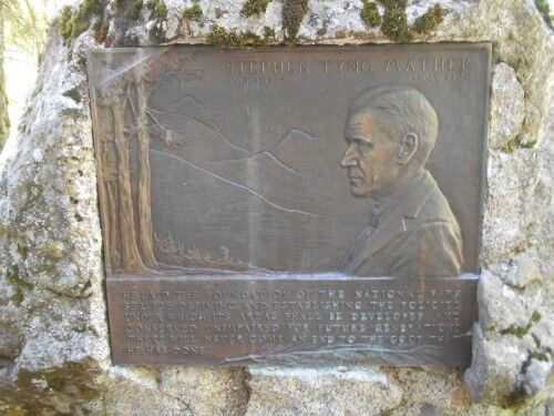
This is what the inscription read:

Stephen Tyng Mather July 4, 1867 – January 22, 1930

He laid the foundation of the national park service, defining and establishing the policies under which its areas shall be developed and conserved unimpaired for future generations. There will never come an end to the good he has done.

Stephen Tyng Mather Memorial Plaque at Sequoia national park

While I know that most people won’t think this is something that is worth going out of their way to see when they visit Sequoia national park due to limited time and so many places to see in the park, it’s a secret bit of knowledge that you can try to spy if you ever happen to be in the area…

Tunnel Log Sequoia National Park

While recently visiting Sequoia National Park, I decided I wanted to see Moro Rock, but the road was closed except to shuttle buses. The shuttle bus stop after Moro Rock is for Tunnel Log. Although the bus I was on was full (all the seats were taken with plenty of people standing), I was surprised when we reached Tunnel Log to see nobody outside and not a soul on the bus move to step outside. I saw this as my chance to escape the weekend crowds for at least a little bit and stepped off the shuttle. The bus took off and, to my delight, I was left there by myself.

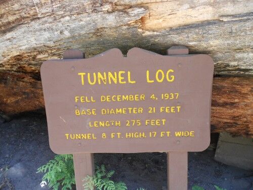
The first thing I did (well, besides a little happy dance to be on my own) was to take a look at the impressive statistics of the hollowed out log:

tunnel log sign Sequoia National Park

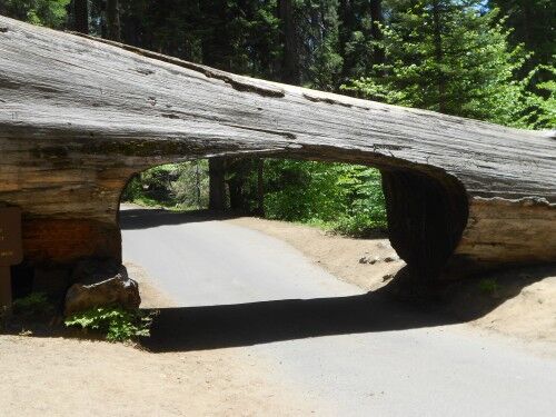
Any tree that is big enough that a car can drive through it is pretty damn impressive:

Tunnel Log at Sequoia national park

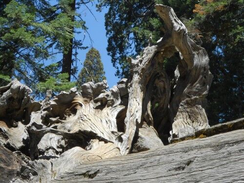
While the tunnel is what I assume most people would focus upon, I also found the weather root system of Tunnel Tree to be both beautiful and on par in impressiveness as the tunnel itself:

root system of Tunnel Log

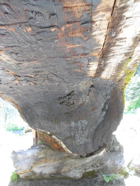
And just because I know most people wouldn’t even bother to take a photo of what the inside roof of the Tunnel Log looked like, I had to do it (charred with graffiti on top)

top inside of Tunnel Log

I am still a little baffled why nobody wanted to explore this area, but I thoroughly enjoyed the chance to do so without anyone else around…

National Park Anti-Graffiti Sign

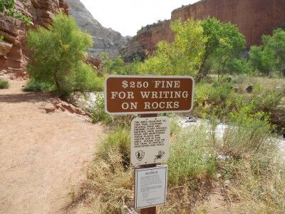
One of the things that distresses me when visiting the National Parks is that is seems that more and more people find it necessary to leave their name inside the National Parks. I’m not sure why people feel the need to deface these natural wonders — what is it that makes people think that it’s a good idea to spray paint or carve their name into the rocks at National Parks? It saddens me to no end that signs like this actually need to be posted these days in National Parks (this one was found at Capitol Reef National Park):

anti-graffiti sign in National Park

I remember hiking in Arches National Park well away from the most visited places and running into a ranger that was cleaning up marks that people had left on some of the remote arches. He said it was a constant battle because if people see that one person has done it, they feel it’s OK for them to do it as well. Sharpie markers, along with gum, were the bane of his existence.

If you ever see park rangers out and about cleaning the natural wonders that we visit, be sure to thank them — and don’t be shy in discouraging anyone from marking natural wonders in the National Parks…

Summer at Crater Lake National Park

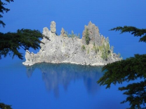
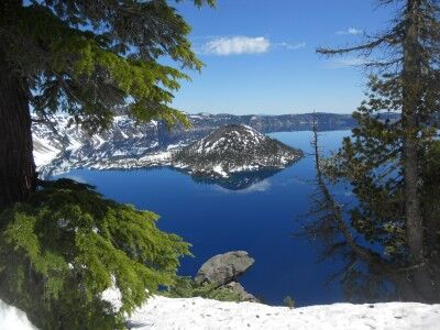
I made my first visit to Crater Lake National Park (OR) earlier this year and was greeted with a lot of snow. I thought that another trip on the first day of summer would be a fun idea and quickly discovered that there is still a lot of snow up there with virtually all hiking paths still closed due to snow. Still, that didn’t stop me from taking some beautiful photos:

Crater Lake National Park on the first day of summer (June 21) in 2011

More Photos of Crater Lake

I also shot a short video of Crater Lake from the viewing area just below the visitors center:

While camping is possible and some camp grounds have been cleared of snow, they are still surrounded by as much as 10 feet of snow making for some cold weather camping. For those looking to visit Crater Lake and want to do a bit of hiking and camping, I would wait until well into July for the snow to melt off. I certainly will be back with the hopes of being able to hike some of the trails on my next visit.