Vasey’s Paradise Grand Canyon National Park Rafting

While it’s possible to hike to Vasey’s Paradise (also called Vaseys Paradise) from Stanton’s cave (only about 1/4 of a mile further away), I chose not to do so. There is thick vegetation at the bottom of Vasey’s Paradise includes the one area in Grand Canyon National Park where poison ivy is abundant, and getting poison ivy was not how I wanted to spend my grand canyon rafting trip. It’s also where the critically endangered Kanab Ambersnail lives.

Vasey’s Paradise is the first waterfall on the Colorado River rafting trip which flows year round (there are plenty of waterfalls along the river that are active during flash floods, but quickly dry up). Vasey’s Paradise was named after a botanist who travelled with Powell surveying the river in 1868. The waterfall gets its water from rain that seeps through the upper sandstone layers of the canyon until it hits harder rock where it gathers. It flows out from the upper cliff faces from two cave holes in the canyon wall.
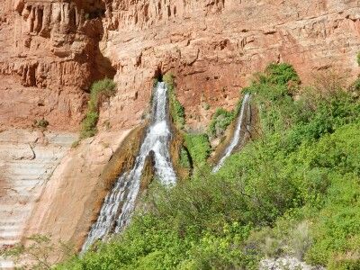
Vasey's Paradise waterfall

This is the first oasis that is seen from the river on the rafting trip, but for the aforementioned reason, isn’t a place where rafts usually stop to explore. It does make for a wonderful contrast to the desert environment as you float past it down the river.
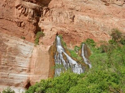
Vaseys Paradise waterfall from Colorado River

Stanton’s Cave Grand Canyon National Park Rafting

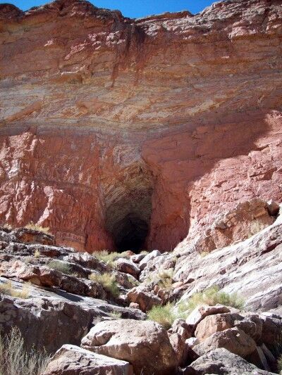
With the South Canyon hike thwarted, I decided to try and make my way to Stanton’s cave in Grand Canyon national Park. To make it to Stanton’s cave from our camping area was a short hike downriver toward Vasey’s Paradise after climbing up a rock ridge above the beach. A good pair of hiking shoes is definitely recommended if you want to attempt this hike.

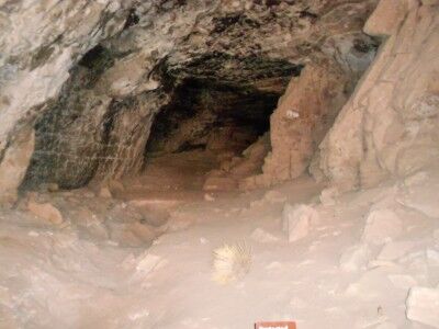
Stanton’s cave is quite large and many artifacts were discovered in it, but it is no longer possible to access the cave as there have been large steel bars placed across its entrance to protect the endangered Townsend’s big-eared bats that live and roost there (This is a good resource if you are looking for more information on the history of Stanton’s cave and bats, and preservation efforts that have taken place over the years). While the cave does first appear to be a former mine and the original signing describes it as such, it’s actually a natural cave.

hiking to entrance of Stanton's Cave

view of Stanton's cave through restricting bars

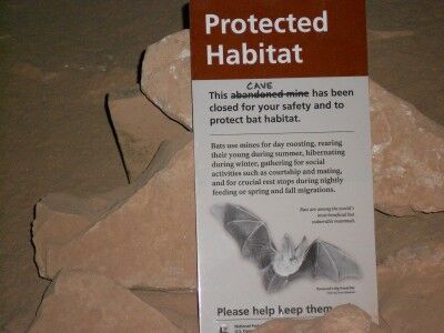
Just inside the bars is a sign explaining why the cave is blocked:

bat sign found in Stanton's Cave

Protected Habitat

This abandoned mine cave has been closed for your safety and to protect bat habitat.

Bats use mines for day roosting, rearing their young during summer, hibernating during winter, gathering for social activities such as courtship and mating, and for crucial rest stops during nightly feeding or spring and fall migrations.

Bats are among the world’s most beneficial but vulnerable mammals. Townsend Big-Eared Bat

The hike to Stanton’s cave is about half a mile (1 mile round trip) from the South Canyon camping beach. It does require some rock scrambling to get up to the ridge above the beach. A path is well worn to the cave, but you do need to be cautious while walking it as there are quite a few loose rocks. Simple head in the direction of Vasey’s Paradise. You may also spot big horn sheep while hiking to the cave (I did).

South Canyon Grand Canyon National Park Rafting

We spent our first night at the South Canyon camping spot between mile 31 and 32 on the Colorado River in Grand Canyon National Park. When you are rafting down the Colorado River, there are designated spots where you are allowed to camp with other spots off limits. We arrived in early afternoon which gave us some time to hike around (if you plan to hike the side canyons when rafting down the Colorado River, a sturdy pair of shoes to change into from your raft water shoes is highly recommended).

I decided to try and hike up South Canyon with a small group from our raft since the guides said that it was a worthwhile hike. The South Canyon trail is a 6.5 mile (10.5 km) trail that leads from the Grand Canyon north rim to the Colorado River. Although we had no plans to hike the entire 6.5 miles of the trail, we were hoping to explore a few miles of the slot canyon.

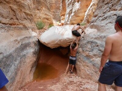
Recent flash floods ended up making it a short lived hike. Less than 100 yards up the canyon was a huge boulder blocking South Canyon, but with a bit of scrambling and a log tilted against the rock, we were able to get past this first obstacle:

rock blocking South Canyon Grand Canyon National Park

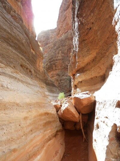
The second obstacle (a number of large rocks piled together in the canyon) just beyond the first rock ended our exploration of South Canyon. The ground beneath the rock was still wet from flash floods the week before creating a thick, sticky mud that didn’t give us much footing. Even with another log placed next to the rocks in an attempt to bypass them, it was simply too large a pile to conquer:

rocks deposited from flash flood in South Canyon

South Canyon appeared to be quite beautiful and would have been a lot of fun to explore if it had been passable. Hopefully future flash floods will clear the huge boulders making it more accessible to hikers in the future.