South Canyon Grand Canyon National Park Rafting

We spent our first night at the South Canyon camping spot between mile 31 and 32 on the Colorado River in Grand Canyon National Park. When you are rafting down the Colorado River, there are designated spots where you are allowed to camp with other spots off limits. We arrived in early afternoon which gave us some time to hike around (if you plan to hike the side canyons when rafting down the Colorado River, a sturdy pair of shoes to change into from your raft water shoes is highly recommended).

I decided to try and hike up South Canyon with a small group from our raft since the guides said that it was a worthwhile hike. The South Canyon trail is a 6.5 mile (10.5 km) trail that leads from the Grand Canyon north rim to the Colorado River. Although we had no plans to hike the entire 6.5 miles of the trail, we were hoping to explore a few miles of the slot canyon.

Recent flash floods ended up making it a short lived hike. Less than 100 yards up the canyon was a huge boulder blocking South Canyon, but with a bit of scrambling and a log tilted against the rock, we were able to get past this first obstacle:
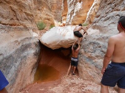
rock blocking South Canyon Grand Canyon National Park

The second obstacle (a number of large rocks piled together in the canyon) just beyond the first rock ended our exploration of South Canyon. The ground beneath the rock was still wet from flash floods the week before creating a thick, sticky mud that didn’t give us much footing. Even with another log placed next to the rocks in an attempt to bypass them, it was simply too large a pile to conquer:
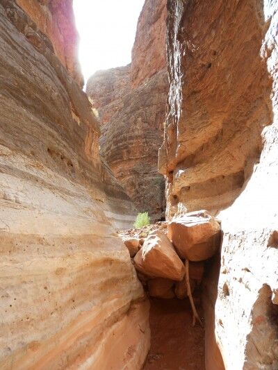
rocks deposited from flash flood in South Canyon

South Canyon appeared to be quite beautiful and would have been a lot of fun to explore if it had been passable. Hopefully future flash floods will clear the huge boulders making it more accessible to hikers in the future.
Ten Mile Rock Grand Canyon National Park Rafting

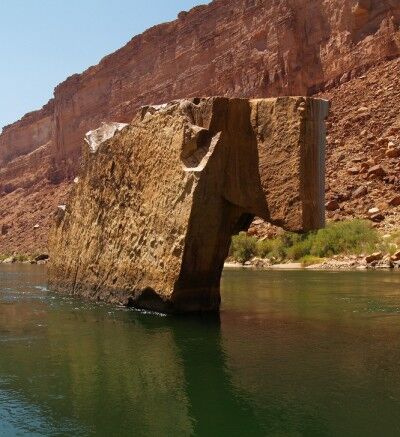
One of the first readily apparent natural landmark within the Colorado River that you pass when rafting in Grand Canyon National Park is Ten Mile Rock. As the name implies, the rock sits in the river approximately ten miles from the start of the rafting trip at Lees Ferry and a few miles past Navajo Bridge.

10 Mile Rock Grand Canyon rafting

It’s advisable to listen to your rafting guide carefully as he/she explains about Ten Mile Rock. Ours decided to test our listening skills, rational reasoning and gullibility by announcing that Ten Mile Rock had been flown in by National Park Service helicopter to mark the tenth mile of the Colorado River. While the rock does have a rather rectangular shape, it ended up at the ten mile mark through natural processes. Only a few on our boat realised that our guide was pulling our leg and several members were shocked when they found out the truth several days later. If nothing else, listening closely and questioning your guides will give you a good indication of the fun they will try to have during the trip and keep them honest.

Navajo Bridge Grand Canyon National Park Rafting

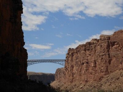
Once you have started the rafting trip through Grand Canyon National Park at Lees Ferry, one of the first landmarks you see is Navajo Bridge. Navajo Bridge is located between miles 4 and 5 from where you started, but can be seen well before you actually reach it.

Navajo Bridge Grand Canyon rafting trip

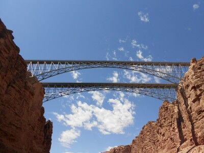
There are actually two Navajo Bridges that span Marble Canyon today. Construction on the original Navajo Bridge (upriver) began in 1927 and the bridge officially opened to traffic in 1929. This bridge is 834 feet in length and reaches 467 feet in height from the Colorado River at the Marble Canyon floor. The opening of the original Navajo Bridge fostered in the closing of Lees Ferry which had been the only way to cross the Colorado River in the vicinity up to that point.

A newer Navajo Bridge (downriver) was built to accommodate increased highway traffic with heavier loads and was completed in September, 1995 at a cost of about $15 million. The newer bridge is 909 feet in length and reaches 470 feet in height from the Colorado River at the Marble Canyon floor. It was constructed next to the original bridge with a similar visual appearance, but updated to conform to modern highway codes. The original Navajo Bridge was then turned into a pedestrian bridge with an interpretive center nearby which explains the history of the bridge and the early crossings of the Colorado River.

two Navajo Bridges spanning Marble Canyon

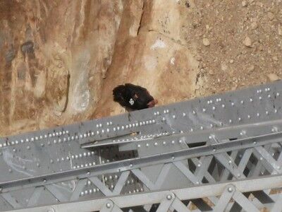
When passing under the Navajo Bridges while on a Colorado River rafting trip through the Grand Canyon, it’s worthwhile to look closely at the bottom of the bridges (definitely take out your binoculars if you brought them). California condors have been reintroduced to the Marble Canyon area and one of their favorite resting places is in the bridge beams under the Navajo Bridges.

California condor in Marble Canyon

California condor on Navajo Bridge photo courtesy of CanyonCountry

Lees Ferry Grand Canyon National Park Rafting

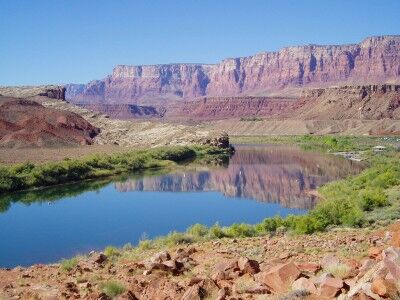
The official beginning for most Grand Canyon rafting trips is at Lees Ferry (also commonly referred to as Lee’s Ferry or Lee Ferry) in Marble Canyon which gives a wonderful preview of what’s to come with the Colorado River surrounded by magnificent canyon scenery:

Lees Ferry at Marble Canyon -- launching site for Grand Canyon National Park rafting trips

Since this is where the Grand Canyon rafting trips launch, this is where you get your initiation to what the rafting trip will be like. You meet the crew that will be guiding you down the river, are given supplies to keep all your belongings dry on the trip, given a quick course of raft safety and life jacket use, and load all your belongings onto the rafts. While there are some historical buildings and beautiful scenery all around, unless you make a concerted effort to seek them out, you will likely miss them as your focus will be on all the activity to get you on the raft and on your way down the Colorado.

There is quite a bit of history that goes with the Lees Ferry launch site. The ferry was originally built in 1871–1872 by John D. Lee with financing from The Church of Jesus Christ of Latter-day Saints. The ferry was located near where the Colorado River and Paria River merge and the crossing was originally called Paria Crossing. For nearly 50 years, Lees Ferry was the only available crossing of the Colorado River by ferry between Moab and Needles. This made Lees Ferry the main Colorado River crossing point for travelers between Utah and Arizona.

The actual ferry at Lees Ferry closed in 1928 with the building of Navajo Bridge (7 miles to the south) across Marble Canyon. The steel wire cable from the ferry still remains and crosses the Colorado River at the old ferry site. This cable marks the entrance to Grand Canyon National Park as you begin the float trip down the Colorado River. Lees Ferry is currently part of Glen Canyon National Recreation Area and is deemed as a historical site.

Photo courtesy of Li Ru Yue

Riverside Walk at Zion National Park

Although a Grand Canyon rafting trip officially begins when you hit the water at Lees Ferry, it unofficially begins when you make your way to Las Vegas. There are options to fly from Las Vagas to Lees Ferry, but I would highly recommend renting a car and driving.

While it’s about a 5 to 6 hour drive from Las Vegas to Lees Ferry, the route allows you to drive through Zion National Park. Planning an extra day or two to explore and play in Zion before a Grand Canyon rafting trip would be an excellent way to begin the entire vacation (while it’s possible to do it after the rafting trip as well, you will have a lot more energy before the trip).

Even if you don’t have the time to give yourself a full day at Zion National Park, it’s still possible to do a short hike while passing through (what we ended up doing). A hike along the Riverside Walk path that takes you to The Narrows (Temple of Sinawava stop) is ideal in this situation since it also requires a trip on the shuttle bus which allows you to see the entire park and gives a quick guided overview of Zion.

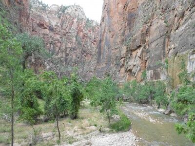
The Riverside Walk is a relatively easy 2 mile round trip (about 1.5 hours) on a maintained path that is suitable for wheelchairs and strollers and gives some wonderful views of the North Fork Virgin River:

Riverside Walk in Zion National Park

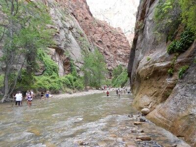
The end of the Riverside Walk path is at the North Fork Virgin River where the beginning of the The Narrows hike begins. This is a much more strenuous hike through the river and requires water shoes (these can be rented at a number of shops just outside the park’s south entrance). You can hike the first few miles of this without a permit, but the entire 16 mile hike up The Narrows does require a permit.

The Narrows at Zion National Park

Perched Over Grand Canyon

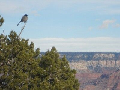
One of the most wonderful aspects of visiting National Parks are all the unexpected photo opportunities that arise. I saw this little bird perched in a perfect position to take in the wonderful view of the Grand Canyon:

Bird perched on pine looking over the Grand Canyon